Pomorie Point
Pomorie Point (Nos Pomorie \'nos po-'mo-ri-e\) is a point on the coast of McFarlane Strait forming the north side of the entrance to Lister Cove, Varna Peninsula, Livingston Island in the South Shetland Islands, Antarctica.
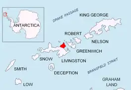
Location of Varna Peninsula on Livingston Island in the South Shetland Islands.
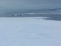
Pomorie Point (on the right) from Miziya Peak, with McFarlane Strait, Meade Islands and Duff Point in the background.
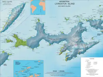
Topographic map of Livingston Island and Smith Island
Location
The point is located at 62°29′05.3″S 60°03′56″W, which is 5.17 km southeast of Williams Point, 7.61 km northeast of Miziya Peak in Vidin Heights, 5.49 km northwest of Inott Point, 4.36 km south-southwest of Duff Point, Greenwich Island, and 2.5 km south-southeast of Channel Rock (British mapping in 1968, Bulgarian mapping in 2005 and 2009).
Maps
- South Shetland Islands. Scale 1:200000 topographic map. DOS 610 Sheet W 62 60. Tolworth, UK, 1968.
- L.L. Ivanov et al. Antarctica: Livingston Island and Greenwich Island, South Shetland Islands. Scale 1:100000 topographic map. Sofia: Antarctic Place-names Commission of Bulgaria, 2005.
- L.L. Ivanov. Antarctica: Livingston Island and Greenwich, Robert, Snow and Smith Islands. Scale 1:120000 topographic map. Troyan: Manfred Wörner Foundation, 2010. ISBN 978-954-92032-9-5 (First edition 2009. ISBN 978-954-92032-6-4)
- Antarctic Digital Database (ADD). Scale 1:250000 topographic map of Antarctica. Scientific Committee on Antarctic Research (SCAR). Since 1993, regularly updated.
- L.L. Ivanov. Antarctica: Livingston Island and Smith Island. Scale 1:100000 topographic map. Manfred Wörner Foundation, 2017. ISBN 978-619-90008-3-0
References
- Pomorie Point. SCAR Composite Antarctic Gazetteer
- Bulgarian Antarctic Gazetteer. Antarctic Place-names Commission. (details in Bulgarian, basic data in English)
External links
- Pomorie Point. Copernix satellite image
This article includes information from the Antarctic Place-names Commission of Bulgaria which is used with permission.
This article is issued from Wikipedia. The text is licensed under Creative Commons - Attribution - Sharealike. Additional terms may apply for the media files.