Point Grondine Park
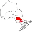
Point Grondine Park is a First Nations-owned nature park on the northern shore of Lake Huron in Sudbury District, Ontario,[2] which occupies the unpopulated historic Point Grondine 3 Indian reserve. It is a ceded reserve of the Wiikwemkoong First Nation, having been reserved under the terms of the Robinson Huron Treaty in 1850.
Point Grondine 3 | |
|---|---|
| Point Grondine Indian Reserve No. 3 | |
 Point Grondine 3 | |
| Coordinates: 46°01′N 81°09′W | |
| Country | |
| Province | |
| District | Sudbury |
| First Nation | Wiikwemkoong |
| Area | |
| • Land | 138.97 km2 (53.66 sq mi) |
The former Point Grondine First Nation abandoned the area in the 1940s, moving to the Wiikwemkoong territory on Manitoulin Island before fully amalgamating with the Wiikwemkoong band in 1968.[3] The Point Grondine area then remained unoccupied and virtually unused by the band until the park was established in 2015.[4] The park is the first phase in a planned Georgian Bay Coast Trail project, which will eventually see a 200-kilometre nature trail extending on indigenous-owned land from Point Grondine to Bayfield Inlet.[5]
Although owned and operated separately, the park is managed in collaboration with the neighbouring Killarney Provincial Park.[6]
References
- Indigenous and Northern Affairs Canada profile
- "New Wikwemikong Point Grondine Park offers hiking and canoeing trails, camping". Manitoulin Expositor, August 26, 2015.
- John S. Marsh and Bruce W. Hodgins, Changing Parks: The History, Future and Cultural Context of Parks and Heritage Landscapes. Dundurn Press, 1998. ISBN 9781459718357. p. 69.
- "First Nation opens new park in northern Ontario". CBC Northern Ontario, August 21, 2015.
- "Sudbury Accent: Pointing the way to the coast". Sudbury Star, November 8, 2014.
- "Killarney Provincial Park to sign MOU with Point Grondine Park at Trails Symposium". Anishinabek News, May 10, 2016.
