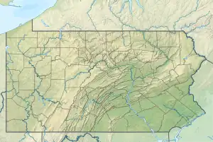
Pine Run (South Branch French Creek tributary)
Pine Run is a 3.3 mi (5.3 km) long tributary to South Branch French Creek in Erie County, Pennsylvania. It is classed as a 1st order stream on the EPA waters Geoviewer site.
| Pine Run Tributary to South Branch French Creek | |
|---|---|
 Location of the mouth of Pine Run  Pine Run (South Branch French Creek tributary) (the United States) | |
| Location | |
| Country | United States |
| State | Pennsylvania |
| County | Erie |
| Physical characteristics | |
| Source | divide between Bentley Run and Beaver Run |
| • location | about 2 miles northeast of Union City, Pennsylvania |
| • coordinates | 41°56′07″N 079°47′29″W[1] |
| • elevation | 1,580 ft (480 m)[2] |
| Mouth | South Branch French Creek |
• location | east of Union City, Pennsylvania |
• coordinates | 41°53′33″N 079°47′07″W[1] |
• elevation | 1,309 ft (399 m)[1] |
| Length | 3.3 mi (5.3 km)[3] |
| Basin size | 2.0 square miles (5.2 km2)[4] |
| Discharge | |
| • location | 1 mile east of Union City, Pennsylvania |
| • average | 5.45 cu ft/s (0.154 m3/s) at mouth with South Branch French Creek[4] |
| Basin features | |
| Progression | South Branch French Creek → French Creek → Allegheny River → Ohio River → Mississippi River → Gulf of Mexico |
| River system | Allegheny River |
| Tributaries | |
| • left | unnamed tributaries |
| • right | unnamed tributaries |
| Bridges | US 6, Elgin Road, Riley Siding Road |
Course
Pine Run rises in Union Township of southern Erie County, Pennsylvania and flows southwest towards Union City, Pennsylvania.
Watershed
Pine Run drains 2.0 square miles of Erie Drift Plain (glacial geology). The watershed receives an average of 46.5 in/year of precipitation.[5]
Additional images
.jpg.webp)
Pine Run (South Branch French Creek tributary)
References
- "GNIS Detail - Pine Run". geonames.usgs.gov. US Geological Survey. Retrieved 6 July 2019.
- "Union City Fish Hatchery Topo Map, Erie County PA (Union City Area)". TopoZone. Locality, LLC. Retrieved 6 July 2019.
- "ArcGIS Web Application". epa.maps.arcgis.com. US EPA. Retrieved 20 October 2019.
- "Pine Run Watershed Report". Waters Geoviewer. US EPA. Retrieved 6 July 2019.
- "ArcGIS Web Application". enviroatlas.epa.gov. US EPA. Retrieved 6 July 2019.
This article is issued from Wikipedia. The text is licensed under Creative Commons - Attribution - Sharealike. Additional terms may apply for the media files.