Pimpirev Peak
Pimpirev Peak (Bulgarian: Пимпирев връх, romanized: Pimpirev vrah, IPA: [pimˈpirɛv ˈvrɤx]) is the ice-covered peak rising to 2565 m[1] on the west side of Rouen Mountains in northern Alexander Island, Antarctica. It surmounts Frachat Glacier to the southeast, Russian Gap to the west and Mozgovitsa Glacier to the north-northwest. The peak was visited on 7 January 1988 by the geologists Christo Pimpirev and Borislav Kamenov during the First Bulgarian Antarctic Expedition.

The feature was named "after the Bulgarian scientist Christo Pimpirev, doyen and leader of the national Antarctic programme."[2]
Location
Pimpirev Peak is located at 69°08′20″S 71°01′14″W, which is 10.7 km north-northwest of Paroriya Buttress, 15.92 km southwest of Mount Hankey, 13.74 km northwest of Mount Hall, and 18.5 km northeast of Breze Peak and 17.5 km east-northeast of Mount Newman in Havre Mountains.
Maps
- British Antarctic Territory. Scale 1:200000 topographic map. DOS 610 – W 69 70. Tolworth, UK, 1971
- Antarctic Digital Database (ADD). Scale 1:250000 topographic map of Antarctica. Scientific Committee on Antarctic Research (SCAR). Since 1993, regularly upgraded and updated
Notes
- Reference Elevation Model of Antarctica. Polar Geospatial Center. University of Minnesota, 2019
- "Pimpirev Peak", Composite Gazetteer of Antarctica
References
External links
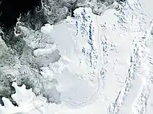
- Pimpirov Peak. Copernix satellite image
This article includes information from the Antarctic Place-names Commission of Bulgaria which is used with permission.