Pic d'Anie
Pic d'Anie (Basque Auñamendi) is a mountain of the Pyrenees in France, located close to the Spanish border. It is 2,507 metres (8,225 ft) high.
| Pic d'Anie Auñamendi | |
|---|---|
 Pic d'Anie | |
| Highest point | |
| Elevation | 2,507 m (8,225 ft) |
| Prominence | 844 m (2,769 ft) |
| Coordinates | 42°56′42″N 00°43′16″W |
| Naming | |
| Language of name | French |
| Geography | |
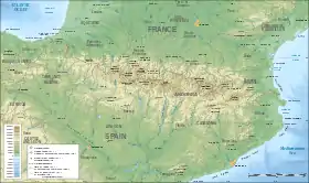 Pic d'Anie Auñamendi Location in the Pyrenees | |
| Location | Pyrénées-Atlantiques, France |
| Parent range | Pyrenees |
| Climbing | |
| Easiest route | Belagua, St Martin and Lescun |
The mountain boasts an almost perfect pyramidal shape and is surrounded by the spectacular karst landscape of. Larra, in the Larra-Belagua massif (Navarre).
The three main access routes to the peak are: Belagua in Spain and Pierre-Saint Martin and Lescun in the French department of Pyrénées-Atlantiques.
References
External links
Wikimedia Commons has media related to Pic d'Anie.
This article is issued from Wikipedia. The text is licensed under Creative Commons - Attribution - Sharealike. Additional terms may apply for the media files.