Petitcodiac, New Brunswick
Petitcodiac (/pɛ.tɪ.koʊ.di.æk/, sometimes shortened to /pɛ.ti/) is a former village in Westmorland County, New Brunswick, Canada. It held village status prior to 2023 and is now part of the village of Three Rivers.
Petitcodiac | |
|---|---|
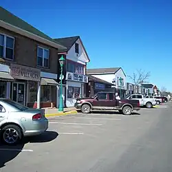
 Downtown Petitcodiac | |
 Seal | |
| Nickname: "Where the River Begins" | |
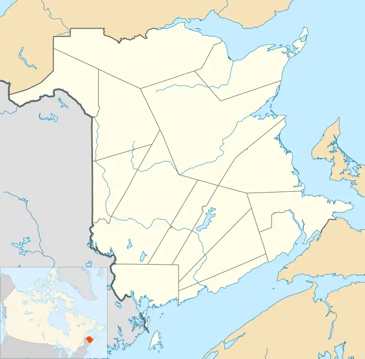
 Petitcodiac The location of Petitcodiac within New Brunswick | |
| Coordinates: 45.93205°N 65.169697°W | |
| Country | Canada |
| Province | New Brunswick |
| County | Westmorland County |
| Municipality | Three Rivers |
| Incorporated Village | November 9, 1966 |
| Electoral Districts Federal | Fundy Royal |
| Provincial | Petitcodiac |
| Area | |
| • Land | 17.18 km2 (6.63 sq mi) |
| Population (2021)[1] | |
| • Total | 1,476 |
| • Density | 85.9/km2 (222/sq mi) |
| • Change (2016–21) | |
| Time zone | UTC-4 (Atlantic (AST)) |
| • Summer (DST) | UTC-3 (ADT) |
| Website | Petitcodiac.ca |
History
It is named after the Petitcodiac River, which begins in the village at the junction of the North River and Anagance River. The name is believed to be derived either from a Mi'kmaq word meaning "bends like a bow" or from a Maliseet word meaning "sound of thunder".[2] Petcoucoyee (Franquelin, 1686); Pacoudiac (deCouagne, 1749); present spelling from mid 19th century.[3]
On 1 January 2023, all or parts of four local service districts were annexed to Petitcodiac as part of the 2023 local governance reforms to establish a new village named Three Rivers.[4][5] The community's name remains in official use.[6]
Present day

The Community Centres around Route 890, Route 885, Route 905, Route 106 and Route 1.
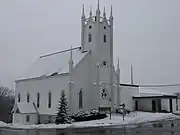
The village features a regional school, an outdoor swimming pool, an arena, a bowling alley, as well as several family-owned shops and churches servicing the surrounding area. There is also a Royal Canadian Air Cadet Squadron.
The Westmorland County Agricultural Fair, established by William Balzer in 1967, is an agricultural fair with a horse show, a sheep show, a produce contest, crafts and baked goods, and a beauty pageant.[8]
Demographics
In the 2021 Census of Population conducted by Statistics Canada, Petitcodiac had a population of 1,476 living in 609 of its 630 total private dwellings, a change of 6.7% from its 2016 population of 1,383. With a land area of 17.18 km2 (6.63 sq mi), it had a population density of 85.9/km2 (222.5/sq mi) in 2021.[1]
|
Income (2016)[11]
|
Mother tongue (2016) [11]
|
Neighbouring communities
- Intervale
- River Glade
- The Glades
- Pollett River
- Anagance
- Hillgrove
- Glenvale
Notable people
Michael Venart
See also
References
- "Census Profile of Petitcodiac". Statistics Canada. 6 December 2022. Retrieved 21 January 2023.
- Dr. Peter Paul interview with anthropologist Harald E.L. Prins and Bunny McBride, Hallowell, Maine, 12/02/1988, in In Memoriam: Peter Lewis Paul, 1902-1989, edited by K. Teeter, 19-21. Hull:Canadian Museum of Civilization, Canadian Ethnology Service. Mercury Series Paper 26, 1993.
- Hamilton, William (1978). The Macmillan Book of Canadian Place Names. Toronto: Macmillan. p. 82. ISBN 0-7715-9754-1.
- "Local Governments Establishment Regulation – Local Governance Act". Government of New Brunswick. 12 October 2022. Retrieved 21 January 2023.
- "RSC 7 Southeast Regional Service Commission". Government of New Brunswick. Retrieved 21 January 2023.
- "Proposed entity names reflect strong ties to nature and history" (Press release). Irishtown, New Brunswick: Government of New Brunswick. 25 May 2022. Retrieved 21 January 2023.
- "'This will be their future': Petitcodiac United Baptist Church opens new wing". Global News. Global News. 22 Dec 2018. Retrieved 4 April 2021.
- "Fair Born of One Man's Dream". Westmorland County Agricultural Fair. Retrieved 7 October 2014.
- Statistics Canada: 1996, 2001, 2006 census
- "2011 Census Profile: Petitcodiac, New Brunswick". Retrieved October 3, 2019.
- "Census Profile, 2016 Census Petitcodiac, Village [Census subdivision], New Brunswick". Statistics Canada. Retrieved October 3, 2019.