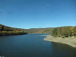
Pepacton Reservoir
The Pepacton Reservoir, also known as the Downsville Reservoir, is a reservoir in Delaware County, New York on the East Branch of the Delaware River in the Catskill Mountains of New York. Part of the New York City water supply system, it was formed by the construction of Downsville Dam, and impounds over one-quarter of the East Branch's flow.
| Pepacton Reservoir | |
|---|---|
 Pepacton reservoir at Route 30 bridge | |
 Pepacton Reservoir Location within New York  Pepacton Reservoir Pepacton Reservoir (the United States) | |
| Location | Delaware County, New York |
| Coordinates | 42°05′20″N 74°49′20″W[1] |
| Type | Reservoir |
| Primary inflows | East Branch of the Delaware River |
| Basin countries | United States |
| Max. length | 15 mi (24 km) |
| Max. width | 0.7 mi (1.12 km) |
| Surface area | 5,726 acres (23.17 km2) |
| Max. depth | 180 ft (55 m) |
| Water volume | 430,256 acre-feet (530,713,000 m3) |
The reservoir lies 12 miles (19 km) south of the village of Delhi and is 101 miles (163 km) northwest of New York City. It is narrow and winding, some 15 miles (24 km) long and about 0.7 miles (1.1 km) across at its widest point. The reservoir is over 160 feet (49 m) deep at its maximum point and contains 430,256 acre-feet (530,713,000 m3) of water at full capacity. This makes it the city water system's largest reservoir by volume.[2][3]
Pepacton Reservoir supplies New York City with nearly 25% of its drinking water. Its water empties into the 25.5-mile (41.0 km) East Delaware Tunnel near the former site of Pepacton, then flows through the aqueduct into the Rondout Reservoir, which empties into the 85-mile (137 km) Delaware Aqueduct. Flow is then routed under the Hudson into the West Branch Reservoir in Putnam County, New York, then on to the Kensico Reservoir in Westchester County just north of The Bronx. From there the aqueduct continues on to Hillview Reservoir, from which it is distributed by tunnel to users in the City.
Peapackton is a Lenape Native American term meaning "marriage of the waters". The reservoir lies on land New York City purchased in the valley in 1942, and led to the displacement of 974 people, destruction of four towns (Arena, Pepacton, Shavertown and Union Grove), and submersion of nearly one-quarter of the Delaware and Northern Railroad in the process. The dam, located at Downsville, was finished in 1954, and the flooding was completed in 1955.
The reservoir is a significant factor in the local economy of Downsville, New York, as thousands of tourists travel to Downsville each year to fish for trout. No motor boats are allowed on the reservoir; non-motorized boats that have been steam-cleaned and that have required tags may be used in the reservoir during the summer.[4]
Tributaries
References
- "Pepacton Reservoir". Geographic Names Information System. United States Geological Survey, United States Department of the Interior. Retrieved 2018-01-20.
- History Of The Nyc Water Supply, Catskill Watershed Corporation. Accessed June 23, 2022. "The Pepacton Reservoir on the East Branch in Delaware County was built between 1947 and 1954. The 2,400-foot-long dam at Downsville impounds the largest of the city’s reservoirs."
- Pepacton Reservoir, New York City Department of Environmental Protection. Accessed June 23, 2022. "It consists of one basin, approximately 15 miles in length and holds 140.2 billion gallons at full capacity, making it the largest reservoir in the City system by volume. It was placed into service in 1955."
- Boating, New York City Department of Environmental Protection. Accessed October 4, 2023. "All boaters must obtain a free DEP Access Permit and all boats must be steam cleaned by a DEP certified steam cleaning vendor before being placed on a resevoir[sic].... Recreational boating (boating for non-anglers) is allowed on Cannonsville, Pepacton, Neversink and Schoharie Reservoirs during the summer.... Non-motorized kayaks, canoes, rowboats, and sculls with the appropriate recreational boat tags may be used."