Peoria Lake
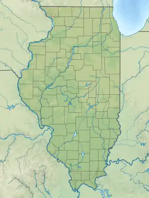
Peoria Lake, sometimes called Lower Peoria Lake, is a section of the Illinois River between Peoria in Peoria County, Illinois and East Peoria in Tazewell County, Illinois. The oldest section of Peoria, the largest city on the river, lies at its shores. From a modern perspective, the lake runs from just south of the McClugage Bridge (US 24/US 150/War Memorial Drive) to the Murray Baker Bridge (Interstate 74). The larger Upper Peoria Lake flows into the lake on its north side, at approximately river mile 166.5.[1]
| Peoria Lake | |
|---|---|
 Peoria Lake  Peoria Lake | |
| Location | Peoria / Tazewell counties, Illinois, U.S. |
| Coordinates | 40°42′8″N 89°33′16″W |
| Primary inflows | Illinois River (Upper Peoria Lake) |
| Primary outflows | Illinois River |
| Basin countries | United States |
History
Several important Native American settlements were located close to the lake, like the main villages of the Kickapoo and Potawatomi tribes.[2] Other tribes may have used it as a game preserve during the winter while living in the Kaskaskia village, as the area was known for its "fat beasts".[2][3][4][5] The Peoria tribe remained near the lake after the Kaskaskia departed before 1700.[6][7][3][8][9]
Peoria Lake was mentioned by the Louis Joliet and Jacques Marquette expedition in 1674. During early European colonization, the lake was called Pimitéoui ("Fat Lake").[4][6][10][5] A French Fort on its banks was called Fort Pimitéoui (1691), later known as Old Fort Peoria.[6][11][8] The French remained in the Peoria area until about 1819.[6]
Geology
The lake is formed by a broadening of the Illinois River. It is approximately 21 mi (34 km) in length.[2] The Peoria Lake originated during the Woodfordian substage of the Wisconsin glaciation.[1][12] It is part of the Bloomington moraine.[12]
Due to the flat stream bed, the water moves slowly, allowing sediment to settle at the bottom.[12]
Fauna
Pollution has been a significant factor in decreasing levels of wildlife, notably the reversal of the Chicago River.[13][14][15] The Clean Water Act of 1977 has helped the fish population rebound.[15]
Recreation
The lake is currently a regional tourist attraction and is used for practice of many watersports. It is also the usual site for the City of Peoria's Fourth of July fireworks display.[16][17]
Several public lands border the Peoria Lake,[15] including:
- Riverfront Park
- East Peoria Riverfront Park
- Grand View Park
- Crevecoeur Nature Preserve
Other notable landmarks include:
- Rock Island Depot and Freight House
- Detweiller Marina and Park
- Peoria Waterworks
- Grandview Drive (south entrance)
- Spindler Marina
- Cooper Park South
- EastPort Marina
- Par-A-Dice
- Peoria Lock and Dam (signifies end of the Peoria Pool at river mile 157.7)[15]
See also
References
- US Army Corps of Engineers, Rock Island District (1990-07-01). "Peoria Lake Enhancement" (PDF). Retrieved 2023-10-13.
- Spooner, Harry L. (1944). "The Historic Indian Villages of the Peoria Lake Area". Journal of the Illinois State Archaeological Society. 1 (3): 15–18. ISSN 2469-2824.
- Morrissey, Robert Michael (2015). "The Power of the Ecotone: Bison, Slavery, and the Rise and Fall of the Grand Village of the Kaskaskia". The Journal of American History. 102 (3): 667–692. ISSN 0021-8723.
- McCafferty, Michael (2009). "The Illinois Place Name "Pimitéoui"". Journal of the Illinois State Historical Society (1998-). 102 (2): 177–192. ISSN 1522-1067.
- Vogel, Virgil J. (1962). "Indian Place Names in Illinois". Journal of the Illinois State Historical Society (1908-1984). 55 (4): 385–458. ISSN 0019-2287.
- A., P. M. (1937). "The Oldest Town in Illinois". Journal of the Illinois State Historical Society (1908-1984). 30 (2): 256–260. ISSN 0019-2287.
- Faye, Stanley; Delisle, Legardeur (1945). "A Search for Copper on the Illinois River: The Journal of Legardeur Delisle, 1722". Journal of the Illinois State Historical Society (1908-1984). 38 (1): 38–57. ISSN 0019-2287.
- Blasingham, Emily J. (1956). "The Depopulation of the Illinois Indians, Part I". Ethnohistory. 3 (3): 193–224. doi:10.2307/480408. ISSN 0014-1801.
- Blasingham, Emily J. (1956). "The Depopulation of the Illinois Indians. Part 2, Concluded". Ethnohistory. 3 (4): 361–412. doi:10.2307/480464. ISSN 0014-1801.
- Kellogg, Louise Phelps (1935). "The Society and the State". The Wisconsin Magazine of History. 19 (2): 245–255. ISSN 0043-6534.
- Lessard, Renald; Mathieu, Jacques; Gouger, Lina (1988). "Peuplement Colonisateur Au Pays Des Illinois". Proceedings of the Meeting of the French Colonial Historical Society. 12: 57–68. ISSN 0362-7055.
- Bevenour, Donald E.; Emmons, Kevin M.; Hobbs, Martin (2007). "The Physical Geography of the Illinois River Valley Near Peoria: An Updated Self-Conducted Field Trip using EcoCaches and GPS Technology" (PDF). Retrieved 2023-10-13.
- Baker, Frank Collins (1926). Richardson, Robert E. (ed.). "Changes in the Bottom Fauna of the Illinois River Due to Pollutional Causes". Ecology. 7 (2): 229–230. doi:10.2307/1928948. ISSN 0012-9658.
- Mathis, B. J.; Cummings, T. F. (1973). "Selected Metals in Sediments, Water, and Biota in the Illinois River". Journal (Water Pollution Control Federation). 45 (7): 1573–1583. ISSN 0043-1303.
- "River Pool -- Illinois - Peoria". www.ifishillinois.org. Retrieved 2023-10-13.
- "Carle Health Red White & BOOM! - Peoria, IL". Carle Health Red White & BOOM!. Retrieved 2023-10-13.
- Kate, Annie (2022-03-23). "Boom is back! Famous fireworks display returns to Central Illinois". CIProud.com. Retrieved 2023-10-13.
External links
- Peoria Lake Habitat Rehabilitation and Enhancement Project – by the United States Army Corps of Engineers
- U.S. Geological Survey Geographic Names Information System: Peoria Lake
