Overton Hill
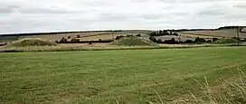
Overton Hill is a 571 ft (174 m) hill at the southern edge of the Marlborough Downs in Wiltshire, England. It lies just west of the village of West Overton and about 4 miles (6 km) west from the town of Marlborough. The A4 road passes close to the north, and to the south is the River Kennet.
| Overton Hill | |
|---|---|
 Round tumuli on Overton Hill | |
| Highest point | |
| Elevation | 174 m (571 ft) |
| Coordinates | 51°24′36″N 1°49′54″W |
| Geography | |
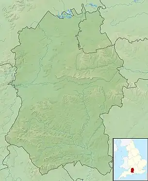
 Overton Hill Overton Hill shown within Wiltshire | |
| Location | Wiltshire, England |
| OS grid | SU118679 |
| Topo map | OS Explorer 157 |
The hill is notable for being the start point of the Ridgeway National Trail, which follows an ancient trackway. There several scheduled archaeological sites including several round barrows (burial mounds)[1] on it, and the site of an Iron Age wooden circle known as The Sanctuary, indicating human activity for thousands of years.[2] The hill is part of the Avebury section of the Stonehenge and Avebury World Heritage Site.[3]
References
- Historic England. "Group of five round barrows north-east of the Sanctuary: part of the Overton Hill round barrow cemetery (1008464)". National Heritage List for England. Retrieved 11 April 2021.
- Historic England. "The Sanctuary, Overton Hill (1014563)". National Heritage List for England. Retrieved 16 June 2022.
- "Stonehenge, Avebury and Associated Sites - 1000097 | Historic England". historicengland.org.uk. Retrieved 16 June 2022.
This article is issued from Wikipedia. The text is licensed under Creative Commons - Attribution - Sharealike. Additional terms may apply for the media files.