Northridge, Los Angeles
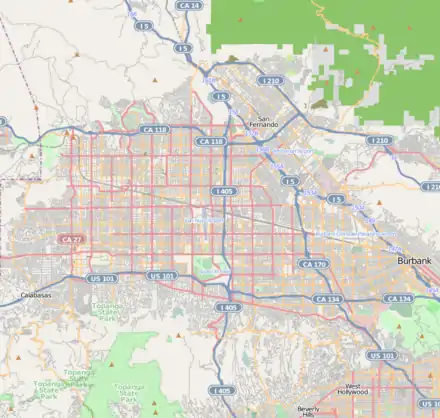
Northridge is a neighborhood in the San Fernando Valley region of the City of Los Angeles. The community is home to California State University, Northridge, and the Northridge Fashion Center.
Northridge | |
|---|---|
 Northridge Location within Los Angeles/San Fernando Valley 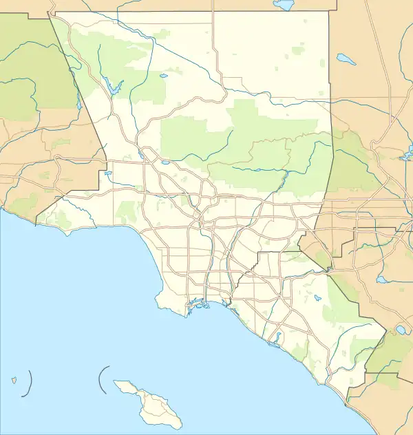 Northridge Northridge (the Los Angeles metropolitan area) | |
| Coordinates: 34°13′41″N 118°32′09″W | |
| Country | United States |
| State | California |
| County | Los Angeles |
| City | Los Angeles |
| Named for | Its location in the northern parts of Los Angeles |
| Population (2008) | |
| • Total | 61,993 |
| ZIP codes | 91324–25; 91327–30[1] |
| Area code(s) | 818 and 747 |
Originally named Zelzah by settlers in 1908, the community was renamed North Los Angeles in 1929 but the appellation sometimes caused confusion between North Hollywood and Los Angeles. In 1938, civic leader Carl S. Dentzel decided to rename the community to Northridge Village, which morphed into modern-day Northridge.[2]
The Northridge area can trace its history back to the Tongva people and later to Spanish explorers. It was sold by the Mexican governor Pío Pico to Eulogio de Celis, whose heirs divided it for resale.[3]
Population
The 2000 U.S. census counted 57,561 residents in the 9.47-square-mile (24.5 km2) Northridge neighborhood—or 6,080 people per square mile (2,350/km2), among the lowest population densities for the city. In 2008, the city estimated that the population had increased to 61,993. In 2000 the median age for residents was 32, about average for city and county neighborhoods; the percentage of residents aged 19 to 34 was among the county's highest.[4]
The neighborhood was considered "highly diverse" ethnically within Los Angeles, with a high percentage of Asian people for the county. The breakdown was whites, 49.5%; Latinos, 26.1%; Asians, 14.5%; blacks, 5.4%; and others, 4.6%. Mexico (24.7%) and the Philippines (9.8%) were the most common places of birth for the 31.8% of the residents who were born abroad—an average figure for Los Angeles.[4]
The median yearly household income in 2008 dollars was $67,906, considered high for the city. Renters occupied 46.4% of the housing stock, and house- or apartment-owners held 53.6%. The average household size of 2.7 people was considered average for Los Angeles.[4]
In 2000 there were 3,803 military veterans, or 8.5% of the population, a high percentage compared to the rest of the city.[4]
Geography

Northridge touches Porter Ranch and Granada Hills on the north, North Hills on the east, Van Nuys on the southeast, Lake Balboa and Reseda on the south and Winnetka and Chatsworth on the west.[5]
History
Tongva
The Northridge area was first inhabited over 2,000 years ago by the Tongva.[6] The village of Totonga was located in the Northridge area.[7] The Tongva lived in dome-shaped houses and are sometimes referred to as the "people of the earth".[8] They spoke a Takic Uto-Aztecan (Shoshonean) language. Many of their pictographs were destroyed by the development of Greater Los Angeles.[9]
Mexican land grant
In the late 1840s, Mexican Governor Pio Pico broke with the tradition of "granting" land and, instead, sold it, without the usual area limitations, to Eulogio de Celis, a native of Spain. By 1850, de Celis was in the Los Angeles census as an agriculturist, 42 years old, and the owner of real estate worth $20,000.[10]
Land division
A few years later, the land was split up. The heirs of Eulogio de Celis sold the northerly half – 56,000 acres (230 km2) – to Senator George K. Porter, who had called it the "Valley of the Cumberland" and Senator Charles Maclay, who exclaimed: "This is the Garden of Eden." Porter was interested in ranching; Maclay in subdivision and colonization. Francis Marion ("Bud") Wright, an Iowa farm boy who migrated to California as a young man, became a ranch hand for Senator Porter and later co-developer of the 1,100-acre (4.5 km2) Hawk Ranch, which is now Northridge land.[11]
Early community
In 1908, the Southern Pacific Railroad lays tracks through the Hawk Ranch property; following this and continuing the pattern of railroad boom towns, the Hawk Ranch was sold for subdivision and was renamed Zelzah in 1910. The name is derived from a biblical name for an oasis as a reference to a water well located in the area. The Zelzah Train Station or Depot was built on the site that is now the northwest corner of Parthenia Avenue and Reseda Boulevard, across the street from the water well. Also in 1910, on January 13, the large balloon America landed on the so-called Zelzah ranch after a 31-mile (50 km) trip from Huntington Park.[12] By April, The Scandia Land and Loan Company was advertising Zelzah Acres with land going for $250 per acre.[13] The company advertised the acres as the "cream of the San Fernando valley, the richest soil in California," describing the ease of transportation provided by the station, the lack of alkali, adobe or hardpan soil, and stating that water for domestic purposes could be welled from 35 to 65 feet and at 140 to 300 feet for general irrigation; water would later become a major selling point for land in the valley after the arrival of the Los Angeles Aqueduct.[14] The initial growth in the region was so marked that discussions of the creation of new school districts were being forwarded to the county school superintendent Mark Keppel, one of these districts being named Zelzah which would benefit 15 children of school age living nine to ten miles from a schoolhouse.[15] By the beginning of 1912, a post office had been established in Zelzah.[16] By April 1913, sales agents E. O. Hanson & Sons were advertising that only 300 of the original 1100 acres were left for sale, by then at $325 an acre.[17]
The first church built in Northridge, the Faith Bible Church, was built in 1917.[18] By the 1920s, the town became a shipping center for agricultural products and continued to be a rural community for many years.[19]
Residents of Zelzah voted to change the community's name to North Los Angeles in 1929.[19] Reseda Boulevard, the main thoroughfare of the community, was paved in 1930. [18]
In 1938, the community's name was changed to the more popular Northridge Village at the suggestion of local resident and director of the Southwest Museum in Los Angeles Carl Denzel; it would later be shortened to just Northridge.[18][19]
Post-war years
The community began to develop rapidly after World War II and agricultural lots were subdivided into suburban housing tracts to meet the demand for single-family homes by veterans and their families. Commercial development began to take place in the 1950s; the San Fernando Valley State College was opened in 1956. Light industry moved into the area and spurred a building boom.[19] The train depot was torn down in 1961 and underpasses were constructed below the railway over Reseda Boulevard and Parthenia Street.[18]
Education
Thirty-four percent of Northridge residents aged 25 and older had earned a four-year degree by 2000, an average percentage for the city but high for the county. The percentages of the same-age residents with a bachelor's degree and a master's degree or higher were high for the county.[4]
Primary and secondary schools
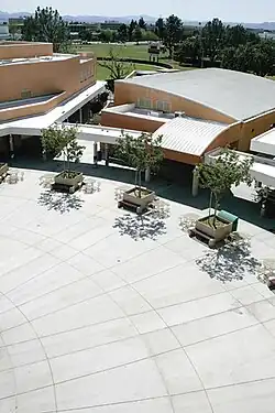
In 1962, Nobel Junior High School in Northridge became the first air-conditioned school in the Los Angeles school district.[20]
In 1982 the board considered closing Prairie Street Elementary School in Northridge.[21] It was located on the California State University, Northridge campus, and that university used Prairie as a laboratory school.[22] In April 1983 an advisory committee of the LAUSD recommended closing eight LAUSD schools, including Prairie Street School.[21] In August 1983 the board publicly considered closing Prairie, which had 280 students at the time.[23] In 1984 the board voted to close the Prairie Street School.[22] In 1985 some parents were trying to have Prairie Street School reopened.[24]
Secondary and lower-grade schools within the Northridge boundaries are:[25]
Public
- Andasol Avenue Elementary School, 10126 Encino Avenue
- Alfred Bernhard Nobel Middle School, 9950 Tampa Avenue
- Topeka Drive Elementary School, 9815 Topeka Drive
- Balboa Gifted / High Ability Magnet Elementary School, alternative, 17020 Labrador Street
- Northridge Academy High School, 9601 Zelzah Avenue
- Oliver Wendell Holmes Middle School, 9351 Paso Robles Avenue
- Dearborn Street Elementary School, 9240 Wish Avenue
- Calahan Street Elementary School, 18722 Knapp Street
- Napa Street Elementary School, 19010 Napa Street
- Northridge Middle School, 17960 Chase Street
- Parthenia Street Elementary School, 16825 Napa Street
Private
- Casa Montessori, 17633 Lassen Street
- Our Lady of Lourdes, 18437 Superior Street
- Highland Hall Waldorf School, K-12, 17100 Superior Street
- Art of Learning Academy, 9535 Alden Avenue
- St. Nicholas School, elementary, 9501 Balboa Boulevard
- First Presbyterian Church of Granada Hill, elementary, 10400 Zelzah Avenue
- Cornerstone Christian Academy, 11031 Yolanda Avenue
- East Valley Academy, K-12, 20212 Londelius Street
- Abraham Joshua Heschel Day School, Elementary and Middle, 17701 Devonshire Street
Colleges
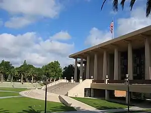
California State University, Northridge, or CSUN, part of the California State University system, offers bachelor's and master's degrees in a number of disciplines. The school is a major producer of K-12 teachers in the region and the nation as a whole. CSUN also has engineering, business, and film programs.[26]
CSUN had its beginnings as a college on Nordhoff Street and Etiwanda Avenue and officially opened in 1956 as San Fernando Valley Campus of Los Angeles State College of Applied Arts and Sciences. Two years later it separated from its parent and became San Fernando Valley State College. By the early 1970s, however, this institution became known as California State University, Northridge. By fall of 2016, CSUN had reached enrollment of almost 40,000 students.[27]
A 2004 study revealed that CSUN is a major contributor to the local economy: between $663 million and $686 million annually. Additionally, CSUN employs 5,800 people directly through the university and adds another 5,700 to 6,000 jobs into the local economy.[28]
Entertainment
Motion pictures and television
Silent star Janet Gaynor and her costume-designer husband Adrian were the first owners of a spacious estate in Northridge, which was later sold to Barbara Stanwyck and Robert Taylor. Later, actor Jack Oakie owned the property and lived on it. The Oakie house was set for the wrecking ball, but in 2010 the city agreed to buy the Tudor-style stone landmark and its 10-acre (40,000 m2) ranch estate.[29]
Marion Marx, wife of Zeppo Marx, and Barbara Stanwyck started Marwyck Ranch as a horse breeding farm. The original house and a small portion of the ranch still exist, and is managed by the city as Oakridge Estate Park. Northridge was known as the "Horse Capital of the West," with regular Sunday horse shows, annual stampedes, and country fairs.[29]
Devonshire Downs
In the late 1960s, Devonshire Downs was the site of two major rock music festivals. The little-known two-day 1967 Fantasy Faire and Magic Music Festival (at "Devonshire Meadows") featured The Doors, Jefferson Airplane, Country Joe and the Fish, The Grass Roots, Canned Heat, Iron Butterfly and several other bands.[30] The better-known but confusingly named 1969 Newport Pop Festival was a massive three-day event that featured Jimi Hendrix and many other top acts. It took place in June and was briefly the largest music festival ever held before losing that distinction to Woodstock the following August. Like its famous successor, it had problems with large numbers of gate-crashers, and some young attendees far from home camped out nearby in sleeping bags. Unlike Woodstock, "nearby" included parts of suburban Northridge, where most of the local residents were horrified to find their neighborhoods invaded by "hippies". A ban on rock music festivals soon followed.[31]
Earthquakes
The 1994 Northridge earthquake was named for Northridge based on early estimates of the location of the quake's epicenter; however, further refinements showed it to be technically in neighboring Reseda.[32] The earthquake, which occurred on a blind thrust fault, was one of the strongest ground motions ever recorded in North America. Freeways collapsed, and many buildings suffered irreparable damages. Vertical and horizontal accelerations lifted structures off their foundations.[33] During the 1994 quake, the Northridge Hospital Medical Center remained open and treated more than 1,000 patients who came to the facility during the first few days after the magnitude 6.7 quake.[34]
This was the second time in 23 years that the area had been affected by a strong earthquake. On February 9, 1971, the San Fernando earthquake (also known as the Sylmar earthquake) struck, having a magnitude of 6.5.[35]
Points of interest
- Brent's Deli, famous deli in Northridge
- CSUN Botanic Garden
- California State University, Northridge (CSUN)
- Donald E. Bianchi Planetarium at CSUN[36]
- Northridge Fashion Center, Regional shopping mall.
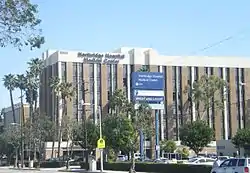
- Northridge Hospital Medical Center
- Studio 606 West, the recording studio of rock band Foo Fighters
- The US Metric Association is based in Northridge.
Hospital
Northridge Hospital Medical Center consists of a 411-bed hospital and serves 2 million residents of the Valley. The hospital is one of only two facilities in the Valley certified as a trauma center for treating life-threatening injuries.[34]
Parks, recreation and sports
The Northridge Recreation Center, located at 18300 Lemarsh St., has an indoor gymnasium, without weights, which may also be used as an auditorium. Its capacity is 400. The park also has barbecue pits, a lighted baseball diamond, lighted indoor basketball courts, lighted outdoor basketball courts, a children's play area, a community room, picnic tables, a lighted soccer field, and lighted tennis courts.[37] The Northridge Pool, on the recreation center grounds, is an outdoor heated seasonal pool.[37][38]
Dearborn Park, located at 17141 Nordhoff St., is an unstaffed, unlocked park has lighted outdoor basketball courts, a children's play area, picnic tables, and lighted tennis courts.[39]
Vanalden Park, located at 8956 Vanalden Ave., is an unstaffed pocket park, has a horseshoe pit, a jogging path, and picnic tables.[40]
Government and infrastructure
Local government
Los Angeles Fire Department Station 70[41] (Northridge) and Station 103[42] (Northridge/CSUN) serve the community.
City of Los Angeles neighborhood councils that cover Northridge:
- Northridge East Neighborhood Council[43]
- Northridge West Neighborhood Council[44]
- Northridge South Neighborhood Council[45]
The Los Angeles Police Department operates two police stations that serve Northridge:[46]
County, state, and federal representation
The Los Angeles County Department of Health Services operates the Pacoima Health Center in Pacoima, serving Northridge.[49]
The United States Postal Service Northridge Post Office is located at 9534 Reseda Boulevard.[50]
- Northridge is represented in the United States Senate by California's Senators Dianne Feinstein and Alex Padilla.[51]
- In the United States House of Representatives, Northridge is located within California's 30th congressional district represented by Democrat Brad Sherman.[52]
- In the State Assembly, Northridge is located within California's 45th State Assembly district represented by Democrat Jesse Gabriel.[53]
- In the California State Senate, Northridge is split between California's 18th State Senate district represented by Democrat Robert Hertzberg,[54] and California's 27th State Senate district represented by Democrat Henry Stern.[55]
- Northridge is located within the City of Los Angeles' 12th City Council District represented by Councilmember Mitchell Englander.[56]
Notable people
- Brooke Abel, Olympic synchronized swimmer
- Ariane Andrew, professional wrestler[57]
- Hal Bernson, Los Angeles City Council member, 1979-2003[58]
- Bob Brunner, producer and screenwriter[59][60]
- Champ Butler, singer[61]
- Matt Cassel, professional football[62]
- Jarron Collins, professional basketball[63]
- Jason Collins, professional basketball[64]
- Jim Davis, actor[65]
- Bobbi Fiedler, Congress member
- Linda Fratianne, figure skater at the 1980 Winter Olympics[66]
- Brian Grazer, film and television producer
- Cole Guttman, ice hockey player
- Jackie Earle Haley, actor[67]
- Mike Houghton, professional football[68]
- Travis Kalanick, Co-founder of Uber[69]
- Ryan Kalish, professional baseball[70]
- Antonia Lofaso, celebrity chef[71]
- Casey Matthews, professional football[72]
- Kyle, entertainer[73]
- Clay Matthews, professional football player[74]
- John H. Meier, business adviser to Howard Hughes[75]
- Lynn Carey Saylor, singer, guitarist and composer[76]
- Bob Skube, professional baseball[77]
- Malcolm Smith, professional football[78]
- Chad Steelberg, Entrepreneur
- Eric Steelberg, cinematographer[79]
- Brian Vranesh, professional golfer[80]
- Duffy Waldorf, professional golfer[81]
- Jeff Weaver, Major League Baseball[82]
- Jered Weaver, Major League Baseball[83]
- Danny Worth, professional baseball[84]
See also
References
- "Northridge ZIP Codes". zipdatamaps.com. 2022. Retrieved November 14, 2022.
- "A Valley oasis comes of age". Daily News. 2008-02-05. Retrieved 2021-01-18.
- Gordon, Ashley (May 25, 2011). "Northridge". Los Angeles Daily News.
- "Northridge", Mapping L.A., Los Angeles Times
- Colored map, Mapping L.A., Los Angeles Times (PDF)
- University, Asian Studies on the Pacific Coast 2016 Conference © California State; Street, Northridge 18111 Nordhoff; Northridge; Us, CA 91330 Phone:677-1200 / Contact (2015-09-12). "About Northridge". California State University, Northridge. Retrieved 2023-04-23.
- Sam. "Villages of the Gabrielino-Tongva". Tongvapeople.com. Archived from the original on July 18, 2017. Retrieved January 13, 2013.
- "Gabrieleno/Tongva Nation". Gabrieleno/Tongva Tribal Council of San Gabriel. Archived from the original on 2001-09-23.
- Roe, Diane (1993). "Pictographs of the Tongva or Gabrielino". Puvungna Educational Materials Regarding the Native Southern Californians In and Around the Long Beach Area. Hanon Sinay / Rancho Los Alamitos Foundation, Long Beach, CA. Archived from the original on May 26, 2010. Retrieved April 7, 2019.
- TheOkayNetwork.com (1997). Andres Pico Adobe - Historic Adobes of Los Angeles County by John R. Kielbasa - Things To Do In Los Angeles. Laokay.com. ISBN 0-8059-4172-X. Retrieved January 13, 2013.
- Historical Society of Southern California (1949). The Historical Society of Southern California quarterly. Allen County Public Library Genealogy Center. Los Angeles, Calif. : The Society.
- "Balloon Makes Enjoyable Trip". Los Angeles Herald. Vol. XXXVII, no. 105. January 14, 1910. p. 3.
- "For Sale". Los Angeles Herald. Vol. XXXVII, no. 205. April 24, 1910. p. 11. Retrieved May 16, 2023.
- "Zelzah Acres". Los Angeles Herald. Vol. XXXIII, no. 102. January 11, 1911. p. 11.
- "Suburbanites Ask for New School Districts". Los Angeles Herald. Vol. XXXIII, no. 33. November 3, 1910. p. 9. Retrieved May 16, 2023.
- "Post Office Changes". San Luis Obispo Daily Telegram. Vol. 14, no. 159. February 15, 1912. p. 2. Retrieved May 16, 2023.
- "Suburban Property: You Should Buy Zelzah Acres". Los Angeles Herald. Vol. XXXIX, no. 158. April 3, 1913. p. 20. Retrieved May 16, 2023.
- Binghannam, Abdul; Baltazar, Jason; Salazar, Jinmi; Sugarman, Joel; Jimenez, Maria; Lanyon, Reva (2015). Northridge Village Gateway Vision (PDF). California State University, Northridge.
{{cite book}}: CS1 maint: location missing publisher (link) - "Northridge Community Plan". planning.lacity.org. Retrieved 2023-05-16.
- "Expired". Photos.lapl.org. Retrieved January 13, 2013.
- Faris, Gerald. "Closing of 8 Schools Recommended, One Near Airport." Los Angeles Times. April 17, 1983. South Bay SB2. Retrieved on January 16, 2012.
- Savage, David G. "L.A. Board to Close 5 More Schools." Los Angeles Times. February 7, 1984. Part II C2. Retrieved on January 16, 2012.
- Pool. Bob. "Board to Consider Closing 4 More Valley Schools." August 7, 1983. Valley V2. Retrieved on January 16, 2012.
- Jalon, Allan and Elaine Woo. "Hope Emerges for Reopening of School in Northridge." Los Angeles Times. July 26, 1985. Retrieved on January 17, 2012.
- "Northridge: Schools," Mapping L.A., Los Angeles Times
- "CSUN University Catalog". catalog.csun.edu. Retrieved 2021-05-25.
- "CSU Total Enrollment by Sex and Student Level, Fall 2016". Archived from the original on 2017-05-02. Retrieved 2017-05-09.
- "California State University No rthridge: Community Impacts" (PDF). California State University, Northridge. Retrieved 2014-01-22.
- "Oakie House saved from destruction". LA Daily News. January 31, 2010. Archived from the original on February 27, 2013. Retrieved January 13, 2013.
- "Prior News". Idafan.com. Retrieved January 13, 2013.
- Beardsley, Jim A. "Newport '69, a retrospect". LA Observed, June 17, 2009. Retrieved January 12, 2013.
- "January 17, 1994 northridge earthquake". National Geophysical Data Center. Retrieved October 9, 2013.
- "Southern California Earthquake Data Center at Caltech". Archived from the original on 2014-10-06. Retrieved 2012-11-13.
- "History". Northridgehospital.org. Retrieved January 13, 2013.
- "San Fernando Earthquake". Southern California Earthquake Data Center. Archived from the original on April 7, 2014. Retrieved October 14, 2013.
- Donald E. Bianchi Planetarium Archived 2006-09-16 at the Wayback Machine at California State University, Northridge
- "Northridge Recreation Center". City of Los Angeles. Retrieved on March 23, 2010.
- "Northridge Pool Archived 2010-01-18 at the Wayback Machine." City of Los Angeles. Retrieved on March 23, 2010.
- "Dearborn Park Archived 2010-04-25 at the Wayback Machine." City of Los Angeles. Retrieved on March 23, 2010.
- "Vanalden Park." City of Los Angeles. Retrieved on March 23, 2010.
- "Station 70". Lafd.org. January 1, 2000. Archived from the original on July 26, 2013. Retrieved January 13, 2013.
- "Station 103". Lafd.org. January 1, 2000. Archived from the original on October 29, 2012. Retrieved January 13, 2013.
- "Northridge East Neighborhood Council". Nenc-la.org. Retrieved January 13, 2013.
- "Northridge West Neighborhood Council". Northridgewest.org. Retrieved January 13, 2013.
- "Northridge South Neighborhood Council". Northridgesouth.wordpress.com. December 7, 2011. Retrieved January 13, 2013.
- West Hills Police Stations lapdonline.org
- Devonshire Community Police Station lapdonline.org
- West Valley Community Police Station lapdonline.org
- "Pacoima Health Center". Los Angeles County Department of Health Services. Retrieved on March 17, 2010.
- "Post Office Location – NORTHRIDGE Archived 2012-07-16 at archive.today". United States Postal Service. Retrieved on December 6, 2008.
- California Senators accessed November 7, 2018
- https://www.govtrack.us/congress/members/CA/30#q=Canoga%20Park%2C%20CA&marker_lng=-118.5978&marker_lat=34.2011 [Canoga Park U.S-Representative]
- https://a45.asmdc.org/district-map[Assembly District 45 Map]
- http://findyourrep.legislature.ca.gov [Find Your Representative CA]
- "Find Address". findyourrep.legislature.ca.gov. Retrieved 2021-01-18.
- http://navigatela.lacity.org/common/mapgallery/pdf/council_districts/CDindex_8.5_11.pdf [Map of LA CITY COUNCIL Districts]
- "WWE Diva Cameron starts right cause with 'Wrong #'". Miami Herald. Retrieved February 17, 2016.
- Los Angeles Public Library reference file
- "Bob Brunner, 'Happy Days' writer, dies". Variety. November 8, 2012. Retrieved November 27, 2012.
- Barnes, Mike (November 7, 2012). "'Happy Days' Writer-Producer Bob Brunner Dies at 78". The Hollywood Reporter. Retrieved November 27, 2012.
- "Singer Champ Butler Handed $210 Fine". The San Bernardino County Sun. April 26, 1960.
- "Matt Cassel". databaseFootball.com. Retrieved December 3, 2012.
- "Jarron Thomas Collins". Basketball-Reference.Com. Retrieved December 3, 2012.
- "Jason Collins". Basketball-Reference.Com. Retrieved December 3, 2012.
- Barbanel, Josh (April 27, 1981). "Jim Davis, Actor, 65, Dies; Led Ewings in Dallas'". New York Times.
- Evans, Hilary; Gjerde, Arild; Heijmans, Jeroen; Mallon, Bill; et al. "Linda Fratianne". Olympics at Sports-Reference.com. Sports Reference LLC. Archived from the original on 2020-04-17.
- Yahoo.com Archived September 27, 2009, at the Wayback Machine
- "Michael Christopher Houghton". Pro-Football.com. Retrieved December 3, 2012.
- Isaac, Mike (23 April 2017). "Uber's C.E.O. Plays With Fire". The New York Times. Retrieved December 4, 2020.
- "Ryan Kalish Stats". Baseball Almanac. Retrieved December 3, 2012.
- "Work/Life Balance: Antonia Lofaso". 11 June 2015.
- "Casey Matthews 50". FoxSports.com. Retrieved December 3, 2012.
- "Kyle is a different kind of West Coast rapper". Los Angeles Times. Retrieved August 24, 2018.
- "Clay Matthews". Packers.com. Retrieved October 18, 2015.
- Age of Secrets: The Conspiracy that Toppled Richard Nixon and the Hidden Death of Howard Hughes written by Gerald Bellett, 1995, Voyageur North America, ISBN 0-921842-42-2
- "OurStage - Lynn Carey Saylor". OurStage. Retrieved May 16, 2017.
- "Bob Skube Stats". Baseball Almanac. Retrieved December 3, 2012.
- "Malcolm Smith". The Official Site of USC Trojan Athletics. Retrieved November 26, 2012.
- "Clubhouse News". American Cinematographer. December 2012. Retrieved September 23, 2015.
- "Brian Vranesh". PGA Tour. Archived from the original on October 26, 2012. Retrieved December 3, 2012.
- "Duffy Waldorf". PGA Tour. Archived from the original on October 30, 2012. Retrieved December 10, 2012.
- "Jeff Weaver Stats". Baseball Almanac. Retrieved December 3, 2012.
- "Jered Weaver Stats". Baseball Almanac. Retrieved December 3, 2012.
- "Danny Worth Stats". Baseball Almanac. Retrieved December 3, 2012.
