Noire River (Huron River tributary)
The Noire River (in French: rivière Noire) is a tributary of the north shore of the Huron River. The latter's current flows into the rivière du Chêne which flows onto the south shore of the St. Lawrence River.
| Noire River | |
|---|---|
 | |
| Native name | Rivière Noire (French) |
| Location | |
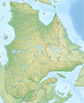
| Country | Canada |
| Province | Quebec |
| Region | Chaudière-Appalaches |
| MRC | Lotbinière Regional County Municipality |
| Physical characteristics | |
| Source | Agricultural and forest streams |
| • location | Laurier-Station and Notre-Dame-du-Sacré-Cœur-d'Issoudun |
| • coordinates | 46.596144°N 71.626821°W |
| • elevation | 93 metres (305 ft) |
| Mouth | Huron River |
• location | Notre-Dame-du-Sacré-Cœur-d'Issoudun |
• coordinates | 46.56166°N 71.70306°W |
• elevation | 89 metres (292 ft) |
| Length | 6.8 kilometres (4.2 mi) |
| Basin features | |
| River system | St. Lawrence River |
| Tributaries | |
| • left | (upstream) |
| • right | (upstream) |
The Rivière Noire flows through the municipalities of Notre-Dame-du-Sacré-Cœur-d'Issoudun and Sainte-Croix-de-Lotbinière, in the Lotbinière Regional County Municipality, in the administrative region of Chaudière-Appalaches, in Québec, in Canada.
Geography
The main neighboring watersheds of the Black River are:
- north side: Petit Saut River, St. Lawrence River;
- east side: Bois Franc stream, Bourret stream, Noire River, Rouge River (Beaurivage River tributary), rivière aux Pins, Beaurivage River;
- south side: Bois Franc-Pierreriche stream, Tête de la Rivière Huron, rivière aux Cèdres, Henri River, rivière du Chêne;
- west side: Huron River, rivière du Chêne.
The Black River has its source in Notre-Dame-du-Sacré-Cœur-d'Issoudun. This area is located 4.7 kilometres (2.9 mi) south of the south shore of the St. Lawrence River, 8.3 kilometres (5.2 mi) southwest of the village center of Saint-Antoine-de-Tilly, at 8.6 kilometres (5.3 mi) west of the center of the village of Saint-Apollinaire, at 1.9 kilometres (1.2 mi) north of the village of Notre-Dame-du-Sacré-Cœur-d'Issoudun and 7.9 kilometres (4.9 mi) north of the center of the village of Laurier-Station.
From its source, the Rivière Noire flows on 6.8 kilometres (4.2 mi) towards the south-west including 1.4 kilometres (0.87 mi) (divided into two segments) in Sainte-Croix-de-Lotbinière. Its course intersects route 271.[1]
The confluence of the Rivière Noire is located at the Route Frenette bridge connecting the route du 5e Rang and the route du sixth Rang, in the municipality of Notre-Dame-du-Sacré-Cœur-d'Issoudun. This confluence is located only 140 metres (460 ft) from the limit of Saint-Janvier-de-Joly.
Toponymy
The toponym "rivière Noire" was made official on August 8, 1977, at the Commission de toponymie du Québec.[2]