Nikolov Cove
Nikolov Cove (Bulgarian: Николов залив, ‘Nikolov Zaliv’ \ni-'ko-lov 'za-liv\) is the 950 m wide cove on Boyd Strait indenting for 500 m the southeast coast of Smith Island in the South Shetland Islands, Antarctica, and entered northeast of Velikan Point and southwest of Razdel Point. Its head is fed by Ovech Glacier.
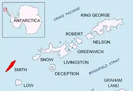
Location of Smith Island in the South Shetland Islands.
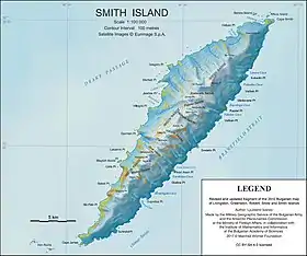
Topographic map of Smith Island.
The cove is named after Todor Nikolov for his support for the First Bulgarian Antarctic Expedition.
Location
Nikolov Cove is located at 62°58′00″S 62°25′10″W, which is 12 km southwest of Cape Smith. Bulgarian mapping in 2009 and 2010.
Maps
- Chart of South Shetland including Coronation Island, &c. from the exploration of the sloop Dove in the years 1821 and 1822 by George Powell Commander of the same. Scale ca. 1:200000. London: Laurie, 1822.
- L.L. Ivanov. Antarctica: Livingston Island and Greenwich, Robert, Snow and Smith Islands. Scale 1:120000 topographic map. Troyan: Manfred Wörner Foundation, 2010. ISBN 978-954-92032-9-5 (First edition 2009. ISBN 978-954-92032-6-4)
- South Shetland Islands: Smith and Low Islands. Scale 1:150000 topographic map No. 13677. British Antarctic Survey, 2009.
- Antarctic Digital Database (ADD). Scale 1:250000 topographic map of Antarctica. Scientific Committee on Antarctic Research (SCAR). Since 1993, regularly upgraded and updated.
- L.L. Ivanov. Antarctica: Livingston Island and Smith Island. Scale 1:100000 topographic map. Manfred Wörner Foundation, 2017. ISBN 978-619-90008-3-0
References
- Bulgarian Antarctic Gazetteer. Antarctic Place-names Commission. (details in Bulgarian, basic data in English)
- Nikolov Cove. SCAR Composite Antarctic Gazetteer
External links
- Nikolov Cove. Copernix satellite image
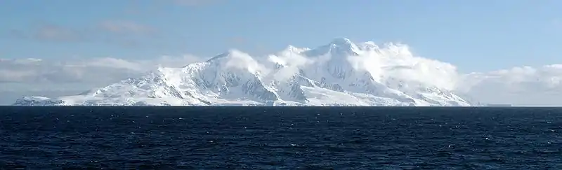
The southeast side of Smith Island from Osmar Strait
This article includes information from the Antarctic Place-names Commission of Bulgaria which is used with permission.
This article is issued from Wikipedia. The text is licensed under Creative Commons - Attribution - Sharealike. Additional terms may apply for the media files.