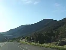
New Mexico State Road 585
State Road 585 (NM 585), is a 2.2-mile (3.5 km) state highway in Taos County, New Mexico, United States, that runs along Paseo Del Cañon East and connects New Mexico State Road 68 (NM 68) in Taos with U.S. Route 64 (US 64) east of Taos.
State Road 585 | ||||
|---|---|---|---|---|
| Paseo Del Cañon East | ||||
NM 585 highlighted in red | ||||
| Route information | ||||
| Maintained by NMDOT | ||||
| Length | 2.204 mi[1] (3.547 km) | |||
| Existed | 1988–present | |||
| Major junctions | ||||
| West end | ||||
| East end | ||||
| Location | ||||
| Country | United States | |||
| State | New Mexico | |||
| Counties | Taos | |||
| Highway system | ||||
| ||||
| ||||
Route description

NM 585 begins at a traffic light–controlled intersection with NM 68 (Paseo Del Pueblo Sur) in southwestern Taos, immediately north of the Taos Visitor Center. (From the intersection Paseo Del Cañon West heads westerly for about one mile [1.6 km] to end at Cam Del Medio. NM 68 heads north–northeast to end at US 64 in northern Taos. NM 68 heads southwesterly toward Ranchos De Taos, Velarde, and Española.) From its western terminus NM 585 heads southeast as a four–lane divided highway for about 0.2 miles (0.32 km) to a roundabout with Gusdorf Road. Curving slightly to the north, it continues east–southeast for about another 0.3 miles (0.48 km) to a roundabout with the north (west) end of Weimer Road. (Weimer Road forms a southern loop off of NM 585.) After the westbound lanes (only) connect with the west end of Calle Palomita, NM 585 has another roundabout, this time with the south end of Camino de Colores.[2]
Heading east from its third roundabout, NM 585 narrows to a two–lane road before connecting with the south end of Camino De La Cruz. After continuing east for about one-half mile (0.80 km) NM 585 crossed Cruz Alta Road/Weimer Road, with Cruz Alta Road on the north and the north (east) end of Weimer Road on the south. After about another 0.4 miles (0.64 km), NM 585 leaves Taos and enters an unincorporated area of Taos County. About 0.2 miles (0.32 km) farther east, NM 585 curves to head northeast before connecting with the east end of Witt Road. Promptly thereafter, reaches its eastern terminus at US 64 at a T intersection. (US 64 heads east toward Angel Fire, Eagle Nest, and Raton.)[2]
History
NM 585 was created in 1988 as a renumbering of a spur of NM 68.
Major intersections
The entire route is in Taos County.
| Location | mi[1][3] | km | Destinations[2] | Notes | |
|---|---|---|---|---|---|
| Taos | 0.000 | 0.000 | Paseo Del Cañon West west | Continuation west beyond western terminus | |
| Western terminus | |||||
| | 2.204 | 3.547 | Eastern terminus: T intersection | ||
| 1.000 mi = 1.609 km; 1.000 km = 0.621 mi | |||||
References
- "Posted Route: Legal Description" (PDF). New Mexico Department of Transportation. March 16, 2010. p. 91. Retrieved October 10, 2018.
- Google. "NM-585, Taos, NM 87571" (Map). Google Maps. Google.
- "TIMS Road Segments by Posted Route/Point with AADT Info; NM, NMX-Routes" (PDF). New Mexico Department of Transportation. April 3, 2013. pp. 5–7. Retrieved December 20, 2013.
External links
![]() Media related to New Mexico State Road 585 at Wikimedia Commons
Media related to New Mexico State Road 585 at Wikimedia Commons
