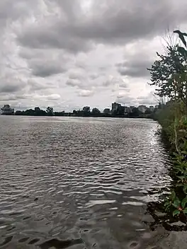
Nepean Bay (Canada)
Nepean Bay,[2] is a bay in the Ottawa River in Ottawa, Ontario, Canada. It is located between Lemieux Island and the Chief William Commanda Bridge on the west and LeBreton Flats on the east.
| Nepean Bay | |
|---|---|
 | |
 Nepean Bay Location in Ontario | |
| Location | Ottawa, Ontario, Canada |
| Coordinates | 45°24′47″N 75°43′27″W |
| Etymology | Sir Evan Nepean[1] |
| Part of | Ottawa River |
| Primary inflows | Nepean Bay inlet |
| Basin countries | Canada |
| Max. length | 862 m (2,828 ft) |
| Max. width | 287 m (942 ft) |
| Surface elevation | 53 m (174 ft) |
History
In the early 20th century, the bay was used for Ottawa's drinking water. In 1912, experts deemed the bay "no fit place under which to lay an intake pipe without great precautions", due to the intake pipe being in disrepair due to the number of logs in the bay from Ottawa's lumber industry.[3] During a typhoid fever epidemic at the time, tests taken from drinking water from the bay showed that it was contaminated with pollution.[4] Plans to build a pipeline to carry treated water over the bay as a bridge was dismissed as a "wild undertaking".[5]
In 1938, following complaints of "nude bathing" at the bay, the city entertained the possibility of establishing a public beach at the site.[6]
The southern half of the bay (40 acres) was in-filled with garbage[7] from excavation work on government projects between 1962 and 1965[8] by the National Capital Commission. The new reclaimed land would be used for park and recreation purposes, and for the construction of the Ottawa River Parkway. The project, which began in 1961 also included a clean-up of the Canadian Pacific Railway tracks and roundhouse in the area.[9] The total cost of the project was estimated at $17,500,000.[7] Originally, the plan was to build a causeway across the bay for the new parkway.[10] The contract to build the parkway along the edge of Nepean Bay was awarded in 1964 to L.J. Corkery Ltd. for $371,969, and involved removing 100,000 cubic yards of sanitary fill from the bay, and replacing it with 300,000 tons of granular fill.[11] This stretch of the parkway was completed in 1967.[12] Other proposed plans for the site at the time included building a heliport[13] and a garbage dump.[14]
References
- "Nepean...Who's Nepean?". Ottawa Citizen. August 17, 1967. Retrieved 2021-07-04.
- "Nepean Bay". Geographical Names Data Base. Natural Resources Canada.
- "Experts Assert Drinking Water Has Been Coming Solely From Nepean Bay". Ottawa Citizen. September 7, 1912. Retrieved 2021-07-04.
- "The Typhoid Not Abating". Ottawa Citizen. February 4, 1911. Retrieved 2021-07-04.
- "A Great Sickness". Ottawa Citizen. October 30, 1995. Retrieved 2021-07-04.
- "Public Beach Near Nepean Bay Asked". Ottawa Citizen. June 28, 1938. Retrieved 2021-07-04.
- "Ottawa of Tomorrow Taking Shape Today". Ottawa Citizen. April 24, 1963. Retrieved 2021-07-04.
- "Ottawa River Parkway rushed to completion for opening in 1967". Ottawa Citizen. July 6, 1966. Retrieved 2021-07-04.
- "First Step Is Taken To Fill In Nepean Bay". Ottawa Citizen. September 20, 1961. Retrieved 2021-07-04.
- "Proposed Causeway Across Nepean Bay". Ottawa Journal. June 25, 1960. Retrieved 2021-07-04.
- "NCC awards fill contract". Ottawa Citizen. August 27, 1964. Retrieved 2021-07-04.
- "Ottawa River Parkway Nearing Completion". Ottawa Citizen. June 16, 1967. Retrieved 2021-07-04.
- "Want Nepean Bay for Heli-Port". Ottawa Journal. February 20, 1959. Retrieved 2021-07-04.
- "City Seeks Nepean Bay Site for Garbage Disposal Area". Ottawa Citizen. February 11, 1959. Retrieved 2021-07-04.