Naliya
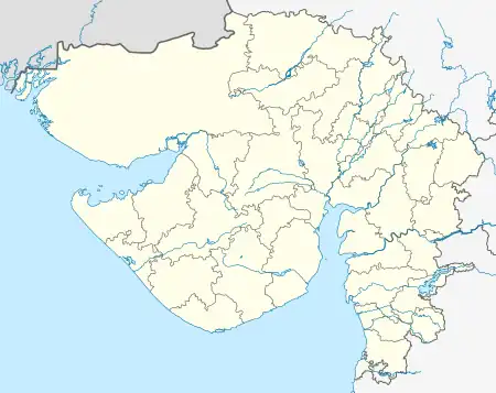
Naliya is a town, which is also the taluka headquarters of Abdasa Taluka of Kutch District (kachchh), Gujarat, India. It is located on the western end of Kutch 19 km by road from ancient port of Jakhau.
Naliya | |
|---|---|
Town | |
 Jain Temple in Naliya | |
 Naliya Location in Gujarat, India  Naliya Naliya (India) | |
| Coordinates: 23°15′40″N 068°49′36″E | |
| Country | |
| State | Gujarat |
| District | Kutch |
| Taluka | Abdasa |
| Named for | Coldest Area In Gujarat |
| Population (2011) | |
| • Total | 11,415 |
| Time zone | UTC+5:30 (IST) |
| Vehicle registration | GJ 12 |
| Lok Sabha constituency | Kachchh |
| Vidhan Sabha constituency | Abdasa[1] |
| Website | gujaratindia |
History
Naliya was a prosperous trading town in past who had trading ties with Zanzibar and Bombay. It had a population of 5238 in 1880.[2]
Climate
| Climate data for Naliya (1981–2010, extremes 1958–2012) | |||||||||||||
|---|---|---|---|---|---|---|---|---|---|---|---|---|---|
| Month | Jan | Feb | Mar | Apr | May | Jun | Jul | Aug | Sep | Oct | Nov | Dec | Year |
| Record high °C (°F) | 36.2 (97.2) |
38.0 (100.4) |
43.4 (110.1) |
43.5 (110.3) |
44.6 (112.3) |
43.4 (110.1) |
41.4 (106.5) |
37.9 (100.2) |
40.7 (105.3) |
42.0 (107.6) |
39.7 (103.5) |
36.9 (98.4) |
44.6 (112.3) |
| Average high °C (°F) | 27.9 (82.2) |
29.9 (85.8) |
33.0 (91.4) |
34.8 (94.6) |
35.1 (95.2) |
34.8 (94.6) |
32.6 (90.7) |
31.3 (88.3) |
32.6 (90.7) |
35.4 (95.7) |
33.6 (92.5) |
29.5 (85.1) |
32.5 (90.5) |
| Average low °C (°F) | 10.4 (50.7) |
13.0 (55.4) |
17.5 (63.5) |
21.6 (70.9) |
26.0 (78.8) |
27.8 (82.0) |
27.0 (80.6) |
25.8 (78.4) |
24.7 (76.5) |
21.1 (70.0) |
16.1 (61.0) |
12.0 (53.6) |
20.2 (68.4) |
| Record low °C (°F) | 1.2 (34.2) |
0.4 (32.7) |
6.4 (43.5) |
11.7 (53.1) |
16.4 (61.5) |
20.0 (68.0) |
22.1 (71.8) |
21.2 (70.2) |
17.4 (63.3) |
11.2 (52.2) |
5.0 (41.0) |
0.6 (33.1) |
0.4 (32.7) |
| Average rainfall mm (inches) | 1.5 (0.06) |
2.5 (0.10) |
0.3 (0.01) |
0.0 (0.0) |
0.3 (0.01) |
35.7 (1.41) |
156.5 (6.16) |
89.0 (3.50) |
34.1 (1.34) |
2.9 (0.11) |
2.8 (0.11) |
0.8 (0.03) |
326.5 (12.85) |
| Average rainy days | 0.1 | 0.3 | 0.1 | 0.0 | 0.1 | 1.4 | 5.0 | 3.5 | 1.6 | 0.3 | 0.2 | 0.1 | 12.7 |
| Average relative humidity (%) (at 17:30 IST) | 32 | 36 | 41 | 50 | 62 | 67 | 74 | 75 | 67 | 48 | 33 | 32 | 52 |
| Source: India Meteorological Department[3][4] | |||||||||||||
Demographics
In the 2011 census, the village of Naliya had 11,415 inhabitants for a gender ratio of 939 females per thousand males.[5]
Indian Air Force Station
Naliya is home to the Naliya Air Force Station of the Indian Air Force, which was built here in view of the town's proximity to Pakistan.[6]
Transport

National Highway 41 connects Naliya to Bhuj.
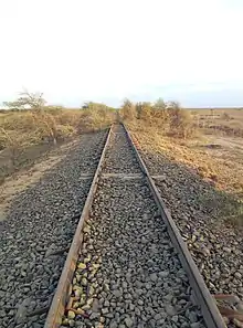
A metre gauge railway line was laid in 1980 to connect the town with Bhuj. Passenger and freight trains ran on it from Naliya railway station to Bhuj. The track was abandoned later after Gandhidham-Bhuj section was converted to broad-gauge and this 101.52 km railway line became isolated. Gauge conversion to broad gauge was approved by the government in 2008.[7] The gauge conversion of 28 km was completed up between Bhuj and Desalpur in 2018. The work in remaining 74 km is in progress.
The Naliya Cantonment Station will be the rail station for Naliya town after the gauge conversion is completed. Due to security reason the 6.12 kilometres (3.80 mi) railway line stretch between Naliya Cantonment and Naliya Town will not be made since Naliya is situated just 25.98 kilometres (16.14 mi) from India-Pakistan border of Sir Creek marsh lands.
Tourism
Naliya Jain Derasar
Naliya is a century old town, which has Jain temples & mosques built several centuries ago.[8][9] It is a famous Jain pilgrimage center and one of the five famous Jain temples of Abdasa ni Panchtirthi (meaning five-temples of Abdasa) is in the town. Other Jain temples are in nearby places in Abdasa Taluka. The main architects of these centuries old Jain temples were Mistris of Kutch.[10][11]
Moolnayak Bhagwaan is Chandraprabha. The main idol of Shri Chandraprabhu Bhagwan is Swet varn(white coloured) of about 72 cm in padmasanastha position.
Bustard Sanctuary

Naliya is also famous for Great Indian Bustard Sanctuary also known as Lala–Parjan Sanctuary, which is located nearby the town. With an area of about only 2 square kilometers, it is the smallest sanctuary in the country. There are approximately 30 great Indian bustards here, second only to Desert National Park, Rajasthan.[12][13]
References
- "Assembly Constituencies-Post delimitation, State: Gujarat, District: Ahmadabad" (PDF). National Information Centre, Government of India. Archived from the original (PDF) on 24 December 2012.
- Gazetteer of the Bombay Presidency: Cutch, Palanpur, and Mahi Kantha. Printed at the Government Central Press. 1880. p. 244.
- "Station: Naliya Climatological Table 1981–2010" (PDF). India Meteorological Department. December 2016. pp. 531–532. Archived from the original (PDF) on 5 February 2020. Retrieved 28 December 2020.
- "Extremes of Temperature & Rainfall for Indian Stations (Up to 2012)" (PDF). India Meteorological Department. December 2016. p. M57. Archived from the original (PDF) on 5 February 2020. Retrieved 28 December 2020.
- "Census 2001 Population Finder: Gujarat: Kachchh: Abdasa: Naliya". Office of The Registrar General & Census Commissioner, Ministry of Home Affairs, Government of India. Archived from the original on 3 June 2013.
- Air Force Station,Naliya (kutch),Kutch-370 655
- "Bhuj-Naliya Broad Gauge rail line sanctioned". 16 October 2008.
- Shri Naliya Tirth
- Naliya
- Kutch Gurjar Kshatriyas : A brief History & Glory: by Raja Pawan Jethwa. (2007) Calcutta.pp:28-29
- Nanji Bapa ni Nondh-pothi published in Gujarati in year 1999 from Vadodara.
- Great Indian Bustard Sanctuary, Naliya, Kachchh
- Naliya Birds