Mulegé Airstrip
Mulegé Airstrip or Mulegé Municipal Airstrip (IATA: MUG, ICAO: MMMG) is a public dirt airstrip located 3 kilometres (1.9 mi) northeast of the town of Mulegé, in the Municipality of Mulegé, Baja California Sur state, northwest Mexico.
Mulegé Airstrip | |||||||||||
|---|---|---|---|---|---|---|---|---|---|---|---|
| Summary | |||||||||||
| Airport type | Public, General aviation | ||||||||||
| Serves | Mulegé | ||||||||||
| Location | Mulegé Municipality, Baja California Sur, Mexico | ||||||||||
| Elevation AMSL | 124 ft / 38 m | ||||||||||
| Coordinates | 26°54′21″N 111°58′14″W | ||||||||||
| Map | |||||||||||
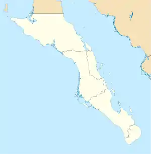
 MUG Location of airport in Baja California Sur  MUG MUG (Mexico) | |||||||||||
| Runways | |||||||||||
| |||||||||||
| Statistics (2016) | |||||||||||
| |||||||||||
Source: Dirección General de Aeronáutica Civil | |||||||||||
It is on the north bank of the Mulegé River, 3 kilometres (1.9 mi) from the Gulf of California coast.
The airstrip is used solely for general aviation purposes. It is a secondary airport to the El Gallito Airstrip, which is the most used, due to better quality installations and safety conditions.
External links
This article is issued from Wikipedia. The text is licensed under Creative Commons - Attribution - Sharealike. Additional terms may apply for the media files.