Mount Peres
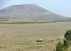
Mount Peres (Arabic: تل الفرس, Tall al-Faras, Hebrew: הר פֶּרֶס, Har Peres) is a volcanic mountain located in central Golan Heights, some 5.5 kilometres (3.4 mi) east of Moshav Keshet.[1] Its highest point is 929 metres (3,048 ft) above sea level, or about 200 metres (660 ft) above ground level. The mountain is the southernmost of a series of dormant volcanoes that stretch up to the northern parts of the Golan Heights. On top of the mountain is a well-preserved crater, 200 m (660 ft) in diameter and 35 m (115 ft) deep.
| Mount Peres | |
|---|---|
| تل الفرس (in Arabic) הר פֶּרֶס (in Hebrew) | |
 | |
| Highest point | |
| Elevation | 929 m (3,048 ft) |
| Coordinates | 32°57′34″N 35°51′50″E |
| Geography | |
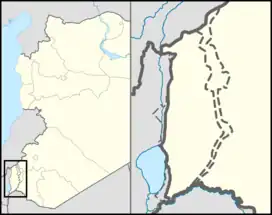 Mount Peres Location in the Golan Heights | |
| Location | Golan Heights |
| Parent range | Peres mountain range |
| Geology | |
| Mountain type | Volcano |
This article is issued from Wikipedia. The text is licensed under Creative Commons - Attribution - Sharealike. Additional terms may apply for the media files.