Montgomery Run (Anderson Creek tributary)
Montgomery Run is a 4.70 mi (7.56 km) long 2nd order tributary to Anderson Creek in Clearfield County, Pennsylvania.
| Montgomery Run Tributary to Anderson Creek | |
|---|---|
 Location of Montgomery Run mouth  Montgomery Run (Anderson Creek tributary) (the United States) | |
| Location | |
| Country | United States |
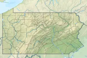
| State | Pennsylvania |
| County | Clearfield |
| Physical characteristics | |
| Source | Moose Creek divide |
| • location | about 5 miles south-southwest of Anderson Creek, Pennsylvania |
| • coordinates | 41°06′36″N 078°33′21″W[1] |
| • elevation | 2,055 ft (626 m)[2] |
| Mouth | |
• location | about 2 miles northeast of Rockton, Pennsylvania |
• coordinates | 41°05′46″N 078°37′26″W[1] |
• elevation | 1,675 ft (511 m)[3] |
| Length | 4.70 mi (7.56 km)[4] |
| Basin size | 10.11 square miles (26.2 km2)[5] |
| Discharge | |
| • location | Anderson Creek |
| • average | 18.94 cu ft/s (0.536 m3/s) at mouth with Anderson Creek[5] |
| Basin features | |
| Progression | Anderson Creek → West Branch Susquehanna River → Susquehanna River → Chesapeake Bay → Atlantic Ocean |
| River system | Susquehanna River |
| Tributaries | |
| • left | Coupler Run Burns Run |
| • right | unnamed tributaries |
| Bridges | Kelley Cellar Road |
Course
Montgomery Run rises about 2 miles northeast of Rockton, Pennsylvania, and then flows generally southwest to join Anderson Creek about 5 miles south-southwest of Anderson Creek.[3]
Watershed
Montgomery Run drains 10.11 square miles (26.2 km2) of area, receives about 45.8 in/year of precipitation, has a wetness index of 446.10, and is about 93% forested.[5]
See also
References
- "GNIS Detail - Montgomery Run". geonames.usgs.gov. US Geological Survey. Retrieved 23 August 2021.
- "Get Maps". USGS Topoview. US Geological Survey. Retrieved 23 August 2021.
- "Get Maps". USGS Topoview. US Geological Survey. Retrieved 23 August 2021.
- "ArcGIS Web Application". epa.maps.arcgis.com. US EPA. Retrieved 23 August 2021.
- "Montgomery Run Watershed Report". US EPA Geoviewer. US EPA. Retrieved 23 August 2021.
Watershed Maps
Course of Montgomery Run (Anderson Creek tributary) in Clearfield County, Pennsylvania, USA
Watershed of Montgomery Run (Anderson Creek tributary) in Clearfield County, Pennsylvania, USA
This article is issued from Wikipedia. The text is licensed under Creative Commons - Attribution - Sharealike. Additional terms may apply for the media files.