Maynard Lake
Maynard Lake is located on the English River system, 80 kilometres (50 mi) northeast of Kenora, Ontario.
| Maynard Lake | |
|---|---|
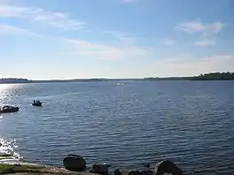 View from the Western shoreline around 7:45 AM | |
 Maynard Lake | |
| Location | Ontario |
| Coordinates | 50.359°N 93.888°W |
| Primary inflows | English River |
| Primary outflows | Maynard Falls |
| Basin countries | Canada |
| Surface area | 12.3 square miles (32 km2) |
| Max. depth | 135 feet (41 m) |
| Surface elevation | 1,050 feet (320 m) Above Sea Level |
| Islands | 10 - 20 |
Access
Maynard Lake is only accessible via seaplane. During the winter it can be accessed by logging roads and ice roads.
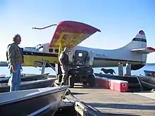
Walsten Air Otter tied to the dock at Maynard
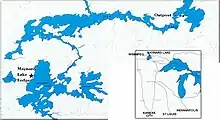
Map of the lake
See also
This article is issued from Wikipedia. The text is licensed under Creative Commons - Attribution - Sharealike. Additional terms may apply for the media files.