Mainpat
Mainpat is a hill station and small village in the Surguja district in the northern part of the state of Chhattisgarh, India. It lies about 55 kilometres (34 mi) by road from Ambikapur. This hill station is 50 km south of divisional headquarter of Ambikapur, 160 km northeast of Korba, and 360 km northeast of state capital Raipur.
Mainpat | |
|---|---|
Hilly village | |
From top, left to right: Mainpat hills, Police training school, Buddhist temple in Mainpat, Buddhist Monastery, Tiger point, waterfall, Ulta pani Mainpat, Aerial view of hills | |
| Nickname: Shimla of Chhattisgarh | |
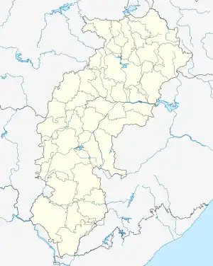
 Mainpat Location in Chhattisgarh, India  Mainpat Mainpat (India) | |
| Coordinates: 22.837°N 83.315°E | |
| Country | |
| State | Chhattisgarh |
| Elevation | 1,085 m (3,560 ft) |
| Languages | |
| • Official | Hindi, Chhattisgarhi |
| Time zone | UTC+5:30 (IST) |
| Vehicle registration | CG |
This hill station is famous for the Ulta Pani or Bisar Paani which seems to defy the gravity and flows upward.[1][2]
Overview
Mainpat is known as the "Shimla/Swiss of Chhattisgarh" and is a popular tourist attraction. It is also home to a number of Tibetan religious exiles who worship at a temple dedicated to Buddha and manufacture designer mats as well as woolen cloth.[3]
Recently, the village has been developed infrastructure like roads & rest houses for travelers. Here one can easily find a lot of adventurous sports like Trekking, Zorbing Ball, Rapling etc. Fields are covered with yellow and white crops.
There is a place in a village called Bisar Paani (5 KM before Mainpat on right side of road going from Ambikapur to Mainpat) where water flows upstream. Villagers have made a canal for watering and water flows upward 30 ft on its own. No device and no scientific explanation could be found. The hill station features the Tiger Point Waterfall, Fish Point Waterfall, Ghaghi waterfall, Zalzali(bouncing land), Parpatiya view point and Buddha temples.
History
1962-63 lot of Tibetans migrated to India. Government of India allotted them the land in Mainpat hill. The Home Ministry gave 3000 acres of land to about 1400 Tibetan immigrants.[4] The village was traditionally home to the Yadavs and tribes including the Manjhi.[5]
Gravity hill
Ulta Pani, also called Bisar Paani, is the place on this hill which is a gravity hill where due to the optical illusion the water seems to defy the gravity and seems flows from bottom to uphill.[1][2]
Connectivity
By road
Nearest bus stand is Ambikapur Bus Terminal from where tourist vehicles can be booked
By Rail
Nearest Railway station is Ambikapur Railway station
By Air
Nearest Airport is Ambikapur Airport which is currently under development after which Ambikapur Airport is poised to get Air connectivity to Raipur & Varanasi
See also
References
- "Chhattisgarh facts: छत्तीसगढ़ का शिमला कर देगा हैरान, यहां चढ़ाई की ओर बहती है धारा, नाम है उल्टापानी- देखें Video". www.patrika.com.
- ultapani, newsreport.
- "Tourism". Surguja District Government. Archived from the original on 14 September 2014. Retrieved 14 April 2014.
- Goyal, Anuradha (1 June 2012). "A Bit Of Tibet In Chhattisgarh State At Mainpat Hill". Inditales. Retrieved 15 October 2020.
- "Chhattisgarh plans Mainpat Carnival". Daily Pioneer. 25 December 2013. Retrieved 14 April 2014.
External links
![]() Mainpat travel guide from Wikivoyage
Mainpat travel guide from Wikivoyage