Mai Kaen district
Mai Kaen (Thai: ไม้แก่น, pronounced [máːj kɛ̀n]) is the southeasternmost district (amphoe) of Pattani province, southern Thailand.
Mai Kaen
ไม้แก่น | |
|---|---|
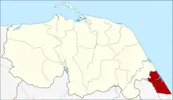 District location in Pattani province | |
| Coordinates: 6°36′36″N 101°40′2″E | |
| Country | Thailand |
| Province | Pattani |
| Seat | Sai Thong |
| Area | |
| • Total | 55.201 km2 (21.313 sq mi) |
| Population (2005) | |
| • Total | 11,269 |
| • Density | 204.1/km2 (529/sq mi) |
| Time zone | UTC+7 (ICT) |
| Postal code | 94220 |
| Geocode | 9408 |
History
The minor district (king amphoe) Mae Kaen was formed on 15 November 1973 by splitting the two tambons Sai Thong and Mai Kaen from Sai Buri district.[1] On 4 July 1994 it was upgraded to a full district.[2]
Geography
Neighboring districts are (from the south clockwise): Mueang Narathiwat and Bacho of Narathiwat province and Sai Buri of Pattani Province. To the east is the Gulf of Thailand.
Administration
The district is divided into four sub-districts (tambons), which are further subdivided into 17 villages (mubans). There are no municipal (thesabans). There are three tambon administrative organizations (TAO).
| No. | Name | Thai name | Villages | Pop. | |
|---|---|---|---|---|---|
| 1. | Sai Thong | ไทรทอง | 5 | 4,369 | |
| 2. | Mai Kaen | ไม้แก่น | 4 | 1,822 | |
| 3. | Talo Krai Thong | ตะโละไกรทอง | 4 | 2,331 | |
| 4. | Don Sai | ดอนทราย | 4 | 2,747 |
References
- ประกาศกระทรวงมหาดไทย เรื่อง แบ่งท้องที่อำเภอสายบุรี จังหวัดปัตตานี ตั้งเป็นกิ่งอำเภอไม้แก่น (PDF). Royal Gazette (in Thai). 90 (147 ง): 3826. November 20, 1973. Archived from the original (PDF) on September 30, 2007.
- พระราชกฤษฎีกาตั้งอำเภอเปือยน้อย ... และอำเภอศรีวิไล พ.ศ. ๒๕๓๗ (PDF). Royal Gazette (in Thai). 111 (21 ก): 32–35. June 3, 1994. Archived from the original (PDF) on September 30, 2007.
This article is issued from Wikipedia. The text is licensed under Creative Commons - Attribution - Sharealike. Additional terms may apply for the media files.