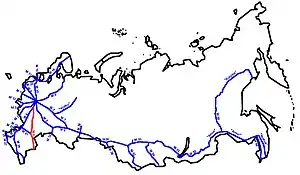
R22 highway (Russia)
The Russian route P22 (also known as the Caspian Highway) is a major trunk road that links Moscow to the Caspian Sea. The road runs from Stupino, then heads southeast across Ryazan Oblast, Tambov Oblast, Voronezh Oblast, and Volgograd Oblast, running along the right bank of the Volga River through Volgograd before terminating at Astrakhan. Its length is 1381 kilometers. The entire route is part of European route E119, the stretch between Volgograd and Astrakhan is also part of European route E40, and the stretch between Borisoglebsk and Saratov is also a part of European route E38. The section from Kashira to Astrakhan is part of AH8, the section from Saratov to Borisoglebsk is part of AH61, and the section from Volgograd to Astrakhan is part of AH70. In 2018, the northern terminus was moved to the M4 south of Stupino, removing the concurrency with the M4. Before 2018 the route was designated as M6.
 | |
|---|---|
| Федеральная автомобильная дорога Р22 | |
| Caspian Highway | |
 | |
| Route information | |
| Part of | |
| Part of | |
| Length | 1,381 km (858 mi) |
| Existed | 1957–present |
| History | Was M6 from 1957-2018 |
| Major junctions | |
| North end | |
| South end | R216 in Astrakhan |
| Location | |
| Country | Russia |
| Highway system | |

Route
- Moscow Oblast
- 0 km – Kashira
- Ryazan Oblast
- 100 km – Mikhaylov
- 192 km – Ryazhsk
- Tambov Oblast
- 242 km – Pervomayskoye
- 286 km – Michurinsk
- 337 km – Tambov
- 377 km – Znamenka
- Voronezh Oblast
- 499 km – Borisoglebsk
- 519 km – Povorino
- Volgograd Oblast
- 609 km – Novoanninsky
- 673 km – Mikhaylovka
- 728 km – Frolovo
- 756 km – Log
- 778 km – Ilovlya
- 861 km – Volgograd
- Astrakhan Oblast
- 945 km – Solodniki
- 972 km – Vyazovka
- 1022 km – Chyorny Yar
- 1062 km – Nikolskoye
- Kalmykia
- 1095 km – Tsagan-Aman
- Astrakhan Oblast
- 1138 km – Yenotayevka
- 1208 km – Zamyany
- 1286 km – Astrakhan