Lower Chitral District
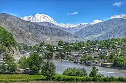
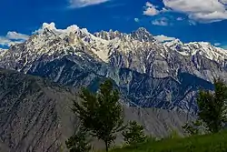
Lower Chitral District (Urdu: ضلع چترال زیریں)(Khowar: موڑی ݯھیترارو ضلع)(Pashto: ښکته چترال ولسوالۍ) is a district in Malakand Division of Khyber Pakhtunkhwa province in Pakistan.[2]
Lower Chitral District
ضلع چترال زیریں موڑی ݯھیترارو ضلع ښکته چترال ولسوالۍ | |
|---|---|
  | |
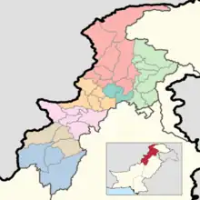
.svg.png.webp) Location of Lower Chitral District in the Khyber Pakhtunkhwa province | |
| Country | Pakistan |
| Province | Khyber Pakhtunkhwa |
| Division | Malakand |
| Established | 2018 |
| Headquarters | Chitral |
| Government | |
| • Type | District Administration |
| • Deputy Commissioner | N/A |
| • District Police Officer | N/A |
| • District Health Officer | Doctor Fayaz Roomi |
| Area | |
| • Total | 6,458 km2 (2,493 sq mi) |
| Population | |
| • Total | 278,328 |
| • Density | 43/km2 (110/sq mi) |
| Time zone | UTC+5 (PST) |
| Number of Tehsils | 2 |
| Website | lowerchitral |
Demographics
| Year | Pop. | ±% p.a. |
|---|---|---|
| 1961 | 54,844 | — |
| 1972 | 87,617 | +4.35% |
| 1981 | 121,641 | +3.71% |
| 1998 | 184,874 | +2.49% |
| 2017 | 278,328 | +2.18% |
| 2023 | 320,407 | +2.37% |
| Sources:[3] | ||
At the time of the 2017 census the district had 38,337 households and a population of 278,328. Lower Chitral had a sex ratio of 937 females per 1000 males and a literacy rate of 63.00% - 75.71% for males and 49.37% for females. 49,780 (17.89%) lived in urban areas. 27.10% of the population was under 10 years of age. 3,902 (1.40%) were from religious minorities, almost all of whom are followers of the indigenous animistic Kalash faith that was once the dominant faith in the district before the spread of Islam.[1]
89.48% of the population spoke languages recorded as 'Other' on the census. Most of these spoke Khowar (or Chitrali), the dominant language of Chitral as a whole. A minority spoke Chitral Kalasha and Wakhi, with the Kalasha dominating several valleys and the Wakhis spread throughout the north of the district near the Afghan border. Pashto is spoken in the southeast of the district by 9.11% of the population.[1] There are some speakers of the Madaklasht dialect, a Persian dialect which is considered similar to the Dari (Tajik) dialect spoken in Badakhshan.[4]
Administrative Divisions
Religious Demographics
| Religion | 1998 Census[5] | 1998 Perc | 2017 Census[6] | 2017 Perc |
|---|---|---|---|---|
| Total | 184,874 | 100.00% | 278,328 | 100.00% |
| Muslim | 182,169 | 98.54% | 274,426 | 98.60% |
| Kalash | 2,602 | 1.41% | 3,725 | 1.34% |
| Christian | 50 | 0.03% | 165 | 0.06% |
| Hindu | 2 | 0.00% | 9 | 0.00% |
| Ahmadi | 51 | 0.03% | 3 | 0.00% |
References
- "District Wise Results / Tables (Census - 2017)". www.pbscensus.gov.pk. Pakistan Bureau of Statistics.
- "Upper Chitral gets status of separate district". dawn.com. 21 November 2018. Retrieved 15 August 2020.
- "Population by administrative units 1951-1998" (PDF). Pakistan Bureau of Statistics.
- "Madaklasht village of Ismaili Muslims sets an example of communal tolerance, harmony". 9 June 2014.
- "1998 District Census Report of Chitral". Retrieved 30 March 2023.
- Census data 2017 pbs.gov.pk
