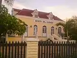
List of monuments of Aruba
This table shows an overview of the monuments of Aruba.
| Object | Year/architect | Town/section | Address | Coordinates | Number? | Image |
|---|---|---|---|---|---|---|
| Ex Havenkantoor |
1940 | Oranjestad | A.M. Schuttestraat 2 | 12.518403°N 70.037536°W |
01-001 Info |
 |
| Waterreservoir |
1905 | Oranjestad | Arendstraat(Rancho) | 12.521836°N 70.037531°W |
01-002 Info |
 |
| Landslaboratorium |
Oranjestad | Caya Ing R.H. Lacle 2 | 12.520134°N 70.030208°W |
01-003 Info |
 | |
| Reina Beatrix School |
1950 | Oranjestad | G.Madurostraat 2 | 12.514703°N 70.032140°W |
01-004 Info |
 |
| Maria Convent |
1920 | Oranjestad | J.E. Irausquinplein 2 A | 12.522757°N 70.034730°W |
01-005 Info |
 |
| Courthouse |
1936 | Oranjestad | J.G. Emanstraat 51 | 12.521595°N 70.035701°W |
01-006 Info |
 |
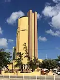
| Watertower Oranjestad |
1939 | Oranjestad | J.G. Emanstraat 67 | 12.521118°N 70.033904°W |
01-007 Info |
 |
| 2nd DOW Office |
1939 | Oranjestad | Lagoenweg 11 | 12.517217°N 70.034454°W |
01-008 Info |
 |
| Government Offices |
1942 | Oranjestad | L.G. Smith Boulevard 76 | 12.518452°N 70.037230°W |
01-009 Info |
.jpg.webp) |
| De Arend Petroleum Company |
1927 | Oranjestad | L.G. Smith Boulevard 172 | 12.533681°N 70.053361°W |
01-010 Info |
 |
| Fort Zoutman/Willem III Toren |
1866 | Oranjestad | Oranjestraat/Zoutmanstraat | 12.517803°N 70.035627°W |
01-011 Info |
 |
| Ex Dow Office |
1949 | Oranjestad | Paardenbaaistraat 2 | 12.521610°N 70.041659°W |
01-012 Info |
 |
| Lime Kiln |
1892 | Oranjestad | Ranchostraat | 12.521537°N 70.037925°W |
01-013 Info |
 |
| Wild House |
1850 | Oranjestad | Schelpstraat 12 | 12.520948°N 70.037887°W |
01-014 Info |
 |
| Henriquez Building |
Oranjestad | Schelpstraat 36/38 | 12.520830°N 70.037936°W |
01-015 Info |
 | |
| Archaeological Museum |
1850 | Oranjestad | Schelpstraat 40,42,44 | 12.520948°N 70.038196°W |
01-016 Info |
|
| John F Kennedy school |
1950 | Oranjestad | Stadionweg 37/ L.G.Smith Blvd | 12.509285°N 70.026627°W |
01-017 Info |
 |
| Yellow House |
1860 | Oranjestad | Weststraat 15 | 12.520956°N 70.039859°W |
01-018 Info |
 |
| School 1888 (ARA building) |
1888 | Oranjestad | Wilhelminastraat 6 | 12.518785°N 70.036246°W |
01-019 Info |
|
| City Hall |
1925 | Oranjestad | Wilhelminastraat 8 | 12.518790°N 70.035900°W |
01-020 Info |
 |
| Ex Police Station Oranjestad |
1940 | Oranjestad | Wilhelminastraat 40 | 12.518408°N 70.034076°W |
01-021 Info |
 |
| Ex landskantoor |
1910 | Oranjestad | Zoutmanstraat 1 | 12.519110°N 70.036901°W |
01-022 Info |
 |
| Censo / Ex Hotel Colombia |
1918 | Oranjestad | Zoutmanstraat 13 | 12.518790°N 70.035900°W |
01-023 Info |
 |
| Princess Wilhelmina Statue |
1955 | Oranjestad | Wilhelmina Park | 12.518408°N 70.034076°W |
01-024 Info |
 |
| Ex Botica Aruba |
1925 | Oranjestad | Steenweg 19 | 12.518408°N 70.034076°W |
01-025 Info |
 |
| Commanders Graves |
Noord | Hato | 12.538985°N 70.036195°W |
02-001 Info |
 | |
| California Lighthouse |
1914 | Noord | Hudishibana | 12.613369°N 70.052415°W |
02-002 Info |
 |
| Imeldahof |
Noord | Noord 2 | 12.560697°N 70.030980°W |
02-003 Info |
 | |
| Cas Tan Tin |
Noord | Pos Abou 19 | 12.545560°N 70.048340°W |
02-004 Info |
 | |
| Police Station Savaneta |
Savaneta | Savaneta 110 | 12.451569°N 69.949833°W |
03-001 Info |
 | |
| Graves |
Savaneta | Savaneta 254 E | 12.449306°N 69.946648°W |
03-002 Info |
 | |
| Uncle Louis Store |
1951 | San Nicolaas | B.van der Veen Zeppenveldstraat7 | 12.435545°N 69.910206°W |
04-001 Info |
 |
| Water Tower San Nicolas |
1939 | San Nicolaas | Bernardstraat | 12.435924°N 69.909112°W |
04-002 Info |
 |
| Commandopost |
1940 | San Nicolaas | Weg naar kust batterij | 12.438389°N 69.889601°W |
04-003 Info |
 |
| Community Church Seroe Colorado |
1939 | San Nicolaas | Seroe Colorado 244 | 12.419797°N 69.884406°W |
04-004 Info |
.jpg.webp) |
| Nicolaas Store |
1939 | San Nicolaas | B.van der Veen Zeppenfeldstraat 27 | 12.435924°N 69.909112°W |
04-005 Info |
.jpg.webp) |
| Balashi Gold Smelter |
1939 | Santa Cruz | Balashi | 12.435924°N 69.909112°W |
05-001 Info |
 |
| Other monuments, category 2 |
Upload Aruban ,not protected buildings and houses, you consider important part of our Heritage |
00-000 Info |
 Upload Photo |
Gallery of other monuments, category 2
Wikimedia Commons has media related to Cultural heritage monuments in Aruba.
References
This article is issued from Wikipedia. The text is licensed under Creative Commons - Attribution - Sharealike. Additional terms may apply for the media files.
%252C_Noord%252C_ARUBA.jpg.webp)
_4.JPG.webp)
