List of cities in Bihar by population
Bihar is administratively divided into 9 divisions and 38 districts. For the administration of urban areas, Bihar has 19 municipal corporations, 89 nagar parishads (city councils), and 154 nagar panchayats (town councils).[1][2][3][4][5][6][7]
| Rank | City | Population (2011) | Rank | City | Population (2011) | |||
|---|---|---|---|---|---|---|---|---|
| 1 | Patna | 5,838,465 | 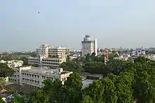 |
11 | Begusarai | 252,008 |  | |
| 2 | Gaya | 4,70,839 | 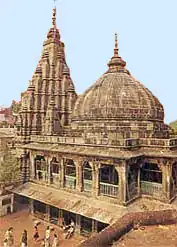 |
12 | Katihar | 240,838 |  | |
| 3 | Bhagalpur | 400,146 |  |
13 | Bettiah | 237,254 | 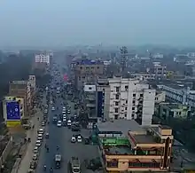 | |
| 4 | Muzaffarpur | 354,462 | 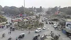 |
14 | Motihari | 221,646 | 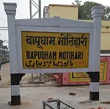 | |
| 5 | Bihar Sharif | 337,819 |  |
15 | Saharsa | 216,491 |  | |
| 6 | Darbhanga | 296,039 |  |
16 | Munger | 213,303 | 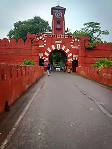 | |
| 7 | Purnia | 282,248 |  |
17 | Chhapra | 202,352 |  | |
| 8 | Sasaram | 264,709 |  |
18 | Sitamarhi | 67,818 | 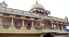 | |
| 9 | Arrah | 261,430 |  |
19 | Madhubani | NA |  | |
| 10 | Samastipur | 253,136 | .jpg.webp) |
Urban Agglomeration
In the census of India 2011, an Urban Agglomeration has been defined as follows:[9]
"An urban agglomeration is a continuous urban spread constituting a town and its adjoining outgrowths (OGs), or two or more physically contiguous towns together with or without outgrowths of such towns. An Urban Agglomeration must consist of at least a statutory town and its total population (i.e. all the constituents put together) should not be less than 20,000 as per the 2001 Census. In varying local conditions, there were similar other combinations which have been treated as urban agglomerations satisfying the basic condition of contiguity."
Constituents of Urban Agglomerations in Bihar
The constituents of Urban Agglomerations in Bihar, with a population of 100,000 or above, are noted below:[10]
- Patna Urban Agglomeration includes Patna (M Corp.), Badalpura (OG), Pataliputra Housing Colony (CT), Phulwari Sharif (NP), Nohsa (CT), Danapur (NP), Dinapur Cantonment (CB), Khagaul (NP) and Saidpura (CT).
- Gaya Urban Agglomeration includes Gaya (M Corp.), Kaler (OG) and Paharpur (CT).
- Bhagalpur Urban Agglomeration includes Bhagalpur (M Corp.),Habibpur (NP),sabour (NP) and Nathnagar(CT)
- Muzaffarpur Urban Agglomeration includes Muzaffarpur (M Corp.), Damodarpur (CT), Dumari urf Damodarpur Shahjahan (CT), Majhauli Khetal (CT), Yehiapur (CT) and Shekhpura (CT).
- Purnia Urban Agglomeration includes Purnia (M Corp.) and Kasba (NP).
- Darbhanga Urban Agglomeration includes Darbhanga (M Corp.), Padri (CT) and Bahadurpur (CT).
- Katihar Urban Agglomeration includes Katihar (M Corp.+OG) and Katihar Railway Colony (OG).
- Chapra Urban Agglomeration includes Chapra (M Corp.) and Sanrha (CT).
- Bettiah Urban Agglomeration includes Bettiah (M Corp.), Tola Mansaraut (CT), Kargahia Purab (CT) and Hat Saraiya (CT).
- Nawada Urban Agglomeration includes Nawada (NP) and Bhadauni (CT).
- Buxar Urban Agglomeration includes Buxar (NP) and Sarimpur (CT).
- Sitamarhi Urban Agglomeration includes Sitamarhi (NP), Rajopatti urf Kota Bazar (CT), Talkhapur Dumra (CT) and Dumra (NP).
- Abbreviations: M Corp. = Municipal corporation, NP = Nagar panchayat, CT = Census town, OG= Out Growth, CB = Cantonment Board
Urban Agglomeration constituents
Urban Agglomerations constituents with a population above 100,000 as per 2011 census are shown in the table below.[11]
| Urban Agglomeration | Name of Constituent | District | Type | Population 2011 | Male | Female | Population (0-6 years) |
Literacy Rate |
|---|---|---|---|---|---|---|---|---|
| Patna | Patna Municipal Corporation | Patna district | M Corp. | 1,683,200 | 894,158 | 789,042 | 190,496 | 84.71 |
| Danapur | Patna district | NP | 182,241 | 97,129 | 85,112 | 25,092 | 78.40 | |
| Gaya | Gaya | Gaya district | M Corp. | 463,454 | 245,764 | 217,690 | 59,015 | 85.74 |
| Bhagalpur | Bhagalpur | Bhagalpur district | M Corp. | 398,138 | 212,005 | 186,113 | 53,775 | 81.16 |
| Muzaffarpur | Muzaffarpur | Muzaffarpur district | M Corp. | 351,838 | 186,145 | 165,693 | 42,276 | 85.16 |
| Darbhanga | Darbhanga | Darbhanga district | M Corp. | 294,116 | 154,970 | 139,146 | 40,392 | 80.88 |
| Purnia | Purnia | Purnia district | M Corp. | 280,547 | 148,021 | 132,526 | 41,046 | 74.48 |
| Katihar | Katihar | Katihar district | M Corp. | 225,982 | 119,142 | 106,840 | 31,036 | 79.87 |
| Chhapra | Chhapra | Saran district | M Corp. | 201,597 | 106,250 | 95,347 | 27,668 | 81.30 |
| Motihari | Mehsi | East Champaran | M Corp. | 182,460 | 63,356 | 39,489 | 23,867 | 81.32 |
| Bettiah | Bettiah | West Champaran district | M Corp. | 132,896 | 70,381 | 62,515 | 18,203 | 82.54 |
| Buxar | Buxar | Buxar district | NP | 102,591 | 54,123 | 84,468 | 13,639 | 94.16 |
See also
| Divisions | 9 |
|---|---|
| Districts | 38 |
| Subdivisions | 101 |
| Cities and towns | 207 |
| Blocks | 534 |
| Villages | 45,103 |
| Panchayats | 8,406 |
| Police Districts | 43 |
| Police Stations | 853 |
References
- "Bihar Civic elections likely in May 2017". Archived from the original on 31 March 2017. Retrieved 30 March 2017.
- Pandey, Ashutosh Kumar (20 March 2017). "बिहार : नगर विकास एवं आवास विभाग की पहल, पुनर्गठन से नगर परिषदों की बढ़ जायेगी संख्या" [Bihar: Initiatives of the Department of Urban Development and Housing, will increase the number of city councils by restructuring]. Prabhat Khabar (in Hindi). Archived from the original on 24 March 2017. Retrieved 19 February 2019.
- "पहली बार कोई महिला बनेगी पटना नगर निगम की मेयर" [For the first time, a woman will become the mayor of Patna Municipal Corporation]. 11 March 2017. Archived from the original on 24 March 2017. Retrieved 24 March 2017.
- "Ward delimitation begins in Chhapra". The Times of India. 23 February 2017. Archived from the original on 27 February 2017. Retrieved 24 March 2017.
- "छपरा को निगम बख्तियारपुर को मिला नगर परिषद का दर्जा". 14 February 2017. Archived from the original on 24 March 2017. Retrieved 24 March 2017.
- "6 पंचायतों को मिलाकर बनाया गया सहरसा नगर निगम, ये रहे बिहार के सभी 19 नगर निगमों के नाम". Dainik Jagran (in Hindi). Retrieved 25 November 2022.
- "बिहार को सहरसा के रूप में मिला एक और नगर निगम, 6 नगर पंचायतों को नगर परिषद का दर्जा". News18 हिंदी (in Hindi). 29 December 2021. Retrieved 26 November 2022.
- "LIST OF URBAN LOCAL BODY Bihar" (PDF).
- "Urban Agglomerations and Cities" (PDF). Provisional Population Totals, Census of India 2011. Retrieved 16 April 2012.
- "Constituents of urban Agglomerations Having Population 1 Lakh & above" (PDF). Provisional Population Totals, Census of India 2011. Retrieved 16 April 2012.
- "Cities having population 1 lakh and above" (PDF). Provisional Population Totals, Census of India 2011. Retrieved 16 April 2012.