Leshukonskoye
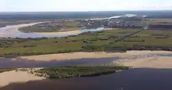
Leshukonskoye (Russian: Лешуконское) is a rural locality (a selo) and the administrative center of Leshukonsky District of Arkhangelsk Oblast, Russia, located on the left bank of the Vashka River. It also serves as the administrative center of Leshukonsky Selsoviet, one of the seven selsoviets into which the district is administratively divided. Municipally, it is the administrative center of Leshukonskoye Rural Settlement. Population: 4,406 (2010 Census);[6] 5,003 (2002 Census);[2] 6,199 (1989 Census).[7]
Leshukonskoye
Лешуконское | |
|---|---|
 View of Leshukonskoye | |
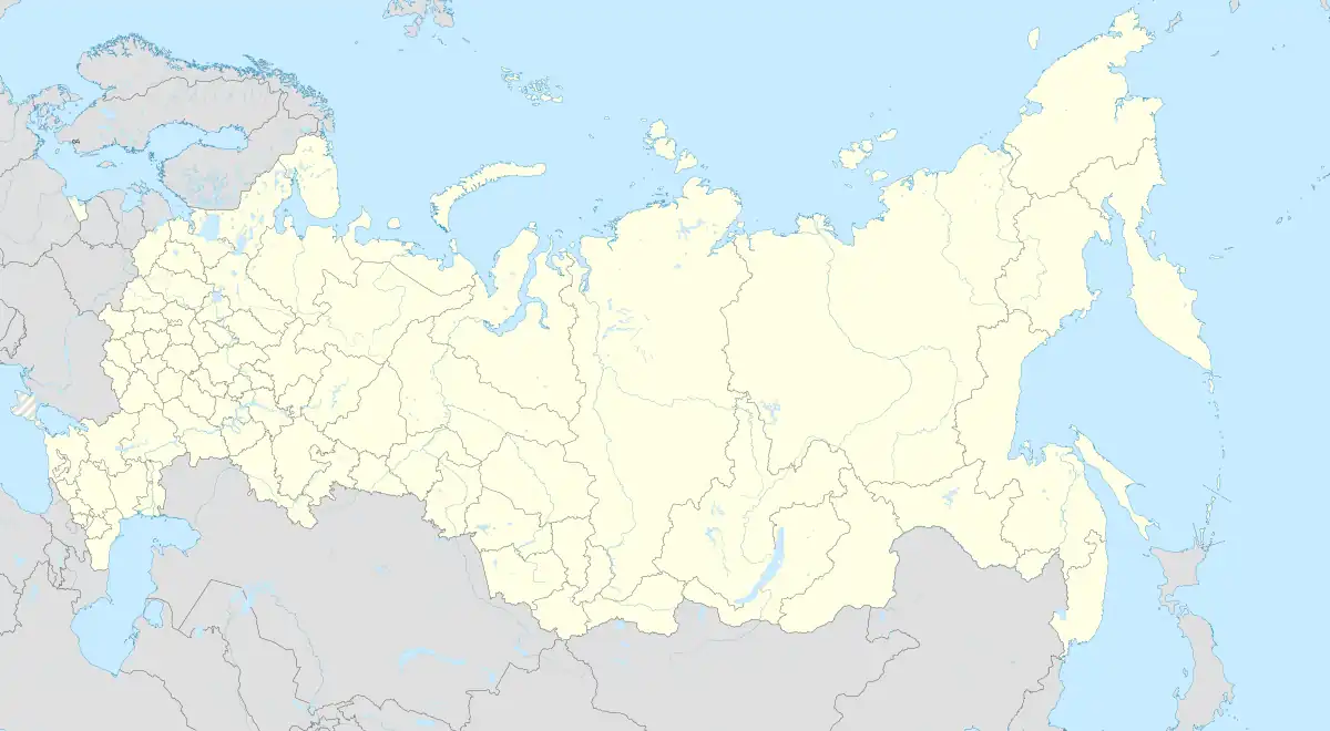
Location of Leshukonskoye | |
 Leshukonskoye Location of Leshukonskoye  Leshukonskoye Leshukonskoye (Arkhangelsk Oblast) | |
| Coordinates: 64°54′N 45°46′E | |
| Country | Russia |
| Federal subject | Arkhangelsk Oblast |
| Administrative district | Leshukonsky District[1] |
| Selsoviet | Leshukonsky Selsoviet[1] |
| Population | |
| • Total | 4,406 |
| • Capital of | Leshukonsky District,[1] Leshukonsky Selsoviet[1] |
| • Municipal district | Leshukonsky Municipal District[3] |
| • Rural settlement | Leshukonskoye Rural Settlement[3] |
| • Capital of | Leshukonsky Municipal District,[3] Verkhnetoyemskoye Rural Settlement[3] |
| Time zone | UTC+3 (MSK |
| Postal code(s)[5] | 164670 |
| OKTMO ID | 11638408101 |
Etymology
The name of Leshukonskoye is apparently derived from the Russian les, which means the forest.[8]
History
The area was originally populated by speakers of Uralic languages and then colonized by the Novgorod Republic. After the fall of Novgorod, the area became a part of the Grand Duchy of Moscow. First Russian settlements on the Mezen River are mentioned under 16th century: Yuroma (1513) and Koynas (1554).[9] Leshukonskoye is known since 1641 and was the administrative center of Ust-Vazhskaya Volost. The middle course of the Mezen was the area where Russian and Komi mixed the most.[8]
In the course of the administrative reform performed in 1708 by Peter the Great the area was included into Archangelgorod Governorate. In 1780, the Governorate was abolished and transformed into Vologda Viceroyalty. In 1796, the area moved into the Arkhangelsk Governorate. The current territory of the district was included into the Mezensky Uyezd. December 28, 1917, a new Ust-Vashsky Uyezd with the center of Ust-Vashka (currently Leshukonskoye) was established, however, in 1925 it was merged back into the Mezensky Uyezd.[9]
In 1929, several governorates were merged into Northern Krai. July 15, 1929 the uyezds were abolished, and Leshukonsky District was established.
Geography
Leshukonskoye is located on the left bank of the Vashka River, several kilometers upstream from its confluence with the Mezen River. Since the roads on the left bank of the Mezen are not connected with the road network of Arkhangelsk Oblast, the only land connection with the outside world is via ferry boat to the village of Smolyanets, on the opposite (right) bank of the Mezen.
| Climate data for Leshukonskoye | |||||||||||||
|---|---|---|---|---|---|---|---|---|---|---|---|---|---|
| Month | Jan | Feb | Mar | Apr | May | Jun | Jul | Aug | Sep | Oct | Nov | Dec | Year |
| Average high °C (°F) | −11 (12) |
−9 (16) |
−2 (28) |
4 (39) |
10 (50) |
17 (63) |
21 (70) |
17 (63) |
11 (52) |
3 (37) |
−3 (27) |
−8 (18) |
4 (40) |
| Average low °C (°F) | −20 (−4) |
−18 (0) |
−12 (10) |
−7 (19) |
0 (32) |
5 (41) |
9 (48) |
8 (46) |
4 (39) |
−2 (28) |
−9 (16) |
−15 (5) |
−5 (23) |
| Average precipitation mm (inches) | 31 (1.2) |
25 (1.0) |
26 (1.0) |
32 (1.3) |
42 (1.7) |
58 (2.3) |
64 (2.5) |
71 (2.8) |
64 (2.5) |
59 (2.3) |
45 (1.8) |
40 (1.6) |
557 (22) |
| Average precipitation days | 22 | 19 | 18 | 15 | 14 | 15 | 14 | 17 | 19 | 22 | 22 | 24 | 221 |
| Mean daily sunshine hours | 0 | 2 | 3 | 6 | 7 | 9 | 9 | 6 | 3 | 1 | 0 | 0 | 4 |
| Source: http://www.worldclimateguide.co.uk/climateguides/russiaeurope/leshukonskoye.php | |||||||||||||
Economy
Industry
Timber industry, including resin production, is present in and around Leshukonskoye.
Transportation
The Mezen River and the Vashka River are both navigable, however, there is no passenger navigation in Leshukonskoye except for the ferry boat to the village of Smolenets. In Summer, the ferry connects to the all-seasonal road to Arkhangelsk, only completed in 2008. In winter, temporary roads (zimniks) were built in snow and the river is frozen over; in Spring and Fall when the river ice is thin, air transport is the only means for passenger connections to Arkhangelsk and the rest of the world.
There is an airport in Leshukonskoye, with weekly flights to Arkhangelsk on Tuesdays.
Education
There is a modern school with all 12 grades and 350 students.[10]
References
Notes
- Государственный комитет Российской Федерации по статистике. Комитет Российской Федерации по стандартизации, метрологии и сертификации. №ОК 019-95 1 января 1997 г. «Общероссийский классификатор объектов административно-территориального деления. Код 11 238 808 008», в ред. изменения №278/2015 от 1 января 2016 г.. (State Statistics Committee of the Russian Federation. Committee of the Russian Federation on Standardization, Metrology, and Certification. #OK 019-95 January 1, 1997 Russian Classification of Objects of Administrative Division (OKATO). Code 11 238 808 008, as amended by the Amendment #278/2015 of January 1, 2016. ).
- Russian Federal State Statistics Service (21 May 2004). Численность населения России, субъектов Российской Федерации в составе федеральных округов, районов, городских поселений, сельских населённых пунктов – районных центров и сельских населённых пунктов с населением 3 тысячи и более человек [Population of Russia, Its Federal Districts, Federal Subjects, Districts, Urban Localities, Rural Localities—Administrative Centers, and Rural Localities with Population of Over 3,000] (XLS). Всероссийская перепись населения 2002 года [All-Russia Population Census of 2002] (in Russian).
- Архангельское областное Собрание депутатов. Областной закон №258-внеоч.-ОЗ от 23 сентября 2004 г. «О статусе и границах территорий муниципальных образований в Архангельской области», в ред. Областного закона №224-13-ОЗ от 16 декабря 2014 г. «Об упразднении отдельных населённых пунктов Соловецкого района Архангельской области и о внесении изменения в статью 46 Областного закона "О статусе и границах территорий муниципальных образований в Архангельской области"». Вступил в силу со дня официального опубликования. Опубликован: "Волна", №38, 8 октября 2004 г. (Arkhangelsk Oblast Council of Deputies. Oblast Law #258-vneoch.-OZ of September 23, 2004 On the Status and Borders of the Territories of the Municipal Formations in Arkhangelsk Oblast, as amended by the Oblast Law #224-13-OZ of December 16, 2014 On Abolishing Several Inhabited Localities in Solovetsky District of Arkhangelsk Oblast and on Amending Article 46 of the Oblast Law "On the Status and Borders of the Territories of the Municipal Formations in Arkhangelsk Oblast". Effective as of the day of the official publication.).
- "Об исчислении времени". Официальный интернет-портал правовой информации (in Russian). 3 June 2011. Retrieved 19 January 2019.
- Почта России. Информационно-вычислительный центр ОАСУ РПО. (Russian Post). Поиск объектов почтовой связи (Postal Objects Search) (in Russian)
- Russian Federal State Statistics Service (2011). Всероссийская перепись населения 2010 года. Том 1 [2010 All-Russian Population Census, vol. 1]. Всероссийская перепись населения 2010 года [2010 All-Russia Population Census] (in Russian). Federal State Statistics Service.
- Всесоюзная перепись населения 1989 г. Численность наличного населения союзных и автономных республик, автономных областей и округов, краёв, областей, районов, городских поселений и сёл-райцентров [All Union Population Census of 1989: Present Population of Union and Autonomous Republics, Autonomous Oblasts and Okrugs, Krais, Oblasts, Districts, Urban Settlements, and Villages Serving as District Administrative Centers]. Всесоюзная перепись населения 1989 года [All-Union Population Census of 1989] (in Russian). Институт демографии Национального исследовательского университета: Высшая школа экономики [Institute of Demography at the National Research University: Higher School of Economics]. 1989 – via Demoscope Weekly.
- Иванова, Т. Г. (2003). К истории региона. Былины Мезени: Север Европейской России. Былины (Свод русского фольклора). Vol. 25. Saint-Petersburg: Наука. pp. 7–11. Retrieved August 5, 2011.
- Лешуконский район (in Russian). Лешуконский муниципальный район. Retrieved August 1, 2011.
- МБОУ "ЛСОШ" (in Russian). narod.ru. Retrieved 4 March 2013.
Sources
- Архангельское областное Собрание депутатов. Областной закон №65-5-ОЗ от 23 сентября 2009 г. «Об административно-территориальном устройстве Архангельской области», в ред. Областного закона №232-13-ОЗ от 16 декабря 2014 г. «О внесении изменений в отдельные Областные Законы в сфере осуществления местного самоуправления и взаимодействия с некоммерческими организациями». Вступил в силу через десять дней со дня официального опубликования. Опубликован: "Волна", №43, 6 октября 2009 г. (Arkhangelsk Oblast Council of Deputies. Oblast Law #65-5-OZ of September 23, 2009 On the Administrative-Territorial Structure of Arkhangelsk Oblast, as amended by the Oblast Law #232-13-OZ of December 16, 2014 On Amending Various Oblast Laws Dealing with the Process of Municipal Self-Government and Relations with Non-Profit Organizations. Effective as of the day which is ten days after the official publication.).