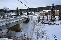
L'Ascension, Quebec
L'Ascension is a municipality in the Laurentides region of Quebec, Canada, part of the Antoine-Labelle Regional County Municipality. The area is known as La Vallée de la Rouge (English: The Valley of the Rouge (river)).
L'Ascension | |
|---|---|
 | |
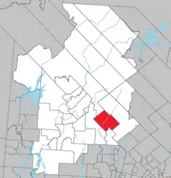
 Location within Antoine-Labelle RCM | |
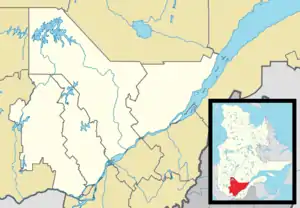
 L'Ascension Location in central Quebec | |
| Coordinates: 46°33′N 74°50′W[1] | |
| Country | |
| Province | |
| Region | Laurentides |
| RCM | Antoine-Labelle |
| Constituted | September 23, 1905 |
| Government | |
| • Mayor | Jacques Allard |
| • Federal riding | Laurentides—Labelle |
| • Prov. riding | Labelle |
| Area | |
| • Total | 352.42 km2 (136.07 sq mi) |
| • Land | 334.82 km2 (129.27 sq mi) |
| Population (2021)[3] | |
| • Total | 899 |
| • Density | 2.7/km2 (7/sq mi) |
| • Pop. 2016-2021 | |
| • Dwellings | 880 |
| Time zone | UTC−5 (EST) |
| • Summer (DST) | UTC−4 (EDT) |
| Postal code(s) | |
| Area code | 819 |
| Highways | |
| Website | www |
History
In 1891, the first missionary made a pastoral visit to the few families that had settled there, and named the place L'Ascension since his visit coincided with the day of the Feast of the Ascension of Jesus Christ.[1]
On September 23, 1905, the Parish Municipality of L'Ascension was formed out of previously unorganized area.[4]
On December 14, 1996, the parish municipality changed statutes and became a (regular) municipality.[1]
Demographics
| 2021 | 2016 | |
|---|---|---|
| Population | 899 (+13.7% from 2016) | 791 (-6.3% from 2011) |
| Land area | 334.82 km2 (129.27 sq mi) | 340.85 km2 (131.60 sq mi) |
| Population density | 2.7/km2 (7.0/sq mi) | 2.3/km2 (6.0/sq mi) |
| Median age | 61.2 (M: 62.0, F: 59.6) | 57.7 (M: 58.1, F: 57.5) |
| Private dwellings | 880 (total) | 877 (total) |
| Median household income | $48,400 | $41,045 |
|
| ||||||||||||||||||||||||||||||||||||
| Source: Statistics Canada | |||||||||||||||||||||||||||||||||||||
Private dwellings occupied by usual residents: 488 (total dwellings: 880)[3]
Mother tongue:
- English as first language: 2.2%
- French as first language: 96.1%
- English and French as first language: 0.6%
- Other as first language: 1.1%
Local government
| Year | Liberal | Conservative | Bloc Québécois | New Democratic | Green | ||||||
|---|---|---|---|---|---|---|---|---|---|---|---|
| 2021 | 26% | 147 | 13% | 76 | 48% | 279 | 5% | 29 | 2% | 11 | |
| 2019 | 30% | 176 | 12% | 69 | 50% | 287 | 3% | 16 | 4% | 23 | |
| Year | CAQ | Liberal | QC solidaire | Parti Québécois | |||||
|---|---|---|---|---|---|---|---|---|---|
| 2018 | 43% | 231 | 9% | 49 | 9% | 46 | 36% | 192 | |
| 2014 | 22% | 108 | 21% | 103 | 5% | 22 | 52% | 254 | |
L'Ascension forms part of the federal electoral district of Laurentides—Labelle and has been represented by Marie-Hélène Gaudreau of the Bloc Québécois since 2019. Provincially, L'Ascension is part of the Labelle electoral district and is represented by Chantale Jeannotte of the Coalition Avenir Québec since 2018.
List of former mayors:
- Yves Meilleur (...–2017)
- Luc St-Denis (2017–2021)
- Jacques Allard (2021–present)
Education
Sainte Agathe Academy (of the Sir Wilfrid Laurier School Board) in Sainte-Agathe-des-Monts serves English-speaking students in this community for both elementary and secondary levels.[11]
See also
References
- "Reference number 324625 in Banque de noms de lieux du Québec". toponymie.gouv.qc.ca (in French). Commission de toponymie du Québec.
- "Geographic code 79050 in the official Répertoire des municipalités". www.mamh.gouv.qc.ca (in French). Ministère des Affaires municipales et de l'Habitation.
- "L'Ascension, Municipalité (MÉ) Census Profile, 2021 Census of Population". www12.statcan.gc.ca. Government of Canada - Statistics Canada. Retrieved 29 June 2022.
- "Répertoire des entités géopolitiques: L'Ascension (municipalité) 23.9.1905 - ..." www.mairesduquebec.com. Institut généalogique Drouin. Retrieved 29 June 2022.
- "2021 Community Profiles". 2021 Canadian Census. Statistics Canada. February 4, 2022. Retrieved 2022-08-23.
- "2016 Community Profiles". 2016 Canadian Census. Statistics Canada. August 12, 2021. Retrieved 2022-06-28.
- "2006 Community Profiles". 2006 Canadian Census. Statistics Canada. August 20, 2019.
- "2001 Community Profiles". 2001 Canadian Census. Statistics Canada. July 18, 2021.
- "Official Voting Results Raw Data (poll by poll results in block 1573)". Elections Canada. Retrieved March 5, 2023.
- "Official Voting Results by polling station (poll by poll results in block 1573)". Elections Québec. Retrieved March 5, 2023.
- "About Us." Saint Agathe Academy. Retrieved on September 4, 2017. See Elementary zone map Archived 2017-09-04 at the Wayback Machine and Secondary zone map Archived 2017-09-04 at the Wayback Machine - Note that all areas covered in the elementary map are also covered in the secondary one.