Kvæøya
Kvæøya is an island in Kvæfjord Municipality in Troms og Finnmark county, Norway. It is located in the Kvæfjorden, an arm of the Gullesfjorden. The island sits about 1.5 kilometres (0.93 mi) southwest of the village of Borkenes. In 2010, the Kvæøy Bridge was completed, connecting the village of Hundstad on the island to a point just west of the village of Straumen on the main island of Hinnøya.
 View of the Kvæfjorden, Kvæøya, and Gullesfjorden from the mountain Raudmoldheia | |
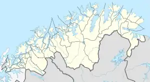
 Kvæøya Location of the island  Kvæøya Kvæøya (Norway) | |
| Geography | |
|---|---|
| Location | Troms og Finnmark, Norway |
| Coordinates | 68.7640°N 16.1096°E |
| Area | 7 km2 (2.7 sq mi) |
| Length | 6 km (3.7 mi) |
| Width | 1.5 km (0.93 mi) |
| Highest elevation | 267 m (876 ft) |
| Highest point | Hilderkleiva |
| Administration | |
Norway | |
| County | Troms og Finnmark |
| Municipality | Kvæfjord Municipality |
The island is considered as very favorable to farming, with large farms located on southern and western sides. The northern and eastern sides of the island are steep and mountainous. There are no buildings or fertile ground on that part of the island. The highest point on the island is the 267-metre (876 ft) tall Hilderkleiva.[1]
See also
This article is issued from Wikipedia. The text is licensed under Creative Commons - Attribution - Sharealike. Additional terms may apply for the media files.