Kupunkamint Mountain
Kupunkamint Mountain (8,802 feet (2,683 m)) is located in the Lewis Range, Glacier National Park in the U.S. state of Montana.[1][3] Kupunkamint Mountain is in the southeastern section of Glacier National Park.[4] The mountain's name was officially adopted in 1940 by the United States Board on Geographic Names to commemorate a Kootenai Indian.[2]
| Kupunkamint Mountain | |
|---|---|
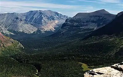
.jpg.webp) Kupunkamint Mountain (left) (White Calf Mountain (right), from the east) | |
| Highest point | |
| Elevation | 8,802 ft (2,683 m)[1] |
| Prominence | 357 ft (109 m)[1] |
| Coordinates | 48°37′06″N 113°25′18″W[2] |
| Geography | |
 Kupunkamint Mountain Location in Montana  Kupunkamint Mountain Location in the United States | |
| Location | Glacier County, Montana, U.S. |
| Parent range | Lewis Range |
| Topo map | USGS Cut Bank Pass, MT |
References
- "Kupunkamint Mountain, Montana". Peakbagger.com. Retrieved December 26, 2018.
- "Kupunkamint Mountain". Geographic Names Information System. United States Geological Survey, United States Department of the Interior. Retrieved December 26, 2018.
- Cut Bank Pass, MT (Map). TopoQwest (United States Geological Survey Maps). Retrieved December 26, 2018.
- "Kupunkamint Mountain : Climbing, Hiking & Mountaineering : SummitPost".
Kupunkamint Mountain (left), and Bad Marriage Mountain (right) seen from the south
This article is issued from Wikipedia. The text is licensed under Creative Commons - Attribution - Sharealike. Additional terms may apply for the media files.