Kovil Nunatak
Kovil Nunatak (Bulgarian: Ковилски нунатак, ‘Kovilski Nunatak’ \'ko-vil-ski 'nu-na-tak\) is the rock-tipped hill of elevation 2041 m[1] projecting from the ice cap west of north-central Sentinel Range in Ellsworth Mountains, Antarctica. It is named after the settlement of Kovil in Southern Bulgaria.
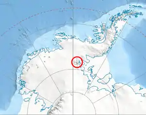
Location of Sentinel Range in Western Antarctica.
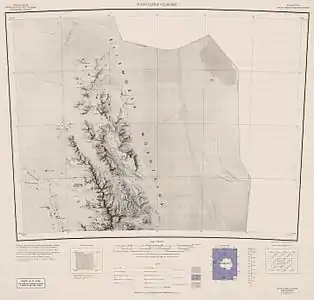
Map of northern Sentinel Range.
Location
Kovil Nunatak is located at 78°02′20.3″S 87°02′59″W, which is 24.93 km west of Mount Goldthwait, 12.68 km northwest of Mount Hubley and 15.46 km southeast of Helfert Nunatak. US mapping in 1961.
Maps
- Newcomer Glacier. Scale 1:250 000 topographic map. Reston, Virginia: US Geological Survey, 1961.
- Antarctic Digital Database (ADD). Scale 1:250000 topographic map of Antarctica. Scientific Committee on Antarctic Research (SCAR). Since 1993, regularly updated.
Notes
- Reference Elevation Model of Antarctica. Polar Geospatial Center. University of Minnesota, 2019
References
- Kovil Nunatak. SCAR Composite Gazetteer of Antarctica.
- Bulgarian Antarctic Gazetteer. Antarctic Place-names Commission. (details in Bulgarian, basic data in English)
External links
- Kovil Nunatak. Copernix satellite image
This article includes information from the Antarctic Place-names Commission of Bulgaria which is used with permission.
This article is issued from Wikipedia. The text is licensed under Creative Commons - Attribution - Sharealike. Additional terms may apply for the media files.