Slope, Hrpelje-Kozina
Slope (pronounced [ˈsloːpɛ]) is a village east of Hrpelje in the Municipality of Hrpelje-Kozina in the Littoral region of Slovenia close to the border with Croatia.[2]
Slope | |
|---|---|
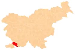
 Slope Location in Slovenia | |
| Coordinates: 45°36′47.84″N 13°59′15.28″E | |
| Country | |
| Traditional region | Littoral |
| Statistical region | Coastal–Karst |
| Municipality | Hrpelje-Kozina |
| Area | |
| • Total | 4.95 km2 (1.91 sq mi) |
| Elevation | 620.8 m (2,036.7 ft) |
| Population (2002) | |
| • Total | 69 |
| [1] | |
Church
The local church is dedicated to the Feast of the Cross and belongs to the Parish of Brezovica.[3]
Mass grave
Slope is the site of a mass grave associated with the Second World War. The Kotar Enclosure Cave Mass Grave (Slovene: Grobišče Jama pod Kotarjevo ogrado) is located in a woods northeast of Tublje pri Hrpeljah. It contains the remains of 15 to 17 people, probably German soldiers and Slovene civilians.[4]
References
- Statistical Office of the Republic of Slovenia
- Hrpelje-Kozina municipal site Archived 2008-12-18 at the Wayback Machine
- Roman Catholic Diocese of Koper List of Churches May 2008 Archived 2009-03-06 at the Wayback Machine
- Ferenc, Mitja (December 2009). "Grobišče Jama pod Kotarjevo ogrado". Geopedia (in Slovenian). Ljubljana: Služba za vojna grobišča, Ministrstvo za delo, družino in socialne zadeve. Retrieved October 11, 2023.
External links
| Settlements | Administrative seat: Hrpelje
|  |
|---|---|---|
| Landmarks |
| |
This article is issued from Wikipedia. The text is licensed under Creative Commons - Attribution - Sharealike. Additional terms may apply for the media files.