Kondopoga Bay
The Kondopoga Bay (Russian: Кондопожская губа, Kondopozhskaya Bay) is a bay (length 32 km, width over 8 km, max depth 78m) in the northwestern part of the Karelian part of the Onega Lake, Russia .[1]
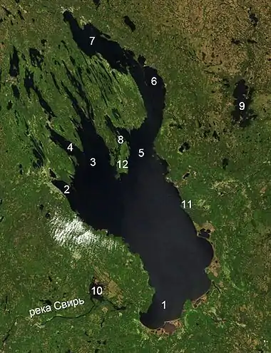 |
The numbers denote:
|
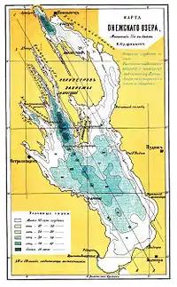
A depth map of the Onego Lake
The Kondopoga Bay is deeply carved in the land by glacial process. The upper part of the bay receives about 90% of the waters of the Suna River via the Nigozersky (Kondopozhsky) Canal. The bay also receives waste water, most of which comes from the Kondopoga paper mill.[2]
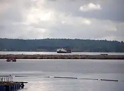
Kondopoga Bay, 2010
A city of Kondopoga is by the northern tip of the bay.
The bay has numerous rock islands, the largest being Suisari.
References
- This article incorporates text from a publication now in the public domain: . Brockhaus and Efron Encyclopedic Dictionary (in Russian). 1906.
- "Кондопожская губа".
This article is issued from Wikipedia. The text is licensed under Creative Commons - Attribution - Sharealike. Additional terms may apply for the media files.