Kamata Kingdom
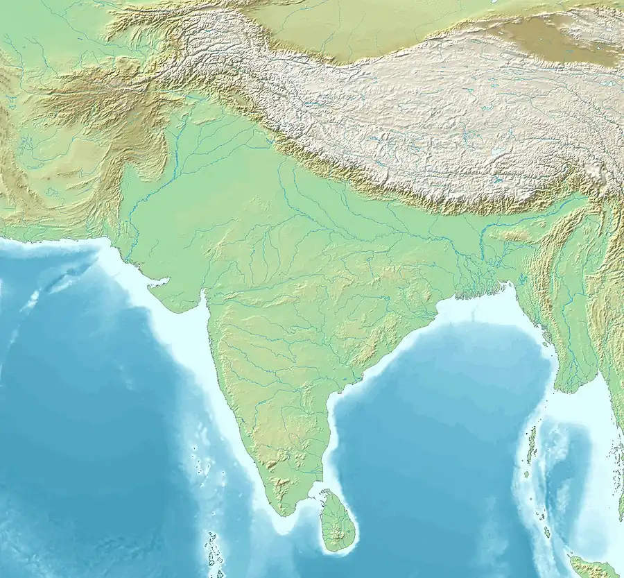
The Kamata Kingdom (pron: ˈkʌmətɑ) emerged in western Kamarupa probably when Sandhya, a ruler of Kamarupanagara, moved his capital west to Kamatapur sometime after 1257 CE.[4] Since it originated in the old seat of the Kamarupa kingdom, and since it covered most of the western parts of it, the kingdom is also sometimes called as Kamarupa-Kamata.
Kamata Kingdom | |||||||||||
|---|---|---|---|---|---|---|---|---|---|---|---|
| c. 1257–1587 | |||||||||||
 ◁ ▷ | |||||||||||
| Capital | Kamarupanagara (present-day North Guwahati) Kamatapur (present-day Gosanimari) | ||||||||||
| Common languages | Early Assamese (eastern part), Proto Kamta (western part) | ||||||||||
| Religion | Hinduism | ||||||||||
| Historical era | Late Medieval period | ||||||||||
• Established by Sandhya | c. 1257 | ||||||||||
• Durlabh Narayan receives Candivara | 1330 | ||||||||||
• Sasanka seizes power | 1365 | ||||||||||
• Niladhwaj establishes Khen dynasty | 1440 | ||||||||||
• Alauddin Hussain Shah defeats the last Khen ruler | 1498 | ||||||||||
| 1515 | |||||||||||
| 1587 | |||||||||||
| |||||||||||
| Today part of | India (North Bengal, Lower Assam) Bangladesh | ||||||||||
| Part of a series on the |
| History of Assam |
|---|
 |
| Categories |
|
| Part of a series on the |
| Culture of Assam |
|---|
 |
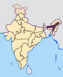
It covered a region corresponding to present-day undivided districts of Kamrup, Goalpara, Jalpaiguri, and Cooch Behar district in India and Rangpur and northern parts of Mymensingh in Bangladesh.[5] The rise of the Kamata kingdom marked the end of the ancient period in the history of Assam and the beginning of the medieval period. The last rulers were the Khens, who were later displaced in 1498 by Alauddin Hussain Shah, the ruler of the Bengal Sultanate. Though Hussain Shah developed extensive administrative structures, he lost political control to a confederation of Baro-Bhuyan within a few years.[6]
Biswa Singha removed the Baro-Bhuyan confederacy and established the Koch dynasty soon, in 1515.[7] The Koches were the last to call themselves Kamateshwars (the rulers of Kamata), but their influence and expansions were so extensive and far-reaching that their kingdom is sometimes called the Koch Kingdom. In the same century the kingdom split in two: Koch Bihar and Koch Hajo. The eastern kingdom, Koch Hajo, was soon absorbed into the Ahom kingdom in the 17th century. The western portion of the Kamata kingdom, Koch Bihar continued to be ruled by a branch of the Koch dynasty and later merged with the Indian territory after the independence of India from the British domain.[8] The boundary between Koch Bihar and Koch Hajo is approximately the boundary between West Bengal and Assam today.
Rulers of Kamata kingdom
Early rulers
Sandhya, was a ruler of Kamarupanagara, the capital of the erstwhile Kamarupa.[9] After withstanding an attack from Malik Ikhtiyaruddin Iuzbak, in which Iuzbak was killed (in 1257), Sandhya moved his capital to Kamatapur, near present-day Cooch Behar town. Sandhya styled himself Kamateswara and the kingdom came to be known as Kamata.[10]
- Sandhya (1228–1260)
- Sindhu Rai (1260–1285)
- Rup Narayan (1285–1300)
- Singhadhwaj (1300–1305)
Middle rulers
Pratapdhvaj was a minister of Singhadhvaj when he usurped power. At his death, his cousin Dharmanarayan seized power. He was challenged by Pratapdhvaj's son Durlabhnarayan and they decided to settle. Durlabhnarayan assumed power Kamrup, Goalpara, Jalpaiguri, Koch Bihar, along with the capital Kamatapur, while Dharmanarayan retained Rangpur and Mymensingh.[11][12] As part of the settlement in about 1330, Durlabhnarayan received from Dharmanarayan the custody of fourteen families of Brahmans and Kayasthas, one among whom was Candivara, the great-great-grandfather of Sankardev.[13] The court poets of Durlabhnarayan (Hema Saraswati and Harivara Vipra) and Indranarayan produced literary works that are considered to be the first examples of Early Assamese.[14]
- Pratapdhvaj (1305–1325)
- Dharma Narayan (1325–1330)
- Durlabh Narayan (1330–1350)
- Indra Narayan (1350–1365)
Baro-Bhuyan rule
The invasion of Assam by Sikandar Shah (1357–1390) weakened Indranarayan. Though Shah had to retreat from central Assam because of an attack on Bengal by Firuz Shah Tughlaq, Indranarayana was sufficiently damaged that a Bhuyan from Darrang, Arimatta, was able to usurp power.[15]
- Sasanka (Arimatta) (1365–1385)
- Gajanka (1385–1400)
- Sukranka (1400–1415)
- Mriganka Jungal Balahu (1415–1440)
Khen dynasty
The Khen dynasty,[16] of Kheng-Bhutanese affiliation,[17] replaced the weak rulers of Kamata kingdom following Arimatta in the middle of the 15th century. Niladhvaj Khen, the first king, united several Baro-Bhuyan chieftains of the area and removed the last of Arimatta's successors—Mriganka. There were only three Khen rulers.
- Niladhwaj (1440–1460)
- Chakradhwaj (1460–1480)
- Nilambar (1480–1498)
The last king, Nilambar expanded the kingdom to include the present Koch Bihar districts of West Bengal and the undivided Kamrup and Darrang districts of Assam and northern Mymensingh in Bangladesh as well as eastern parts of Dinajpur district, though he was removed by Alauddin Husain Shah in 1498.
Bengal Sultanate rule
Alauddin Hussain Shah, a Sultan of Bengal, removed the last Khen ruler in 1498.[18] This followed a long siege that likely started in 1493 soon after Alauddin's ascension and ended in a treacherous win with 24,000 infantry, cavalry and a war flotilla.[19] Alauddin destroyed the city and eventually annexed the region up to Hajo by 1502,[20] removed the local chieftains, and established military control over the region.[21] He established his son Shahzada Danyal as an administrator and issued coins in his own name as the "conqueror of Kamru and Kamata ...".[22] This rule was short since the Baro-Bhuyans rose up in revolt soon after and exterminated Sultanate rule.[6]
- Shahzada Danyal (c1498-c1509)
Nevertheless, the Muslim rule had lasting effects. Hussein Shah's coins continued to be used till 1518, when the Koch dynasty began consolidating their rule. Ghiasuddin Aulia, a Muslim divine figure from Mecca, established a colony at Hajo. His tomb, which is said to contain a little soil from Mecca, now called "Poa Mecca" ("a quarter Mecca"), is frequented by Hindus and Muslims alike.[23]
Baro-Bhuyan Interregnum
Alauddin Hussain Shah's representative in Kamata, his son Shahzada Danyal and his officers, was seized and killed by the Baro-Bhuyans of the region and the region lapsed into their confederated style of governance till the Koches took over.[7] Though it is not known when the Baro-Bhuyan rule began, historians estimate that Biswa Singha's campaign against the Baro-Bhuyans began in about 1509.[24]
Koch kingdom
- Biswa Singha (1515–1540)
- Nara Narayan (1540–1587)
The Kamata kingdom then passed into the hands of the Koch dynasty, with Biswa Singha consolidating his control over the Bara-Bhuyans one after another and establishing the Koch dynasty with its dominion from the Karatoya river in the west to the Barnadi river in the east.[25] In the 1581 Raghudev, the son of Chilarai and the nephew of Nara Narayan, affected a split in the kingdom[26]—Koch Hajo and Koch Bihar.[27] Though Raghudev had accepted the suzerainty of his uncle,[28] the two parts of the original Kamata kingdom split for good in 1587 when Naranarayan died,[29] the boundary between them forming roughly the administrative boundary between the present-day Assam and West Bengal.
Koch Hajo, the eastern kingdom, soon came under attack from the Mughal, and the region went back and forth for between the Mughal and the Ahoms, finally settling with the Ahoms. Koch Bihar, the western kingdom, first befriended the Mughals and then the British, and the rulers maintained the princely state till the end of the British rule.
Administration system
Yuvaraj: Biswa Singha appointed his brother Sisu as the Yuvaraj. The descendant of Sisu became the Raikat kings of Jalpaiguri.
Karjis/Karzis: Biswa Singha appointed twelve minister from his tribesman to form a Karjee, this position was hereditary. Two important Karjee and Yuvaraj form a cabinet.
Senapati: Commander of a standing army.
Paik System
Paik: Individual male
Thakuria: in charge of over 20 paiks.
Saikia: in charge of over 100 paiks.
Hazari: in charge of over 1000 paiks.
Omra: in charge of over 3000 paiks.
Nawab: in charge of over 66,000 paiks.
See also
Notes
- "639 Identifier Documentation: aho – ISO 639-3". SIL International (formerly known as the Summer Institute of Linguistics). SIL International. Retrieved 29 June 2019.
Ahom [aho]
- "Population by Religious Communities". Census India – 2001. Ministry of Home Affairs, Government of India. Retrieved 1 July 2019.
Census Data Finder/C Series/Population by Religious Communities
- "Population by religion community – 2011". Census of India, 2011. The Registrar General & Census Commissioner, India. Archived from the original on 25 August 2015.
2011census/C-01/DDW00C-01 MDDS.XLS
- "Kamarupa was reorganized as a new state. 'Kamata' by name with Kamatapur as capital. The exact time when the change was made is uncertain. But possibly it had been made by Sandhya (c1250-1270) as a safeguard against mounting dangers from the east and the west. Its control on the eastern regions beyond the Manah (Manas river) was lax." (Sarkar 1992, pp. 40–41)
- "Broadly speaking it included the districts of Kamrup, Goalpara, Koch Bihar, Rangpur, and some portions of Mymensingh." (Sarkar 1992, p. 39)
- "But the rule of the Muslims was short. The Bhuyans made a united attack on Daniel's garrison and destroyed it to the last man."(Baruah 1986:181)
- "The kingdom again passed on to the rule of the Bhuyans till the rise of the Koches in about 1515 AD." (Baruah 1986:181)
- "Historical Acts/Statements of Cooch Behar". Archived from the original on 17 October 2013. Retrieved 27 October 2013.
- (Baruah 1986:175)
- (Baruah 1986:176)
- (Baruah 1986:177)
- (Sarkar 1992:41f)
- (Neog 1980:50)
- (Baruah 1986:178)
- "Indranarayan's inability to resist the Muslims paved the way for the rise of the Bhuyans. Indeed, one of them, Arimatta or Sasanka became so ambitious that he killed Indranarayan and usurped the throne of Kamata." (Baruah 1986:178–179)
- (Sarkar 1992:44)
- "There was a significant trade relationship between khengpas and Indians. During winter seasons the people of hill had to migrate to the plains with their goats and sheep. Khengpas were known for their excellence in warfare and statecraft. A Khen chief established a dynasty in Kamata (kamrupa) by virtue of his courage and skill. We have evidence of three kheng kings of this dynasty who ruled Kamrupa (Kamta)." (Dorji 2005:34)
- The dates and duration of this invasion are not well established. See Sarkar (1992, pp. 46–47).
- (Sarkar 1992:46–47)
- (Sarkar 1992:47)
- "Kamrup came to be used as a colony of the Afhans. They drove away the Hindu chieftains and assumed the civil and military administration of the area." (Sarkar 1992:47)
- Sircar, D. C. (2008). Studies in Indian Coins. Motilal Banarsidass Publishe. ISBN 978-81-208-2973-2.
- (Sarkar 1992:48)
- (Nath 1989:28–29)
- "[Bisu, the son of Haria Mandal,] organised the strength of his tribe and defeated all the neighboring Bhuyans one after another and at last made himself the master of the dominion extending from the Karatoya in the west to the Barnadi in the east." (Baruah 1986:204)
- (Baruah 1986:214)
- "The Persian writers called the eastern part of the kingdom Koch Hajo and the western part Koch Behar. Assamese chronicles referred to them as Kamrup and Behar respectively." (Baruah 1986:214–215)
- (Baruah 1986:214)
- (Baruah 1986:205)
References
- Baruah, S L (1986), A Comprehensive History of Assam, New Delhi: Munshiram Manoharlal Publishers Pvt. Ltd.
- Boruah, Nirode (2011). "Kamarupa to Kamata: The political Transition and the New Geopolitical Trends and Spaces". Proceedings of the Indian History Congress. 72: 78–86. JSTOR 44146698.
- Dorji, Lham (2005). "The Historical Anecdotes of Kheng Nobilities". Journal of Bhutan Studies. Thimpu: Centre for Bhutan Studies. 13. ISSN 1608-411X.
- Nath, D. (1989), History of the Koch Kingdom, C. 1515-1615, Mittal Publications, ISBN 8170991099, archived from the original on 3 May 2023, retrieved 26 March 2023
- Neog, Maheshwar (1980). Early History of the Vaishnava Faith and Movement in Assam. Delhi: Motilal Banarsidass. ISBN 9788120800076.
- Sarkar, J. N. (1992), "Chapter II The Turko-Afghan Invasions", in Barpujari, H. K. (ed.), The Comprehensive History of Assam, vol. 2, Guwahati: Assam Publication Board, pp. 35–48
