Kent Wildlife Trust
Kent Wildlife Trust (KWT) is a conservation charity in the United Kingdom that was founded in 1958, previously known as the Kent Trust for Nature Conservation.[2] It aims to "work with people to restore, save and improve our natural spaces" and to "ensure that 30% of Kent and Medway – land and sea – is managed to create a healthy place for wildlife to flourish".[3] In 2023, they have reported over 30,000 members and an annual income of £8 million.[4] KWT manages over ninety nature reserves in Kent, of which thirty-seven are Sites of Special Scientific Interest, three are national nature reserves, five are Special Areas of Conservation, four are Special Protection Areas, six are local nature reserves, thirty-eight are in Areas of Outstanding Natural Beauty and one is a scheduled monument.

Kent is a county in the southeastern corner of England. It is bounded to the north by Greater London and the Thames Estuary, to the west by Sussex and Surrey, and to the south and east by the English channel and the North Sea. The county town is Maidstone.[5] It is governed by Kent County Council, with twelve district councils: Ashford, Canterbury, Dartford, Dover, Folkestone and Hythe, Gravesham, Maidstone, Thanet, Tonbridge and Malling and Tunbridge Wells. Medway is geographically part of Kent but is a separate unitary authority.[6][7] The chalk hills of the North Downs run from east to west through the county, with the wooded Weald to the south. The coastline is alternately flat and cliff-lined.[5]
Nature reserves
Key
Public access
|
Classifications
|
Sites
| Site | Photograph | Area[lower-alpha 1] | Location[lower-alpha 1] | Public access | Classifications | Description |
|---|---|---|---|---|---|---|
| Ashford Warren and Hoads Wood[8] |  |
34.5 hectares (85 acres) |
Ashford 51.160°N 0.862°E TR002439 |
YES | This site has acid grassland, which is nationally rare, and mature woodland. There are also pools which have water violets, great crested newts and grass snakes.[8] | |
| Bigbury Camp[9] |  |
Not available |
Canterbury 51.279°N 1.034°E TR117577 |
YES | SM[10] | This Iron Age hillfort may have been the site of a battle when Julius Caesar invaded Britain in 55 BC. It is now part of Howfield Wood.[9] |
| Blue Bell Hill[11] |  |
5 hectares (12 acres) |
Chatham 51.331°N 0.501°E TQ743621 |
YES | AONB,[11] NCR,[12] SSSI[13] | This hill has typical chalk grassland flora such as salad burnet, bird's foot trefoil and fairy flax. Butterflies include the chalk hill blue and brown argus.[11] |
| Brenchley Wood[14] |  |
15 hectares (37 acres) |
Tonbridge 51.154°N 0.355°E TQ648420 |
YES | This ancient wood is dominated by mature beech and oak trees. A former pine plantation in the north of the site is now being restored to heathland.[14] | |
| Broadham Down[15] |  |
16 hectares (40 acres) |
Canterbury 51.245°N 0.986°E TR085538 |
YES | This nature reserve has views over the Stour Valley. Three species of bat hibernate on the site, which has chalk grassland, woodland and scrub. Flowering plants include fragrant and common spotted orchids.[15] | |
| Burham Down[16] |  |
110 hectares (270 acres) |
Rochester 51.334°N 0.489°E TQ735624 |
PP | AONB,[17] NCR,[18] SAC,[19] SSSI[20] | This site has woodland, chalk grassland, and two chalk pits which provide shelter for birds in the winter and breeding sites in the summer. Woodland flora include orchids.[16] |
| Burham Marsh[21] | 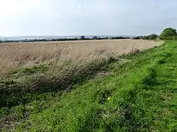 |
36 hectares (89 acres) |
Rochester 51.327°N 0.459°E TQ714615 |
FP | SSSI[22] | These tidal reedbeds on the River Medway provide habitats for waterfowl and waders such as kingfishers, cormorants, herons and geese.[21] |
| Collingwood[23] | 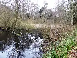 |
3 hectares (7.4 acres) |
Cranbrook 51.035°N 0.509°E TQ760292 |
YES | This reserve is woodland which has many exotic species as well as native trees. It is centred on a lake which has water lilies and bulrushes.[23] | |
| Conningbrook Lakes Country Park[24] | 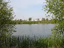 |
34 hectares (84 acres) |
Ashford 51.156°N 0.899°E TR028436 |
YES | There are three lakes in these former gravel pits, and other habitats are ponds, a river, grassland and wet woodland. In the winter there are migratory wildfowl and wetland birds such as wigeon, tufted duck and gadwall.[24] | |
| Cowden Pound Pastures[25] |  |
6 hectares (15 acres) |
Edenbridge 51.170°N 0.086°E TQ459433 |
NO | SSSI[26] | This small valley has neutral grassland, ancient woodland and marshes. The middle field has one of the largest populations of devil's bit scabious in Kent.[27] |
| Cromers Wood[28] |  |
28 hectares (69 acres) |
Sittingbourne 51.311°N 0.733°E TQ906604 |
YES | This ancient semi-natural wood is located on the south-east slope of a dry valley. Most of it is sweet chestnut coppice with oak standards.[28] | |
| Darland Banks[29] | 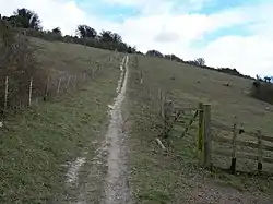 |
45 hectares (110 acres) |
Gillingham 51.359°N 0.572°E TQ792654 |
YES | LNR[30] | This area of chalk grassland has diverse fauna and flora, including the largest population of man orchids in Britain. There are birds such as willow warbler, yellowhammer, linnet and lesser whitethroat.[29][30] |
| Downe Bank[31] |  |
5 hectares (12 acres) |
Orpington 51.329°N 0.063°E TQ438609 |
YES | SSSI[32] | Charles Darwin, who lived locally, carried out scientific research on the chalk grassland site, and it was the first to be purchased by the KWT in 1962.[31] |
| East Blean Wood[33] |  |
122 hectares (300 acres) |
Canterbury 51.335°N 1.148°E TR194642 |
YES | NCR,[34] NNR[35][36] SAC[37] SSSI[34] | This site has mixed coppice with some mature oaks. Insects include the rare and protected heath fritillary butterfly, and there is a wide variety of woodland birds.[38] |
| Fackenden Down[39] | 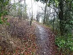 |
14 hectares (35 acres) |
Sevenoaks 51.323°N 0.196°E TQ531605 |
YES | AONB,[40] SSSI[40] | This site is mainly chalk grassland, with some woodland and scrub. There are a variety of orchids, and butterflies such as the brown argus, common blue and dark green fritillary.[39] |
| The Gill[41] |  |
12 hectares (30 acres) |
Cranbrook 51.120°N 0.468°E TQ728385 |
NO | This site has been planted with sweet chestnut, which dominates most of it. Flora includes bluebells, early purple orchids and marsh-marigold.[41] | |
| Hewitt's Chalk Bank[42] | 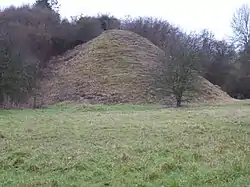 |
4 hectares (9.9 acres) |
Sevenoaks 51.346°N 0.124°E TQ480629 |
NO | This former refuse tip has a large mound which is the soil from the excavation of a railway tunnel. Habitats are grassland and scrub, and unusual flora include grass vetchling and dark mullein.[42] | |
| Holborough Marshes[43] |  |
35 hectares (86 acres) |
Snodland 51.337°N 0.449°E TQ707626 |
YES | SSSI[44] |
The marshes have a variety of wetland habitats; freshwater marshes, woodland, brackish and tidal reedbeds, wet grassland, scrub, and freshwater and saline dykes. Flowers include the grey mouse-ear.[43] |
| Hothfield Heathlands[45] | 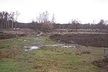 |
86 hectares (210 acres) |
Ashford 51.177°N 0.820°E TQ972458 |
YES | LNR,[46] SSSI[47] | This site has areas of heath and the best valley bog in the county, both habitats which are uncommon in Kent. Over a thousand insect species have been recorded, several of which are nationally rare, such as the bee Lasioglossum semilucens and the cranefly Tipula holoptera.[48] |
| Ivy Hatch[49] |  |
0.5 hectares (1.2 acres) |
Sevenoaks 51.269°N 0.274°E TQ587547 |
YES | Several streams run through this small site, and there are many wetland plants, including sphagnum moss. There are many common spotted orchids, and trees such as alders and hazels.[49] | |
| Kemsing Down[50] |  |
16 hectares (40 acres) |
Sevenoaks 51.313°N 0.223°E TQ550594 |
YES | AONB[51] | Habitats in this downland site include ancient and secondary woodland, scrub and chalk grassland. There are man, pyramidal and common spotted orchids, and butterflies include the brown argus and grizzled skipper.[50] |
| Kiln Wood[52] |  |
6 hectares (15 acres) |
Maidstone 51.232°N 0.700°E TQ886515 |
YES | This wood is mainly oak, hornbeam and hazel, and it is managed by coppicing. A stream at the northern end has lady fern, herb paris and broad buckler-fern.[52] | |
| The Larches[53] |  |
25 hectares (62 acres) |
Maidstone 51.299°N 0.562°E TQ787587 |
YES | AONB,[13] NCR,[54] SAC,[55] SSSI[13] |
This site has chalk grassland, woods and scrub. Grassland flora include autumn gentian, pyramidal orchid and broad-leaved helleborine, and there are butterflies such as the chalkhill blue and marbled white.[53] |
| Longfield Chalk Bank[56] |  |
2 hectares (4.9 acres) |
Longfield 51.400°N 0.296°E TQ598693 |
YES | This site is mainly chalk grassland. but it also has areas of woodland and scrub. Fauna include the common blue butterfly, slow worm, common lizard and willow warbler.[56] | |
| Lydden Temple Ewell[57] | 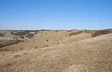 |
90 hectares (220 acres) |
Dover 51.162°N 1.255°E TR277453 |
YES | NCR,[58] NNR[36][59] SAC,[60] SSSI[61] | This site has some of the finest chalk downland in Europe. Flora include the burnt-tip and early spider orchid. There are butterflies such the Adonis blue and chalkhill blue.[62] |
| Marden Meadow[63] |  |
5.6 hectares (14 acres) |
Tonbridge 51.173°N 0.521°E TQ763445 |
YES | SSSI[64] | These unimproved neutral meadows are cut for hay each year and then grazed. There are also ponds and hedgerows which are probably of ancient origin, and trees include midland hawthorns and wild service-trees.[65] |
| Nashenden Down[66] |  |
55 hectares (140 acres) |
Rochester 51.364°N 0.484°E TQ730657 |
YES | AONB[66] | This nature reserve was created from a large arable field in 2009, and it is being regenerated with chalk grassland species, partly by colonisation from a steep bank which escaped ploughing and partly by seed spreading. An area of scrub provides a habitat for birds.[66] |
| Oare Marshes[67] |  |
81 hectares (200 acres) |
Faversham 51.346°N 0.889°E TR013647 |
FP | LNR,[68] NCR[69] Ramsar,[70] SPA[71] SSSI[72] | This site has salt marshes, fresh water dykes and reed beds. It is of international importance for migratory, overwintering and breeding wetland birds.[67] |
| Oare Meadow[73] | 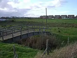 |
2 hectares (4.9 acres) |
Dover 51.331°N 0.879°E TR006630 |
YES | SSSI[72] | This small site has a pond and bog, which are fed by a spring. Wetland plants include ragged-robin and yellow iris There is also a flower meadow.[73] |
| Old Park Hill[74] |  |
40 hectares (99 acres) |
Dover 51.147°N 1.279°E TR294438 |
YES | AONB[74] | This steeply sloping hill has woodland, scrub and grassland. Scrub encroached on the other areas when the site was neglected, and KWT is removing it to restore its mainly grassland habitat, providing an increased area suitable for meadow butterflies, reptiles and orchids.[74] |
| Park Gate Down[75] | 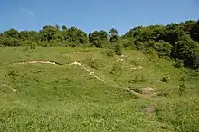 |
7 hectares (17 acres) |
Canterbury 51.169°N 1.010°E TR168457 |
YES | SAC,[76] SSSI[77] | This dry valley has ancient chalk grassland with areas of scrub and woodland. It has many orchid species such as early-purple, common-spotted, pyramidal, green-veined and monkey.[78] |
| Parsonage Wood[79] |  |
9 hectares (22 acres) |
Cranbrook 51.067°N 0.563°E TQ797329 |
YES | SSSI[80] | This is an example of a woodland ghyll in the High Weald. The trees are mainly coppiced, but some of the ground flora are species which are indicative of ancient woods, such as butcher's broom, violet helleborine and pendulous sedge.[81] |
| Polhill Bank[82] | 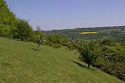 |
4 hectares (9.9 acres) |
Sevenoaks 51.324°N 0.166°E TQ510605 |
YES | AONB[82] | This chalk grassland site is on a south-east facing slope. There is also an area of scrub, which provides a habitat for birds such as blackcap and willow warbler. Flora include rock-rose.[82] |
| Quarry Wood[83] | 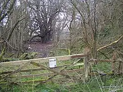 |
26 hectares (64 acres) |
Maidstone 51.239°N 0.465°E TQ722518 |
YES | The wood is mainly sweet chestnut coppice, but at the northern end there are mature oak and beech trees. A small stream runs along the bottom of the valley.[83] | |
| Queendown Warren[84] |  |
76 hectares (190 acres) |
Sittingbourne 51.334°N 0.621°E TQ827629 |
YES | AONB,[84] LNR,[85] NCR,[86] SAC,[87][88] SSSI[89] | This site has dry grassland and woodland on a south facing slope. It has two rare plants, early spider orchid and meadow clary, and a rich variety of insects.[90] |
| Romney Marsh[91] | 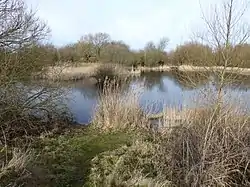 |
11 hectares (27 acres) |
New Romney 50.997°N 0.960°E TR078261 |
YES | LNR,[92] Ramsar,[93] SSSI[94] | This site is formed from ancient sand dunes which have been left behind as the sea has retreated over the last two thousand years, and it has plants such as sea spurrey. There are also ponds left by gravel extraction, some permanent and others which dry out in the summer.[95] |
| Ruxley Gravel Pits[96] | 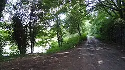 |
11 hectares (27 acres) |
Orpington 51.410°N 0.118°E TQ474700 |
NO | SSSI[97] | There are four water filled pits with areas of fen. Over 500 plants species have been recorded and 169 birds, out of which 53 breed on the site. There are also 23 butterfly species, 23 dragonfly and over 500 beetles. Water quality is high.[97] |
| Sandwich and Pegwell Bay[98] |  |
615 hectares (1,520 acres) |
Ramsgate 51.320°N 1.358°E TR341632 |
YES | GCR,[99][100] LNR,[101] NCR,[102] NNR,[36][103] Ramsar,[104] SAC,[105][106] SPA,[107] SSSI[108] | This site has the only ancient dune pasture in the county, and other habitats include saltmarshes, shingle beaches and sand dunes. It is internationally important for its birds, including black-tailed godwit, oystercatchers and sandwich terns.[98] |
| Sevenoaks Wildlife Reserve[109] |  |
73 hectares (180 acres) |
Sevenoaks 51.287°N 0.178°E TQ520565 |
PP | SSSI[110] | This site has flooded gravel pits which have over two thousand species of fauna and flora, including a variety of breeding and wintering birds. There are also areas of reedbeds and woodland.[111] |
| Sladden Wood[112] |  |
7 hectares (17 acres) |
Dover 51.140°N 1.225°E TR257428 |
YES | The main trees in this ancient wood are hornbeam, field maple and hazel, and there are ground flora such as green hellebore and yellow archangel.[112] | |
| South Blean[113] |  |
329 hectares (810 acres) |
Canterbury 51.275°N 0.999°E TR093571 |
YES | This site has native woodland, conifer plantations, heath and bog. KWT is gradually removing the conifers to allow natural regeneration, and it also manages the site by grazing and coppicing. Birds include nightjars and nightingales.[113] | |
| South Swale[114] |  |
420 hectares (1,000 acres) |
Whitstable 51.345°N 0.957°E TR060648 |
YES | LNR,[115] Ramsar,[70] SPA,[71] SSSI[72] | This coastal site has wetland and grassland, with mudflats which attract a large population of waders and wildfowl in winter. Flora include yellow horned-popies, sea-lavender and golden samphires.[114] |
| Spong Wood[116] |  |
18 hectares (44 acres) |
Ashford 51.169°N 1.034°E TR122455 |
YES | Common trees in this coppiced wood include sweet chestnut, oak, hornbeam and hazel. Orchids can be found on the high slopes and ramsons lower down.[116] | |
| Spuckles and Kennelling Woods[117] |  |
20 hectares (49 acres) |
Faversham 51.238°N 0.802°E TQ957525 |
YES | AONB[117] | These ancient woods on the steep escarpment of the Kent Downs have diverse trees including mature oaks and beeches. Flora include greater butterfly and lady orchids.[117] |
| Stockbury Hill Wood[118] | 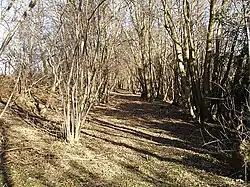 |
5 hectares (12 acres) |
Sittingbourne 51.317°N 0.633°E TQ836608 |
NO | This wood is mainly yew, hornbeam and oak. It has a variety of orchids, such as bird's-nest, lady and fly. There are orange tip and holly blue butterflies.[118] | |
| Stone Wood[119] |  |
Not available |
Ashford 51.099°N 0.803°E TQ964370 |
YES | This site was clear felled in 1992 and left to regenerate naturally. The KWT acquired it in 2002 and is encouraging native plants and animals to occupy it.[119] | |
| Turners Field[120] |  |
11 hectares (27 acres) |
Tenterden 51.074°N 0.685°E TQ882340 |
YES | This field is managed as part of an organic farm, and has grassland, a stream, a pond, scrub and mature woodland. Herbs include pepper saxifrage, black knapweed and bird's-foot trefoil.[120] | |
| Tyland Barn[121] |  |
Not available |
Maidstone 51.306°N 0.515°E TQ754593 |
YES | This is the headquarters of the KWT. It has a nature park which is designed to show the variety of habitats in the county, such as a pond, wildflower meadows and woodland.[121] | |
| Wattle Wood[122] |  |
1 hectare (2.5 acres) |
Tenterden 51.087°N 0.673°E TQ873354 |
YES | This ancient coppice with standards wood has diverse flora and fauna. There are many early purple orchids, and mammals such as dormice.[122] | |
| West Blean and Thornden Woods[123] |  |
490 hectares (1,200 acres) |
Herne Bay 51.328°N 1.075°E TR143633 |
YES | NCR,[124] SSSI[124] | More than fifty species of birds breed in these woods, and the diverse invertebrate fauna include five nationally rare and thirteen nationally scarce species. There is also a population of the declining and protected hazel dormouse.[125] In July 2022, as part of the Wilder Blean project, European bison were released in to West Blean and Thornden Woods.[126] |
| Westfield Wood[127] |  |
5 hectares (12 acres) |
Aylesford 51.318°N 0.517°E TQ755607 |
YES | AONB,[127] NCR,[18]SAC,[128] SSSI[13] | This is described by the KWT as an "internationally important yew woodland" on steep chalk slopes. There is also an area of hazel and ash coppice, with ground flora such as butcher's broom and green hellebore.[127] |
| Yockletts Bank[129] | 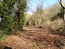 |
23 hectares (57 acres) |
Canterbury 51.189°N 1.037°E TR123477 |
YES | AONB,[129] SSSI[130] | This sloping site has woodland on dry chalk soils. There are diverse woodland breeding birds, and the ground flora is dominated by bluebells, but there are also many orchids.[131] |
Wildlife
The Wilder Blean project, headed up by the Wildwood Trust and Kent Wildlife Trust, is introducing European bison to a 2,500-acre conservation area in Blean, near Canterbury.[132] The reintroduction to the UK in 2022, the first time in 6000 years, will consist of a herd of 3 females and 1 male.[133][134]
Notes
- The area and location are taken from the Wildlife Trust page for each site.
References
Citations
- Sample, Ian (29 November 2017). "Caesar's invasion of Britain began from Pegwell Bay in Kent, say archaeologists". The Guardian. Archived from the original on 29 November 2017. Retrieved 29 November 2017.
- "About us". Kent Wildlife Trust. Archived from the original on 14 November 2017. Retrieved 24 May 2018.
- "About us". Kent Wildlife Trust. Retrieved 6 August 2018.
- "2016 Annual Review" (PDF). Kent Wildlife Trust. Archived from the original (PDF) on 6 January 2018. Retrieved 24 May 2018.
- "Kent". Encyclopedia Britannica. Archived from the original on 22 April 2018. Retrieved 15 May 2018.
- "District councils". Kent County Council. Archived from the original on 27 October 2017. Retrieved 15 May 2018.
- "Council and democracy". Kent County Council. Archived from the original on 6 February 2007. Retrieved 19 April 2007.
- "Ashford Warren & Hoads Wood". Kent Wildlife Trust. Archived from the original on 17 July 2018. Retrieved 16 July 2018.
- "Bigbury Camp". Kent Wildlife Trust. Archived from the original on 17 July 2018. Retrieved 16 July 2018.
- "Bigberry Camp: List Entry 1005169". Historic England. Archived from the original on 26 January 2018. Retrieved 25 January 2018.
- "Blue Bell Hill". Kent Wildlife Trust. Archived from the original on 17 July 2018. Retrieved 16 July 2018.
- Ratcliffe, p. 118
- "Designated Sites View: Wouldham to Detling Escarpment". Sites of Special Scientific Interest. Natural England. Retrieved 15 January 2018.
- "Brenchley Wood". Kent Wildlife Trust. Archived from the original on 17 July 2018. Retrieved 16 July 2018.
- "Broadham Down". Kent Wildlife Trust. Archived from the original on 17 July 2018. Retrieved 16 July 2018.
- "Burham Down". Kent Wildlife Trust. Archived from the original on 17 July 2018. Retrieved 16 July 2018.
- "Wouldham to Detling Escarpment citation" (PDF). Sites of Special Scientific Interest. Natural England. Archived (PDF) from the original on 2 January 2018. Retrieved 3 March 2018.
- Ratcliffe, p. 47
- "Designated Sites View: North Downs Woodlands". Special Area of Conservation. Natural England. Retrieved 16 January 2018.
- "Designated Sites View: Wouldham to Detling Escarpment". Sites of Special Scientific Interest. Natural England. Archived from the original on 24 May 2018. Retrieved 3 March 2018.
- "Burham Marsh". Kent Wildlife Trust. Archived from the original on 17 July 2018. Retrieved 16 July 2018.
- "Designated Sites View: Holborough to Burham Marshes". Sites of Special Scientific Interest. Natural England. Archived from the original on 10 February 2018. Retrieved 9 February 2018.
- "Collingwood". Kent Wildlife Trust. Archived from the original on 17 July 2018. Retrieved 16 July 2018.
- "Conningbrook Lakes Country Park". Kent Wildlife Trust. Archived from the original on 17 July 2018. Retrieved 16 July 2018.
- "Cowden Pound Pastures". Kent Wildlife Trust. Archived from the original on 17 July 2018. Retrieved 16 July 2018.
- "Designated Sites View: Cowden Pound Pastures". Sites of Special Scientific Interest. Natural England. Archived from the original on 13 March 2018. Retrieved 15 January 2018.
- "Cowden Pound Pastures citation" (PDF). Sites of Special Scientific Interest. Natural England. Archived (PDF) from the original on 2 January 2018. Retrieved 12 March 2018.
- "Cromers Wood". Kent Wildlife Trust. Archived from the original on 17 July 2018. Retrieved 16 July 2018.
- "Darland Banks". Kent Wildlife Trust. Archived from the original on 17 July 2018. Retrieved 16 July 2018.
- "Designated Sites View: Darland Banks". Local Nature Reserves. Natural England. Retrieved 25 January 2018.
- "Downe Bank". Kent Wildlife Trust. Archived from the original on 17 July 2018. Retrieved 16 July 2018.
- "Designated Sites View: Downe Bank and High Elms". Sites of Special Scientific Interest. Natural England. Retrieved 25 January 2018.
- "East Blean Wood". Kent Wildlife Trust. Archived from the original on 17 July 2018. Retrieved 16 July 2018.
- "Designated Sites View: East Blean Woods". Sites of Special Scientific Interest. Natural England. Retrieved 16 January 2018.
- "Designated Sites View: Blean Woods". National Nature Reserves. Natural England. Retrieved 12 January 2018.
- "Kent's National Nature Reserves". Natural England. 2 August 2014. Archived from the original on 24 January 2018. Retrieved 23 January 2018.
- "Designated Sites View: Blean Complex". Special Area of Conservation. Natural England. Retrieved 12 January 2018.
- "East Blean Woods citation" (PDF). Sites of Special Scientific Interest. Natural England. Archived (PDF) from the original on 2 January 2018. Retrieved 5 February 2018.
- "Fackenden Down". Kent Wildlife Trust. Archived from the original on 17 July 2018. Retrieved 16 July 2018.
- "Designated Sites View: Otford to Shoreham Downs". Sites of Special Scientific Interest. Natural England. Retrieved 18 January 2018.
- "The Gill". Kent Wildlife Trust. Archived from the original on 18 July 2018. Retrieved 16 July 2018.
- "Hewitt's Chalk Bank". Kent Wildlife Trust. Archived from the original on 17 July 2018. Retrieved 16 July 2018.
- "Holborough Marshes". Kent Wildlife Trust. Archived from the original on 17 July 2018. Retrieved 16 July 2018.
- "Designated Sites View: Holborough to Burham Marshes". Sites of Special Scientific Interest. Natural England. Archived from the original on 10 March 2018. Retrieved 25 January 2018.
- "Hothfield Heathlands". Kent Wildlife Trust. Archived from the original on 17 July 2018. Retrieved 16 July 2018.
- "Hothfield Common". Local Nature Reserves. Natural England. Retrieved 15 January 2018.
- "Designated Sites View: Hothfield Common". Sites of Special Scientific Interest. Natural England. Retrieved 15 January 2018.
- "Hothfield Common citation" (PDF). Sites of Special Scientific Interest. Natural England. Archived (PDF) from the original on 2 January 2018. Retrieved 12 February 2018.
- "Ivy Hatch". Kent Wildlife Trust. Archived from the original on 17 July 2018. Retrieved 16 July 2018.
- "Kemsing Down". Kent Wildlife Trust. Archived from the original on 17 July 2018. Retrieved 16 July 2018.
- "Interactive Map". Kent Downs Area of Outstanding Natural Beauty. Archived from the original on 4 November 2017. Retrieved 22 January 2018.
- "Kiln Wood". Kent Wildlife Trust. Archived from the original on 17 July 2018. Retrieved 16 July 2018.
- "The Larches". Kent Wildlife Trust. Archived from the original on 19 July 2018. Retrieved 16 July 2018.
- Ratcliffe, pp. 47, 118
- "Designated Sites View: North Downs Woodlands". Special Area of Conservation. Natural England. Retrieved 16 January 2018.
- "Longfield Chalk Bank". Kent Wildlife Trust. Archived from the original on 17 July 2018. Retrieved 16 July 2018.
- "Lydden Temple Ewell". Kent Wildlife Trust. Archived from the original on 18 July 2018. Retrieved 16 July 2018.
- "Designated Sites View: Lydden and Temple Ewell Down". Sites of Special Scientific Interest. Natural England. Retrieved 16 January 2018.
- "Designated Sites View: Lydden Temple Ewell". National Nature Reserves. Natural England. Retrieved 16 January 2018.
- "Designated Sites View: Lydden & Temple Ewell Downs". Special Area of Conservation. Natural England. Retrieved 16 January 2018.
- "Designated Sites View: Lydden and Temple Ewell Downs". Sites of Special Scientific Interest. Natural England. Retrieved 25 January 2018.
- "Lydden and Temple Ewell Downs citation" (PDF). Sites of Special Scientific Interest. Natural England. Archived (PDF) from the original on 2 January 2018. Retrieved 15 February 2018.
- "Marden Meadow". Kent Wildlife Trust. Archived from the original on 17 July 2018. Retrieved 16 July 2018.
- "Designated Sites View: Marden Meadows". Sites of Special Scientific Interest. Natural England. Archived from the original on 13 March 2018. Retrieved 15 January 2018.
- "Marden Meadows citation" (PDF). Sites of Special Scientific Interest. Natural England. Archived (PDF) from the original on 2 January 2018. Retrieved 12 March 2018.
- "Nashenden Down". Kent Wildlife Trust. Archived from the original on 17 July 2018. Retrieved 16 July 2018.
- "Oare Marshes". Kent Wildlife Trust. Archived from the original on 17 July 2018. Retrieved 16 July 2018.
- "Designated Sites View: Oare Marshes". Local Nature Reserves. Natural England. Archived from the original on 24 May 2018. Retrieved 22 January 2018.
- Ratcliffe, p. 4
- "Designated Sites View: The Swale". Ramsar Site. Natural England. Retrieved 22 January 2018.
- "Designated Sites View: The Swale". Special Protection Area. Natural England. Retrieved 22 January 2018.
- "Designated Sites View: The Swale". Sites of Special Scientific Interest. Natural England. Retrieved 22 January 2018.
- "Oare Meadow". Kent Wildlife Trust. Retrieved 18 July 2018.
- "Old Park Hill". Kent Wildlife Trust. Archived from the original on 17 July 2018. Retrieved 16 July 2018.
- "Park Gate Down". Kent Wildlife Trust. Retrieved 16 July 2018.
- "Designated Sites View: Parkgate Down". Special Area of Conservation. Natural England. Retrieved 18 January 2018.
- "Designated Sites View: Parkgate Down". Sites of Special Scientific Interest. Natural England. Retrieved 26 January 2018.
- "Parkgate Down citation" (PDF). Sites of Special Scientific Interest. Natural England. Archived (PDF) from the original on 2 January 2018. Retrieved 22 February 2018.
- "Parsonage Wood". Kent Wildlife Trust. Archived from the original on 17 July 2018. Retrieved 16 July 2018.
- "Designated Sites View: Parsonage Wood". Sites of Special Scientific Interest. Natural England. Retrieved 15 January 2018.
- "Parsonage Wood citation" (PDF). Sites of Special Scientific Interest. Natural England. Archived (PDF) from the original on 2 January 2018. Retrieved 4 February 2018.
- "Polhill Bank". Kent Wildlife Trust. Archived from the original on 17 July 2018. Retrieved 16 July 2018.
- "Quarry Wood". Kent Wildlife Trust. Archived from the original on 17 July 2018. Retrieved 16 July 2018.
- "Queendown Warren". Kent Wildlife Trust. Archived from the original on 17 July 2018. Retrieved 16 July 2018.
- "Designated Sites View: Queendown Warren". Local Nature Reserves. Natural England. Retrieved 18 January 2018.
- Ratcliffe, p. 120
- "Designated Sites View: Queendown Warren". Special Area of Conservation. Natural England. Retrieved 18 January 2018.
- "Queendown Warren". Special Areas of Conservation. Joint Nature Conservation Committee. Archived from the original on 27 May 2016. Retrieved 18 January 2018.
- "Designated Sites View: Queendown Warren". Sites of Special Scientific Interest. Natural England. Retrieved 18 January 2018.
- "Queendown Warren citation" (PDF). Sites of Special Scientific Interest. Natural England. Archived (PDF) from the original on 2 January 2018. Retrieved 23 February 2018.
- "Romney Marsh". Kent Wildlife Trust. Archived from the original on 17 July 2018. Retrieved 16 July 2018.
- "Romney Warren". Local Nature Reserves. Natural England. Retrieved 7 February 2018.
- "Designated Sites View: Dungeness, Romney Marsh and Rye Bay". Ramsar Site. Natural England. Retrieved 25 January 2018.
- "Designated Sites View: Dungeness, Romney Marsh and Rye Bay". Sites of Special Scientific Interest. Natural England. Archived from the original on 11 January 2017. Retrieved 25 January 2018.
- "Romney Warren Country Park" (PDF). Romney Marsh Countryside Partnership. Archived (PDF) from the original on 20 August 2016. Retrieved 25 January 2018.
- "Ruxley Gravel Pits". Kent Wildlife Trust. Archived from the original on 17 July 2018. Retrieved 16 July 2018.
- "Ruxley Gravel Pits citation" (PDF). Sites of Special Scientific Interest. Natural England. Archived (PDF) from the original on 4 March 2016. Retrieved 31 May 2016.
- "Sandwich and Pegwell Bay". Kent Wildlife Trust. Archived from the original on 17 July 2018. Retrieved 16 July 2018.
- "Pegwell Bay (Quaternary of South-East England)". Geological Conservation Review. Joint Nature Conservation Committee. Archived from the original on 12 January 2018. Retrieved 11 January 2018.
- "Pegwell Bay (Mesozoic – Tertiary Fish/Amphibia)". Geological Conservation Review. Joint Nature Conservation Committee. Archived from the original on 12 January 2018. Retrieved 11 January 2018.
- "Designated Sites View: Prince's Beachlands". Local Nature Reserves. Natural England. Retrieved 18 January 2018.
- Ratcliffe, pp. 2–4
- "Designated Sites View: Sandwich and Pegwell Bay". National Nature Reserves. Natural England. Retrieved 18 January 2018.
- "Designated Sites View: Thanet Coast and Sandwich Bay". Ramsar Site. Natural England. Retrieved 18 January 2018.
- "Designated Sites View: Sandwich Bay". Special Area of Conservation. Natural England. Retrieved 18 January 2018.
- "Designated Sites View: Thanet Coast". Special Area of Conservation. Natural England. Retrieved 18 January 2018.
- "Designated Sites View: Thanet Coast and Sandwich Bay". Special Protection Area. Natural England. Retrieved 18 January 2018.
- "Designated Sites View: Sandwich Bay to Hacklinge Marshes". Sites of Special Scientific Interest. Natural England. Archived from the original on 14 March 2018. Retrieved 25 January 2018.
- "Sevenoaks Wildlife Reserve". Kent Wildlife Trust. Archived from the original on 17 July 2018. Retrieved 16 July 2018.
- "Designated Sites View: Sevenoaks Gravel Pits". Sites of Special Scientific Interest. Natural England. Archived from the original on 24 May 2018. Retrieved 26 January 2018.
- "Sevenoaks Gravel Pits citation" (PDF). Sites of Special Scientific Interest. Natural England. Archived (PDF) from the original on 2 January 2018. Retrieved 27 February 2018.
- "Sladden Wood". Kent Wildlife Trust. Archived from the original on 17 July 2018. Retrieved 16 July 2018.
- "South Blean". Kent Wildlife Trust. Archived from the original on 17 July 2018. Retrieved 16 July 2018.
- "South Swale". Kent Wildlife Trust. Archived from the original on 17 July 2018. Retrieved 16 July 2018.
- "Designated Sites View: South Bank of the Swale". Local Nature Reserves. Natural England. Retrieved 22 January 2018.
- "Spong Wood". Kent Wildlife Trust. Archived from the original on 17 July 2018. Retrieved 16 July 2018.
- "Spuckles & Kennelling Woods". Kent Wildlife Trust. Archived from the original on 17 July 2018. Retrieved 16 July 2018.
- "Stockbury Hill Wood". Kent Wildlife Trust. Archived from the original on 17 July 2018. Retrieved 16 July 2018.
- "Stone Wood". Kent Wildlife Trust. Archived from the original on 17 July 2018. Retrieved 16 July 2018.
- "Turners Field". Kent Wildlife Trust. Archived from the original on 17 July 2018. Retrieved 16 July 2018.
- "Tyland Barn". Kent Wildlife Trust. Archived from the original on 17 July 2018. Retrieved 16 July 2018.
- "Wattle Wood". Kent Wildlife Trust. Archived from the original on 17 July 2018. Retrieved 16 July 2018.
- "West Blean and Thornden Woods". Kent Wildlife Trust. Archived from the original on 17 July 2018. Retrieved 16 July 2018.
- "Designated Sites View: West Blean and Thornden Woods". Sites of Special Scientific Interest. Natural England. Retrieved 26 January 2018.
- "West Blean and Thornden Woods citation" (PDF). Sites of Special Scientific Interest. Natural England. Archived (PDF) from the original on 2 January 2018. Retrieved 2 March 2018.
- "Wilder Blean | Kent Wildlife Trust". www.kentwildlifetrust.org.uk. 18 July 2022. Archived from the original on 18 July 2022. Retrieved 18 July 2022.
- "Westfield Wood". Kent Wildlife Trust. Archived from the original on 17 July 2018. Retrieved 16 July 2018.
- "Designated Sites View: North Downs Woodlands". Special Area of Conservation. Natural England. Archived from the original on 24 May 2018. Retrieved 26 January 2018.
- "Yockletts Bank". Kent Wildlife Trust. Archived from the original on 17 July 2018. Retrieved 16 July 2018.
- "Designated Sites View: Yockletts Bank". Sites of Special Scientific Interest. Natural England. Retrieved 26 January 2018.
- "Yockletts Bank citation" (PDF). Sites of Special Scientific Interest. Natural England. Archived (PDF) from the original on 2 January 2018. Retrieved 25 February 2018.
- Chantler-Hicks, Lydia (10 July 2020). "Bison to be introduced to Kent woodland". Kent Online. Retrieved 11 July 2020.
- "European bison to be introduced into Kent woodland". BBC News. 9 July 2020. Retrieved 10 July 2020.
- GrrlScientist (20 July 2020). "Bison To Return To British Woodland After Absence Of More Than Six Millennia". Forbes. Retrieved 21 July 2020.
Sources
- Ratcliffe, Derek, ed. (1977). A Nature Conservation Review. Vol. 2. Cambridge, UK: Cambridge University Press. ISBN 978-0-521-21403-2.