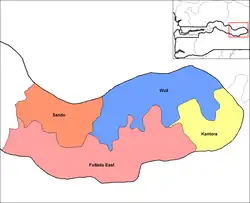
Kantora District
Kantora District is one of the four districts of the Upper River Division of the Gambia. it is the easternmost district of the country
The name derives from the Mandinka phrase "kana-ntoro," meaning "do not trouble me," referring to the disputes that Tiramakhan Traore's expedition struggled with there. They founded the village of Songkunda, meaning "place of agreement," to commemorate the re-establishment of peace.[1]
The name of the area appears in written records as early as the 1456 voyage of Diego Gomes.[2] At one point Kantora was a province of the Kabu Empire but it had different boundaries then.[3] In particular, Duarte Pacheco Pereira noted in 1506 that Sutuco on the north bank of the river was the main trading center of Kantora.[4] By the 1621 visit of Richard Jobson, however, the north bank was under the control of the King of Wuli.[5]
References
- Djibril Tamsir Niane, "Histoire des Mandingues de l'Ouest: le royaume du Gabou", p 21
- Bühnen, Stephan. “Place Names as an Historical Source: An Introduction with Examples from Southern Senegambia and Germany.” History in Africa, vol. 19, 1992, pp. 45–101. JSTOR, https://doi.org/10.2307/3171995. Accessed 27 Jul. 2022.
- Clark, Andrew F. and Lucie Colvin Phillips. Historical Dictionary of Senegal, (Metuchen, New Jersey: The Scarecrow Press, 1994) p. 172
- Pereira, Duarte Pacheco (1936). Kimble, George H.T. (ed.). Esmeraldo de Situ Orbis. Ashgate.
- Jobons, Richard (1623). Eason, James (ed.). The Golden Trade: or, A discovery of the River Gambra, and the Golden Trade of the Aethiopians. Retrieved 12 June 2023.