Kandalaksha
Kandalaksha (Russian: Кандала́кша; Finnish: Kantalahti, also Kandalax or Candalax in the old maps; Karelian: Kannanlakši; Skolt Sami: Käddluhtt) is a town in Kandalakshsky District of Murmansk Oblast, Russia, located at the head of Kandalaksha Gulf on the White Sea, north of the Arctic Circle. Population: 35,654 (2010 Census);[2] 40,564 (2002 Census);[6] 54,080 (1989 Census).[7]
Kandalaksha
Кандалакша | |
|---|---|
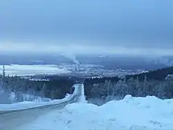
 A view of Kandalaksha | |
.png.webp) Flag _(2008).png.webp) Coat of arms | |
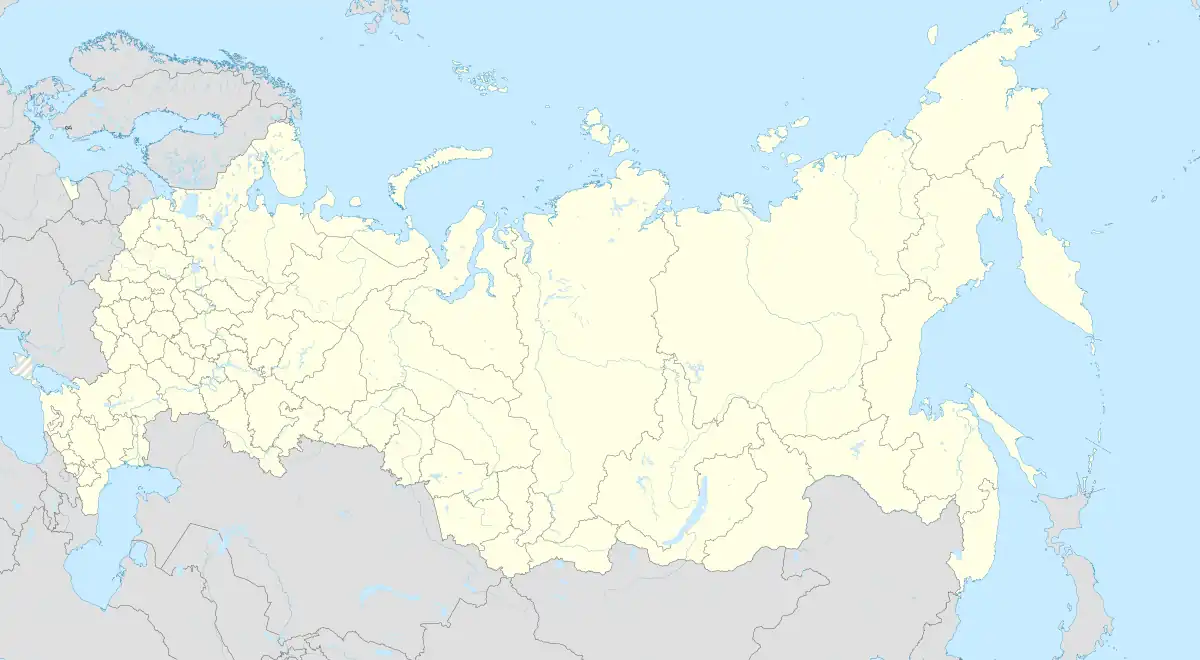
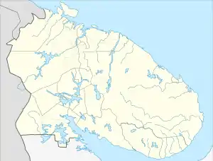
Location of Kandalaksha | |
 Kandalaksha Location of Kandalaksha  Kandalaksha Kandalaksha (Murmansk Oblast) | |
| Coordinates: 67°09′25″N 32°24′42″E | |
| Country | Russia |
| Federal subject | Murmansk Oblast |
| Administrative district | Kandalakshsky District |
| Founded | 11th century |
| Town status since | April 20, 1938[1] |
| Elevation | 20 m (70 ft) |
| Population | |
| • Total | 35,654 |
| • Estimate (2018)[3] | 31,329 (−12.1%) |
| • Municipal district | Kandalakshsky Municipal District |
| • Urban settlement | Kandalaksha Urban Settlement |
| Time zone | UTC+3 (MSK |
| Postal code(s)[5] | 184041 |
| Dialing code(s) | +7 81533 |
| OKTMO ID | 47608101001 |
History
The settlement was founded the 11th century but may have existed as a temporary stop for fishermen from the 9th century. In the 13th century, it became a part of the Novgorod Republic along with the southern part of the Kola Peninsula, and in 1478 was annexed by the Grand Duchy of Moscow. In 1915, the construction of a seaport started, and in 1918 a railroad connecting Moscow to Murmansk running through Kandalaksha was opened. On August 29, 1927, Kandalaksha was made the administrative center of the newly established Kandalakshsky District,[8] and on June 1, 1932, it was granted work settlement status.[1] Status of a town of district significance was granted to it on April 20, 1938.[1] On February 9, 1940, Kandalaksha was administratively separated from the district and granted the status of a town of oblast significance.[1]
In July 1941, during World War II, the town was the primary target of an unsuccessful German-Finnish offensive which attempted to cut the strategic Kirov Railway.
By the Decree of the Presidium of the Supreme Soviet of the RSFSR of March 19, 1959, the Councils of Deputies of Kandalaksha and of Kandalakshsky District were merged into one Kandalaksha Town Council of Deputies.[9] While the district was nominally retained as a separate administrative division, all its subdivisions were administratively subordinated to the town's Council of Deputies.[9]
Since 1995, Vitino oil port operates near Beloye More a few kilometers south of Kandalaksha.
Kandalaksha Mayor Nina Varlamova was murdered in an attack in December 2008.[10]
International relations
.jpg.webp)
Geography
The town is located at the head of Kandalaksha Gulf on the White Sea, north of the Arctic Circle.
Climate
Kandalaksha has a subarctic climate (Dfc) with mild, rainy summers, and cold, snowy winters.
| Climate data for Kandalaksha (Climate ID:22217) | |||||||||||||
|---|---|---|---|---|---|---|---|---|---|---|---|---|---|
| Month | Jan | Feb | Mar | Apr | May | Jun | Jul | Aug | Sep | Oct | Nov | Dec | Year |
| Record high °C (°F) | 7.5 (45.5) |
8.0 (46.4) |
12.2 (54.0) |
18.9 (66.0) |
27.2 (81.0) |
31.4 (88.5) |
31.6 (88.9) |
32.0 (89.6) |
22.1 (71.8) |
14.7 (58.5) |
11.4 (52.5) |
8.0 (46.4) |
32.0 (89.6) |
| Average high °C (°F) | −8.4 (16.9) |
−7.6 (18.3) |
−2.2 (28.0) |
3.3 (37.9) |
9.2 (48.6) |
15.9 (60.6) |
19.0 (66.2) |
16.2 (61.2) |
10.6 (51.1) |
4.0 (39.2) |
−2.7 (27.1) |
−6.3 (20.7) |
4.3 (39.7) |
| Daily mean °C (°F) | −12.3 (9.9) |
−11.7 (10.9) |
−6.5 (20.3) |
−1 (30) |
4.9 (40.8) |
11.2 (52.2) |
14.6 (58.3) |
12.1 (53.8) |
7.0 (44.6) |
1.4 (34.5) |
−5.4 (22.3) |
−9.8 (14.4) |
0.4 (32.7) |
| Average low °C (°F) | −16.9 (1.6) |
−16.4 (2.5) |
−11.2 (11.8) |
−5.6 (21.9) |
0.8 (33.4) |
6.8 (44.2) |
10.3 (50.5) |
8.1 (46.6) |
3.5 (38.3) |
−1.4 (29.5) |
−8.7 (16.3) |
−13.8 (7.2) |
−3.7 (25.3) |
| Record low °C (°F) | −43.5 (−46.3) |
−41.6 (−42.9) |
−34.6 (−30.3) |
−27.9 (−18.2) |
−15 (5) |
−4.5 (23.9) |
1.8 (35.2) |
−3.6 (25.5) |
−9.7 (14.5) |
−21.8 (−7.2) |
−30.4 (−22.7) |
−39.5 (−39.1) |
−43.5 (−46.3) |
| Average precipitation mm (inches) | 39 (1.5) |
31 (1.2) |
30 (1.2) |
26 (1.0) |
47 (1.9) |
52 (2.0) |
76 (3.0) |
59 (2.3) |
52 (2.0) |
52 (2.0) |
45 (1.8) |
37 (1.5) |
546 (21.4) |
| Average rainy days | 1 | 2 | 3 | 9 | 18 | 18 | 18 | 18 | 19 | 15 | 6 | 3 | 130 |
| Average snowy days | 24 | 23 | 22 | 15 | 9 | 1 | 0 | 0 | 1 | 11 | 21 | 24 | 151 |
| Average relative humidity (%) | 86 | 84 | 81 | 75 | 72 | 69 | 74 | 79 | 84 | 86 | 89 | 87 | 81 |
| Source: Roshydromet[11] | |||||||||||||
See also
References
Notes
- Administrative-Territorial Division of Murmansk Oblast, pp. 52–53
- Russian Federal State Statistics Service (2011). Всероссийская перепись населения 2010 года. Том 1 [2010 All-Russian Population Census, vol. 1]. Всероссийская перепись населения 2010 года [2010 All-Russia Population Census] (in Russian). Federal State Statistics Service.
- "26. Численность постоянного населения Российской Федерации по муниципальным образованиям на 1 января 2018 года". Federal State Statistics Service. Retrieved January 23, 2019.
- "Об исчислении времени". Официальный интернет-портал правовой информации (in Russian). June 3, 2011. Retrieved January 19, 2019.
- Local post office info http://www.russianpost.ru/PostOfficeFindInterface/FindOPSByPostOfficeID.aspx?index=184041
- Russian Federal State Statistics Service (May 21, 2004). Численность населения России, субъектов Российской Федерации в составе федеральных округов, районов, городских поселений, сельских населённых пунктов – районных центров и сельских населённых пунктов с населением 3 тысячи и более человек [Population of Russia, Its Federal Districts, Federal Subjects, Districts, Urban Localities, Rural Localities—Administrative Centers, and Rural Localities with Population of Over 3,000] (XLS). Всероссийская перепись населения 2002 года [All-Russia Population Census of 2002] (in Russian).
- Всесоюзная перепись населения 1989 г. Численность наличного населения союзных и автономных республик, автономных областей и округов, краёв, областей, районов, городских поселений и сёл-райцентров [All Union Population Census of 1989: Present Population of Union and Autonomous Republics, Autonomous Oblasts and Okrugs, Krais, Oblasts, Districts, Urban Settlements, and Villages Serving as District Administrative Centers]. Всесоюзная перепись населения 1989 года [All-Union Population Census of 1989] (in Russian). Институт демографии Национального исследовательского университета: Высшая школа экономики [Institute of Demography at the National Research University: Higher School of Economics]. 1989 – via Demoscope Weekly.
- Administrative-Territorial Division of Murmansk Oblast, p. 35
- Administrative-Territorial Division of Murmansk Oblast, p. 55
- Malpas, Anna (December 18, 2008). "Mayor Stabbed To Death". Moscow Times. Archived from the original on May 9, 2012. Retrieved January 12, 2009.
- "Climate of Kandalaksha" (in Russian). Weather and Climate (Погода и климат). Retrieved November 1, 2019.
Sources
- Архивный отдел Администрации Мурманской области. Государственный Архив Мурманской области. (1995). Административно-территориальное деление Мурманской области (1920-1993 гг.). Справочник. Мурманск: Мурманское издательско-полиграфическое предприятие "Север".
External links
 Media related to Kandalaksha at Wikimedia Commons
- Official website of Kandalaksha (in Russian)
- Kandalaksha Business Directory (in Russian)
- Kandalaksha Nature Reserve
- Information about Kandalaksha for tourists