Qadas
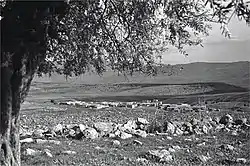
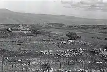
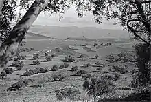
Qadas (also Cadasa; Arabic: قدس) was a Palestinian village located 17 kilometers northeast of Safad that was depopulated during the 1948 Arab–Israeli war.[5][6] One of seven villages populated by Shia Muslims, called Metawalis, that fell within the boundaries of British Mandate Palestine, Qadas is today known as the tell of the ancient biblical city of Kedesh.[7][6] The village of Qadas contained many natural springs which served as the village water supply and a Roman temple dating back to the 2nd century AD.[5]
Qadas
قدس Kades, Kadas, Cadasa | |
|---|---|
Village | |
 Qadas 1939 | |
| Etymology: Kadesh[1] | |
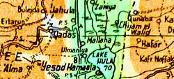
.jpg.webp) 1870s map 1870s map .jpg.webp) 1940s map 1940s map.jpg.webp) modern map modern map .jpg.webp) 1940s with modern overlay map 1940s with modern overlay mapA series of historical maps of the area around Qadas (click the buttons) | |
 Qadas Location within Mandatory Palestine | |
| Coordinates: 33°06′48″N 35°31′39″E | |
| Palestine grid | 199/279 |
| Geopolitical entity | Mandatory Palestine |
| Subdistrict | Safad |
| Date of depopulation | 28 May 1948[2] |
| Area | |
| • Total | 14,139 dunams (14.139 km2 or 5.459 sq mi) |
| Population (1945) | |
| • Total | 390[3][4] |
| Cause(s) of depopulation | Influence of nearby town's fall |
| Current Localities | Yiftah, Malkia, Ramot Naftali |
The village was razed following its depopulation, and is today known as the archaeological site of Tel Kedesh.
History
Ancient period
Qadas is the site of the ancient biblical city of Kedesh.[7][8] Kedesh Naphtali is mentioned in the Book of Joshua as a Canaanite citadel conquered by the Israelites; later, it became a city of refuge belonging to the Tribe of Naphtali. In the 8th century BCE, during the reign of Pekah king of Israel, Tiglath-Pileser III of the Neo-Assyrian Empire captured Kedesh and deported its inhabitants to Mesopotamia.
Classical antiquity
In classical antiquity, Kedesh was known as Qadasa. In 259 BCE, Kedesh was mentioned in the Zenon Papyri.[9] According to 1 Maccabees, a battle between Jonathan Maccabeus and the Seleucid king Demetrius II Nicator took place in Kedesh.[10][11]
According to Josephus, after the Jews were massacred in Caesarea in 66 CE, they avenged by attacking a series of gentile cities, including Qadasa, which was then controlled by the Tyrians. During the First Jewish-Roman War, Titus established his camp there prior to his departure for battle with John of Gischala.[12]
Archaeological excavations conducted at Kedesh have shown that the town had prospered in the second and third centuries CE, and a large Roman temple complex was built there.[12]
Middle ages
Under the rule of the Islamic Abbasid Caliphate in the 10th century CE, Qadas was a town in Jund al-Urrdun ("District of Jordan").[13] According to al-Muqaddasi in 985, "Qadas was a small town on the slope of the mountain. It is 'full of good things'. Jabal Amilah is the district which is in its neighborhood. The town possesses three springs from which the people drink, and they have a bath below the city. The mosque is in the market, and in its court is a palm tree. The climate of this place is very hot. Near Qadas is the (Hulah) Lake."[14][15] Moreover, he described half of Qadas inhabitants as Shia Muslims.[16]
The 14th-century Jewish traveller Ishtori Haparchi wrote of Kedesh: "About half a day's distance southward of Paneas, known in Arabic as Banias, is Kedesh, in the mountain of Naphtali, and it is [now] called Qades."[17]
Ottoman era
In 1517, Qadas was incorporated into the Ottoman Empire after it was captured from the Mamluks, and by 1596, it was under the administration of the nahiya ("subdistrict") of Tibnin, under Sanjak Safad. It paid taxes on wheat, barley, olives, cotton, orchards, beehives, and goats, as well as a press that processed either grapes or olives.[18][19]
Victor Guérin visited in 1875, and described the most important ruins there.[20]
In 1881, the PEF's Survey of Western Palestine (SWP), Qadas was described as a stone-built village, situated on a spur of a ridge. The population, which was estimated to be between 100 and 300, cultivated fig and olive trees.[21] SWP also noted that the "Metawali" from Qadas went to nearby Al-Nabi Yusha' to venerate the name of Joshua.[22]
British Mandate era
Qadas was a part of the French-controlled Lebanon until 1923, when the British Mandate of Palestine's borders were delineated to include it.
Rainfall and the abundance of springs allowed the village to develop a prosperous agricultural economy based on grain, fruit, and olives.[23]
In the 1931 census of Palestine, conducted by the British Mandate authorities, Qadas had a population of 273; 1 Christian and 272 Muslims, in a total of 56 houses.[24]
In the 1945 statistics the village had a total of 5,709 dunums of land allotted to cereals, while 156 dunums were irrigated or used for orchards.[23][25]


1948 war, and aftermath
Qadas was occupied by Israeli forces during Operation Yiftach on 28 May 1948. Defended by the Arab Liberation Army and the Lebanese army, its inhabitants fled under the influence of the fall of, or exodus from, neighbouring towns.[26]

In June, 1948, kibbutz Manara requested land from the newly depopulated village of Qadas, as it was "suitable for winter crops."[27]
The settlement of Yiftach was built in 1948 to the northeast of the village site on lands belonging to Qadas. The village land is also used by the settlements of Malkiyya, founded in 1949, and Ramot Naftali, established in 1945.[28]
Walid Khalidi described the remaining structures of the former village in 1992 as follows:
"Stones from the destroyed houses are strewn over the fenced-in site, and a few partially destroyed walls near the spring are visible. The flat portions of the surrounding lands are planted with apple trees; the spring provides drinking water for cattle.[28]
Hassan Nasrallah, the secretary-general of Hezbollah, has publicly recalled on occasion the fate of Qadas and the other Metawali villages in his references to the 1948 annexation of several Lebanese villages, the expulsion of their residents, the expropriation of their property and the destruction of their homes.[6]
As of 2023, an archaeological project was underway to investigate the recent history of Qadas before its destruction.[29] Team leader Raphael Greenberg noted that his project was unusual in its focus on Palestinian remains, contrary to the usual practice of digging around or through them to reach what is beneath.[29]
See also
References
- Palmer, 1881, p. 76
- Morris, 2004, p. xvi, village #24. Also gives cause of depopulation
- Government of Palestine, Department of Statistics. Village Statistics, April, 1945. Quoted in Hadawi, 1970, p. 71
- Department of Statistics, 1945, p. 10
- "Welcome to Qadas". Palestine Remembered. Retrieved 2007-12-03.
- Danny Rubinstein (2006-08-06). "The Seven Lost Villages". Haaretz. Archived from the original on October 1, 2007.
- "The Hebrew University Excavations at Tel Qedesh". sites.google.com. Retrieved 2023-02-12.
A Shi'a village by the name of Qadas occupied part of the mound in the last centuries, and was abandoned in the aftermath of the 1948 War.
; "The Hebrew University Expedition to Qedesh in the Galilee". Archaeological Institute of America. 2021-11-21. Retrieved 2023-02-12.Tel Qedesh is one of the largest biblical mounds in northern Israel. First settled as early as the Chalcolithic period, the site reached its peak during the Early Bronze Age, when an enormous site (ca. 60 hectares), extending well beyond the main mound, emerged during this crucial phase of early Levantine urbanism. A Canaanite city continued to thrive on the mound during the second millennium BCE, to be followed by an important Israelite center during the Iron Age II, known as one of the Refuge and Levite Cities (Joshua 20:7; 21:32). Following its conquest by the Assyrian King Tiglath Pileser III in 732 BCE (2 Kings 15:29), it re-emerged as a Phoenician administrative center during the Persian and Hellenistic periods, and later as an important pagan town on the boundary between Tyre and Jewish Galilee during the Second Temple period (BJ 3:35–40). A rural cultic center, housing two temples and numerous mausolea (elaborate burial monuments), developed here in the Late Roman period, and an important market town is attested during the Early Islamic period. In the more recent past, the mound was occupied by a small Shi'ite village by the name of Qadas… the Arab village of Qadas, which was occupying the upper mound during the last centuries.
- Al-Ya'qubi quoted in le Strange, 1890, p.467.
- Papyrus Cairo Zenon I 59.004
- Antiquities of the Jews 13.154–62; The Wars of the Jews 2.459, 4.104.
- 1 Maccabees 11:63–74 (text)
- Fischer, Moshe; Ovadiah, Asher; Roll, Israel (1984). "The Roman Temple at Kedesh, Upper Galilee: A Preliminary Study". Tel Aviv. 11 (2): 146–172. doi:10.1179/tav.1984.1984.2.146. ISSN 0334-4355.
- Al-Ya'qubi quoted in le Strange, 1890, p.39.
- Muqaddasi, 1886, p. 28
- Muqaddasi quoted in le Strange, 1890, p.468
- Muqaddasi, 1886, p.
- Ishtori Haparchi, Sefer Kaftor Ve'ferah (vol. 2), ed. Avraham Yosef Havatzelet, Jerusalem 2007, (chapter 11) p. 53 (Hebrew). The editor (ibid.), note 8, makes note of the fact that the site is mentioned in Joshua 20:7, but that today it is called Tell Kedesh, located at grid reference 200 / 285.
- Hütteroth and Abdulfattah, 1977, p. 181. Quoted in Khalidi, 1992, p. 484
- Note that Rhode, 1979, p. 6 Archived 2019-04-20 at the Wayback Machine writes that the register that Hütteroth and Abdulfattah studied was not from 1595/6, but from 1548/9
- Guérin, 1880, pp. 355-362; as given in Conder and Kitchener, 1881, SWP I, p. 229
- Conder and Kitchener, 1881, SWP I, p. 202. Quoted in Khalidi, 1992, p. 484
- Conder and Kitchener, 1881, SWP I, p. 228
- Khalidi, 1992, p.484.
- Mills, 1932, p. 109
- Government of Palestine, Department of Statistics. Village Statistics, April, 1945. Quoted in Hadawi, 1970, p. 120
- Morris, 2004, pp. 251, 303, 361, 402. Khalidi, 1992, pp. 484, 485
- Morris, 2004, p. 363, note #130, p. 402
- Khalidi, 1992, p.485.
- Ariel David (September 13, 2023). "Digging Up the Nakba: Israeli Archaeologists Excavate Palestinian Village Abandoned in 1948". Haaretz.
Bibliography
- Conder, C.R.; Kitchener, H.H. (1881). The Survey of Western Palestine: Memoirs of the Topography, Orography, Hydrography, and Archaeology. Vol. 1. London: Committee of the Palestine Exploration Fund. (SWP I, pp. 226-227)
- Department of Statistics (1945). Village Statistics, April, 1945. Government of Palestine.
- Guérin, V. (1880). Description Géographique Historique et Archéologique de la Palestine (in French). Vol. 3: Galilee, pt. 2. Paris: L'Imprimerie Nationale.
- Hadawi, S. (1970). Village Statistics of 1945: A Classification of Land and Area ownership in Palestine. Palestine Liberation Organization Research Center.
- Hütteroth, Wolf-Dieter; Abdulfattah, Kamal (1977). Historical Geography of Palestine, Transjordan and Southern Syria in the Late 16th Century. Erlanger Geographische Arbeiten, Sonderband 5. Erlangen, Germany: Vorstand der Fränkischen Geographischen Gesellschaft. ISBN 3-920405-41-2.
- Khalidi, W. (1992). All That Remains: The Palestinian Villages Occupied and Depopulated by Israel in 1948. Washington D.C.: Institute for Palestine Studies. ISBN 0-88728-224-5.
- Mills, E., ed. (1932). Census of Palestine 1931. Population of Villages, Towns and Administrative Areas. Jerusalem: Government of Palestine.
- Morris, B. (2004). The Birth of the Palestinian Refugee Problem Revisited. Cambridge University Press. ISBN 978-0-521-00967-6.
- Mukaddasi (1886). Description of Syria, including Palestine. London: Palestine Pilgrims' Text Society. (p. 70)
- Palmer, E.H. (1881). The Survey of Western Palestine: Arabic and English Name Lists Collected During the Survey by Lieutenants Conder and Kitchener, R. E. Transliterated and Explained by E.H. Palmer. Committee of the Palestine Exploration Fund.
- Rhode, H. (1979). Administration and Population of the Sancak of Safed in the Sixteenth Century. Columbia University.
- Strange, le, G. (1890). Palestine Under the Moslems: A Description of Syria and the Holy Land from A.D. 650 to 1500. Committee of the Palestine Exploration Fund.
External links
- Welcome the Qadas
- Qadas, Zochrot
- Survey of Western Palestine, Map 4: IAA, SWP Wikimedia commons
- Qadas, from the Khalil Sakakini Cultural Center
- Villages of Palestine - Qadas, Dr. Khalil Rizk