Kabardanga
Kabardanga is a locality in South Kolkata in West Bengal, India. It is a part of Kolkata Municipal Corporation.It is a locality of partly Behala area and partly Tollygunge area.
Kabardanga | |
|---|---|
Neighbourhood in Kolkata (Calcutta) | |
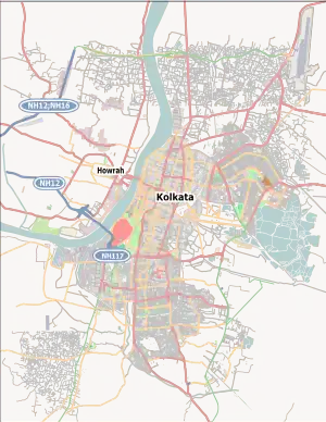
 Kabardanga Location in Kolkata | |
| Coordinates: 22.46346275°N 88.33320765°E | |
| Country | |
| State | West Bengal |
| City | Kolkata |
| District | Kolkata[1][2][3] |
| Metro Station | Thakurpukur,Tollygunge,Kudghat |
| Municipal Corporation | Kolkata Municipal Corporation |
| KMC ward | 142,143 |
| Population | |
| • Total | For population see linked KMC ward page |
| Time zone | UTC+5:30 (IST) |
| PIN | 700 104, 700 082, 700 093 |
| Area code | +91 33 |
| Lok Sabha constituency | Kolkata Dakshin |
| Vidhan Sabha constituency | Behala Purba |
Geography
It is located in south west Kolkata.The main road of the area is Mahatma Gandhi road, which connects Thakurpukur/Joka to Tollygunge. The area can also be reached from Behala via Motilal Gupta road or Raja Ram Mohan Roy road by crossing the narrow streets of sodpur/Haridevpur.
Transport
Bus
- 12C/1B
- 40B
- Kalitala Mini
- C8
Auto Rickshaw
- Kabardanga - Thakurpukur
- Kabardanga - Tollygunge Metro
- Kabardanga - Nepalgunj hat
Metro
Nearest Metro stations are:-
- Thakurpukur Metro Station
- Mahanayak Uttam Kumar metro station (Tollygunge)
- Netaji Metro Station (Kudghat)
Administration
The area is under the administration of Haridevpur police station of South west division (Behala Division) of Kolkata Police. The whole M.G Road(3A bus stand x-ing to Tollygunge Karunamoyee) is administered by Thakurpukur Traffic guard.
The kabardanga locality partly falls under Joka(700104) pincode, partly under Haridevpur(700082) pincode and partly under Purba Putiary(700093) pincode.
It is a part of Behala purba(700104,700082) and Tollygunge(700093) Assembly constituency.
References
- "Kolkata district".
- "Electors Details As On 30-10-2010" (PDF). Archived from the original (PDF) on 29 May 2013.
- "KMC Wards in South 24 Parganas".