Jacumba Mountains
The Jacumba Mountains are a mountain range of the Peninsular Ranges system, located in eastern San Diego County, Southern California, near the U.S. border with Mexico.
| Jacumba Mountains | |
|---|---|
 | |
| Highest point | |
| Peak | Jacumba Peak |
| Elevation | 1,375 m (4,511 ft) |
| Coordinates | 32°41.87′N 116°09.87′W |
| Geography | |
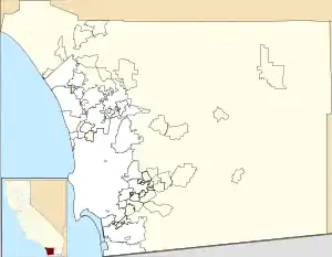 Location of Jacumba Mountains in California[1]  Jacumba Mountains (southern California) 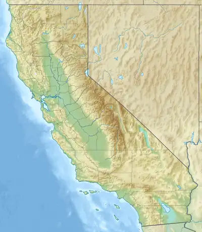 Jacumba Mountains (California) | |
| Country | United States |
| State | California |
| District | San Diego County |
| Range coordinates | 32°43′11.212″N 116°10′21.060″W |
| Parent range | Peninsular Ranges |
| Topo map | USGS Jacumba |
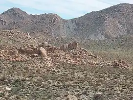
The mountain range lies in a northwest-southeasterly direction, east of the In-Ko-Pah Mountains, and north of Interstate 8. The range is approximately 11.5 miles (18.5 km) long, and Table Mountain at the southeast end of the range is located about 3 miles (4.8 km) northeast of the town of Jacumba.[2]
The Jacumba Mountains reach an elevation of 4,512 feet (1,375 m) at Jacumba Peak, near the southern end of the chain.[3]
The Tierra Blanca Mountains and the Sawtooth Mountains are to the northwest, and Anza-Borrego Desert State Park due north. The Coyote Mountains lie to the northeast. The Volcanic Hills area lies on the northeast flank of the range.[2]
References
- "Jacumba Mountains". Geographic Names Information System. United States Geological Survey, United States Department of the Interior. Retrieved 2009-05-04.
- El Cajon, California, 30x60 Minute Topographic Quadrangle, USGS, 1979
- Jacumba, CA, 7.5 Minute Topographic Quadrangle, USGS 1997
- Allan, Stuart (2005). California Road and Recreation Atlas. Benchmark Maps. p. 117. ISBN 0-929591-80-1.