Iwahig River
The Iwahig River, also known as Balsahan River, is a watershed located in the Iwahig Penal Colony in Palawan, Philippines.[1] It has an elevation of 8 metres (26 ft) with an approximate length of 4.14 kilometres (2.57 mi)[2] The river basin is a 22,859-hectare (56,490-acre) watershed encompassing the city of Puerto Princesa in Palawan province.[2]
| Iwahig River Balsahan River | |
|---|---|
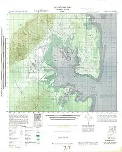 Iwahig River Operational Map 1st Edition - NARA | |
| Location | |
| Country | Philippines |
| Region | Palawan |
| Physical characteristics | |
| Source | |
| • coordinates | 9°08′58.993116″N 118°4′52.014720″E |
| • elevation | 8 metres (26 ft) |
| Length | 4.14 kilometres (2.57 mi) |
| Basin size | 22,859 ha (228.59 km2) |
Topography
The basin area has a gentle a slope to steep slopes with an elevation range of 10 metres (33 ft) to more than 300 metres (980 ft) above sea level.[2] Soil types includes Guimbalaon clay, Taburos clay and Bay clay loam. The basin's large area are unclassified with its mountainous land with a closed canopy of trees that covers almost the entire basin.[3]
Flooding
The towns of Iwahig ang Montible were found susceptible to flooding by the study conducted by the Mines and Geosciences Bureau.[2]
References
- Dangan-Galon, Floredel; Dolorosa, Roger. "Species richness of bivalves and gastropods in Iwahig River-Estuary, Palawan, the Philippines". Retrieved 4 December 2021.
{{cite journal}}: Cite journal requires|journal=(help) - "LiDAR-Surveys-and-Flood-Mapping-of-Iwahig-Penal-Rive" (PDF). University of the Philippines Training Center for Applied Geodesy and Photogrammetry. Retrieved 4 December 2021.
- "The Master Plan Study of Power Development In Palawan Province Republic of the Philippines" (PDF). Retrieved 4 December 2021.
{{cite journal}}: Cite journal requires|journal=(help)