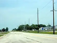
Iowa Highway 48
Iowa Highway 48 is a 48-mile-long (77 km) state highway which runs from north to south in southwest Iowa. It begins at the northern edge of Shenandoah at U.S. Highway 59 and ends at U.S. Highway 6 near Lewis. The highway has seen few changes since its creation.
Iowa Highway 48 | ||||
|---|---|---|---|---|
Iowa 48 highlighted in red | ||||
| Route information | ||||
| Maintained by Iowa DOT | ||||
| Length | 47.919 mi[1] (77.118 km) | |||
| Major junctions | ||||
| South end | ||||
| North end | ||||
| Location | ||||
| Country | United States | |||
| State | Iowa | |||
| Counties | ||||
| Highway system | ||||
| ||||
Route description

Iowa Highway 48 begins in Shenandoah at an intersection with U.S. Highway 59 (US 59), which serves as the line separating Fremont County and Page County. It heads east for one mile (1.6 km) before turning to the northeast to become parallel to a line of the BNSF Railway.[2] It travels northeast for 6 miles (9.7 km) and turns east shortly after passing through Essex. Three miles (4.8 km) east of Essex, Iowa 48 turns north at an intersection with Page County Road J20 (CR J20).[1]
From CR J20, Iowa 48 heads due north for 12+1⁄2 miles (20.1 km) to the intersection with US 34 in Red Oak. From Red Oak, Iowa 48 continues due north for 8 miles (13 km) until it turns east to cross the East Nishnabotna River and pass through Elliott before turning back to the north.[3] It then travels north for 6 miles to Griswold, where it intersects Iowa 92. Iowa 48 continues north for 5+1⁄2 miles (8.9 km), again crossing the East Nishnabotna, until its northern end at U.S. Highway 6 west of Lewis.[1]
History
Originally, Iowa Highway 48 was a short highway connecting Shenandoah and Red Oak, roughly along the path the route takes today.[4] By 1952, the route was in its present location and ended at US 6 west of Lewis. Only the original section had been paved at this time.[5] By 1976, the entire highway was paved.[6]
Major intersections
| County | Location | mi[1] | km | Destinations | Notes |
|---|---|---|---|---|---|
| Fremont–Page county line | Shenandoah | 0.000 | 0.000 | ||
| Montgomery | Red Oak | 23.155 | 37.264 | ||
| Cass | Griswold | 42.172 | 67.869 | ||
| Cass Township | 47.919 | 77.118 | |||
| 1.000 mi = 1.609 km; 1.000 km = 0.621 mi | |||||
References
- 2009 Volume of Traffic on the Primary Road System of Iowa (PDF) (Report). Iowa Department of Transportation. January 1, 2009. Retrieved December 4, 2010.
- Iowa State Railroad Map (PDF) (Map). Iowa Department of Transportation. July 1, 2008. Retrieved December 5, 2010.
- Transportation Map (PDF) (Map). Iowa Department of Transportation. 2010. Retrieved December 5, 2010.
- Junior Road Map: Western Iowa (Map). Rand McNally & Company. 1926. Retrieved December 5, 2010.
- Iowa State Highway Map (PDF) (Map). Iowa State Highway Commission. 1952. Retrieved December 5, 2010.
- Iowa State Highway Map (PDF) (Map). Iowa Department of Transportation. 1976. Retrieved December 5, 2010.
External links
- End of Iowa 48 at Iowa Highway Ends
