Ill Crag
Ill Crag is a fell in the English Lake District. At 935 metres (3,068 ft), it is the fourth-highest[1] peak in England, after Scafell Pike, Sca Fell, and Helvellyn. Ill Crag overlooks Eskdale and has splendid views across to Bowfell and Crinkle Crags.
| Ill Crag | |
|---|---|
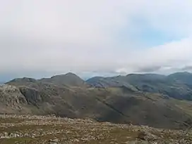 On the Ill Crag plateau | |
| Highest point | |
| Elevation | 935 m (3,068 ft) |
| Prominence | 57 m (187 ft) |
| Parent peak | Scafell Pike |
| Listing | Hewitt, Nuttall |
| Coordinates | 54°27′18″N 3°12′00″W |
| Geography | |
 Ill Crag | |
| Parent range | Southern Fells |
| OS grid | NY223073 |
| Topo map | OS Landrangers 89, 90 |
| Climbing | |
| Easiest route | From Esk Hause |
Topography
It forms part of the Scafell chain, and lies about 1 km east of Scafell Pike. Broad Crag lies immediately to the west, between Ill Crag and the Pike.
Ascents
Ill Crag may be climbed en route to Scafell Pike, via a path from Esk Hause, but it is commonly passed by without going to the actual summit, which is rocky making progress slow. Ill Crag's summit is a few hundred metres to the south of the path from Esk Hause to Scafell Pike.
This article is issued from Wikipedia. The text is licensed under Creative Commons - Attribution - Sharealike. Additional terms may apply for the media files.