Ibapah Peak (Juab County, Utah)
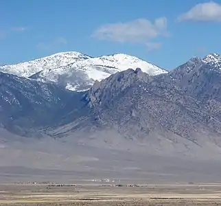
Ibapah Peak is a 12,087-foot (3,684 m)[2] summit in Juab County, Utah in the United States. It is the highest point of the Deep Creek Range and is located less than 5 miles (8.0 km) east of the Utah-Nevada border, and about 10 miles (16 km) northwest of the town of Trout Creek, Utah.[1] With a topographic prominence of 5,247 feet (1,599 m)[1] it is the eighth-most prominent summit in Utah.
| Ibapah Peak | |
|---|---|
 | |
| Highest point | |
| Elevation | 3,684 m (12,087 ft) |
| Prominence | 5,247 ft (1,599 m)[1] |
| Parent peak | Doso Doyabi |
| Isolation | 61.18 mi (98.46 km)[1] |
| Listing | Ultra |
| Coordinates | 39°49′42″N 113°55′11″W[2] |
| Geography | |
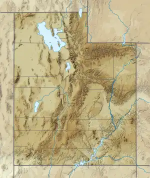 Ibapah Peak Location in the state of Utah | |
| Parent range | Deep Creek Range |
| Topo map | USGS Ibapah Peak |
References
- "Ibapah Peak". Peakbagger. 7 July 2017.
- U.S. Geological Survey Geographic Names Information System: Ibapah Peak (Juab County, Utah)
External links
- Ibapah Peak at SummitPost
This article is issued from Wikipedia. The text is licensed under Creative Commons - Attribution - Sharealike. Additional terms may apply for the media files.