Hebrizelm Hill
Hebrizelm Hill (Halm Hebrizelm \'h&lm he-bri-'zelm\) is a rocky hill rising to 70 m on the south-west coast of Greenwich Island, South Shetland Islands. An offshoot of the hill is forming Kaspichan Point. The hill is named after the Thracian King Hebryzelmis, 389–384 BC.
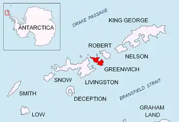
Location of Greenwich Island in the South Shetland Islands.
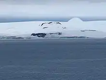
Hebrizelm Hill, with Tile Ridge and Mt. Plymouth in the background.
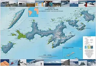
Topographic map of Livingston Island, Greenwich, Robert, Snow and Smith Islands.
Location
The hill is located at 62°30′58.2″S 59°51′40″W which is 1.1 km northwest of Triangle Point, and 1.95 km south-southwest of Tile Ridge (Bulgarian topographic survey Tangra 2004/05).
Maps
- L.L. Ivanov et al. Antarctica: Livingston Island and Greenwich Island, South Shetland Islands. Scale 1:100000 topographic map. Sofia: Antarctic Place-names Commission of Bulgaria, 2005.
- L.L. Ivanov. Antarctica: Livingston Island and Greenwich, Robert, Snow and Smith Islands. Scale 1:120000 topographic map. Troyan: Manfred Wörner Foundation, 2009. ISBN 978-954-92032-6-4
References
- Hebrizelm Hill. SCAR Composite Gazetteer of Antarctica
- Bulgarian Antarctic Gazetteer. Antarctic Place-names Commission. (details in Bulgarian, basic data in English)
External links
- Hebrizelm Hill. Copernix satellite image
This article includes information from the Antarctic Place-names Commission of Bulgaria which is used with permission.
This article is issued from Wikipedia. The text is licensed under Creative Commons - Attribution - Sharealike. Additional terms may apply for the media files.