Harz (Landkreis Goslar)
Harz is an unincorporated area in the German district of Goslar.
Harz | |
|---|---|
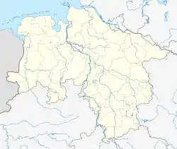
Location of Harz (Landkreis Goslar) within Goslar district _in_GS.svg.png.webp) | |
 Harz  Harz | |
| Coordinates: 51°47′N 10°25′E | |
| Country | Germany |
| State | Lower Saxony |
| District | Goslar |
| Area | |
| • Total | 371.56 km2 (143.46 sq mi) |
| Population (2021-12-31)[1] | |
| • Total | 0 |
| • Density | 0.0/km2 (0.0/sq mi) |
| Time zone | UTC+01:00 (CET) |
| • Summer (DST) | UTC+02:00 (CEST) |
The uninhabited area is located in the Upper Harz (Lower Saxony). With a size of 371.76 km2 (31 December 2006), it is the largest unincorporated area in Germany. Although there are no residents reported, it carries administrative functions; the Community Identification Number is 03 1 53 504. The area extends over large parts of the Upper Harz, from Seesen/Langelsheim in the northwest to Hohegeiß in the south of the district of Goslar. The Harz unincorporated area in the district of Goslar has many enclaves: Thus the community of Clausthal-Zellerfeld has two exclave districts, Wildemann and Altenau-Schulenberg im Oberharz, and the community of Braunlage has an exclave district, Sankt Andreasberg, and other settlements (mostly restaurants) within the Harz area.
The administration of the community-free area is the responsibility of the Lower Saxony Forestry Office Clausthal,[2] which also collects business taxes from some quarries and would issue civil status certificate (birth certificate, death certificate) for events that occurred in the area. The forestry office also provides security and order.
References
- "LSN-Online Regionaldatenbank, Tabelle A100001G: Fortschreibung des Bevölkerungsstandes, Stand 31. Dezember 2021" (in German). Landesamt für Statistik Niedersachsen.
- Gemeindefreies Gebiet Harz Archived 2016-06-01 at the Wayback Machine auf www.landesforsten.de, retrieved 1 June 2016.