Halsteren
Halsteren is a town in the Dutch province of North Brabant. It is located in the municipality of Bergen op Zoom, about 1 km north of that city. Halsteren has an old church from the 14th century and a new church, built in 1919. A little village called Polder was located between Halsteren and Tholen in the Middle Ages.
Halsteren
Altere | |
|---|---|
Town | |
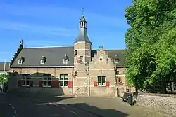 Former town hall of Halsteren | |
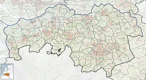 Halsteren Location in the province of North Brabant in the Netherlands  Halsteren Halsteren (Netherlands) | |
| Coordinates: 51°31′N 4°16′E | |
| Country | Netherlands |
| Province | North Brabant |
| Municipality | Bergen op Zoom |
| Area | |
| • Total | 16.43 km2 (6.34 sq mi) |
| Elevation | 6 m (20 ft) |
| Population (2021)[1] | |
| • Total | 12,325 |
| • Density | 750/km2 (1,900/sq mi) |
| Time zone | UTC+1 (CET) |
| • Summer (DST) | UTC+2 (CEST) |
| Postal code | 4661[1] |
| Dialing code | 0164 |
History
The village was first mentioned in 1272 as Halstert, and means "bend in the highland with a tail". It developed on a westward pointing sandy ridge.[3]
The Dutch Reformed church was built in the 14th century. It was extended in 1457. After a fire in 1607, it was extensively restored. In 1799, it was returned to the Catholic church and restored several times. In 1961, it became a Dutch Reformed church again. The Catholic St. Quirinus Church was built between 1911 and 1912 and has a double tower. The former town hall dates from 1633. It was restored and extended in 1917. It was restored in 1944 after a fire.[4]
Halsteren was home to 538 people in 1840.[5] Halsteren was a separate municipality until 1997, when it became a part of Bergen op Zoom.[6]
The village of Polder or Polre was located near Halsteren. It disappeared in a flood in 1570 and most of the village is still buried underneath a metre of mud.[5]
Gallery
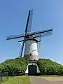 Windmill: the Sint Antoniusmolen
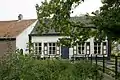 Farm in Halsteren
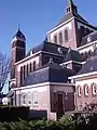 Quirinus Church
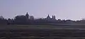 View on Halsteren
References
- "Kerncijfers wijken en buurten 2021". Central Bureau of Statistics. Retrieved 15 April 2022.
- "Postcodetool for 4661AA". Actueel Hoogtebestand Nederland (in Dutch). Het Waterschapshuis. Retrieved 15 April 2022.
- "Halsteren - (geografische naam)". Etymologiebank (in Dutch). Retrieved 15 April 2022.
- Chris Kolman & Ronald Stenvert (1997). Halsteren (in Dutch). Zwolle: Waanders. ISBN 90 400 9945 6. Retrieved 15 April 2022.
- "Halsteren". Plaatsengids (in Dutch). Retrieved 15 April 2022.
- Ad van der Meer and Onno Boonstra, Repertorium van Nederlandse gemeenten, KNAW, 2011.
External links
 Media related to Halsteren at Wikimedia Commons
- Information about Halsteren on the site of the BHIC (Dutch)