Halloran Springs, California
Halloran Springs is a set of springs in the Mojave Desert in San Bernardino County, California, United States.[2] It is located on Interstate 15 between Baker, California and Las Vegas, Nevada approximately 15 miles (24 km) northeast of Baker.
Halloran Springs | |
|---|---|
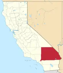
 Halloran Springs Location within the state of California  Halloran Springs Halloran Springs (the United States) | |
| Coordinates: 35°22′21″N 115°53′26″W | |
| Country | United States |
| State | California |
| County | San Bernardino |
| Elevation | 2,986 ft (910 m) |
| Time zone | UTC-8 (Pacific (PST)) |
| • Summer (DST) | UTC-7 (PDT) |
| ZIP code | 92309 |
| Area codes | 442/760 |
| FIPS code | 06-31736 |
| GNIS feature ID | 1667018 |
The ZIP code is 92309 and the community is inside area codes 442 and 760.
It is a popular site for urban exploration due to the abandoned train and gas station, which has a graffitied OBEY sign below a large, red, lettered sign that says "EAT."
References
- "Halloran Springs". Geographic Names Information System. United States Geological Survey, United States Department of the Interior. Retrieved April 12, 2015.
- Waring 1915, p. 344.
Reference bibliography
- Waring, Gerald Ashley (1915). Springs of California. U.S. Geological Survey Water Supply Paper. Vol. 338. U.S. Government Printing Office. doi:10.3133/wsp338.
This article is issued from Wikipedia. The text is licensed under Creative Commons - Attribution - Sharealike. Additional terms may apply for the media files.