Gwaxdlala/Nalaxdlala (Lull/Hoeya) Marine Refuge
The Gwaxdlala/Nalaxdlala (Lull/Hoeya) Marine Refuge is a marine refuge in coastal British Columbia, Canada. The Mamalilikulla First Nation designated the area as an Indigenous Protected and Conserved Area in 2021, with the Canadian government declaring it a marine refuge in 2023.[1] The area is home to rich biodiversity including eelgrass, kelp, cold-water corals, sponges, rockfish, and salmon.[2]
| Gwaxdlala/Nalaxdlala (Lull/Hoeya) Marine Refuge | |
|---|---|
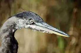 A Great blue heron in the Knight Inlet. | |
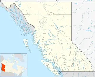 Location in British Columbia | |
| Location | Knight Inlet, British Columbia, Canada |
| Coordinates | 50°41′34″N 126°00′23.7″W |
| Area | 2,140 ha (8.3 sq mi) |
| Designation | Marine refuge |
| Established | 2023 |
| Governing body | Fisheries and Oceans Canada |
| Website | Gwaxdlala/Nalaxdlala (Lull/Hoeya) marine refuge |
Geography
The marine refuge is located in the Knight Inlet and includes Lull Bay and part of the Hoeya Sound.
References
- Canada, Fisheries and Oceans (DFO). "First marine refuge within the Northern Shelf Bioregion is established". www.newswire.ca. Retrieved 2023-08-28.
- Government of Canada, Fisheries and Oceans Canada (2023-02-05). "Gwaxdlala/Nalaxdlala (Lull/Hoeya) marine refuge". www.dfo-mpo.gc.ca. Retrieved 2023-08-28.
This article is issued from Wikipedia. The text is licensed under Creative Commons - Attribution - Sharealike. Additional terms may apply for the media files.