Grozden Peak
Grozden Peak (Bulgarian: връх Грозден, romanized: vrah Grozden, IPA: [ˈvrɤɣ ˈɡrɔzdɛn]) is the rocky peak rising to 1193 m[1] in the west foothills of Hemimont Plateau on Fallières Coast in Graham Land, Antarctica. It surmounts Kom Glacier and its tributaries to the south, west and north.
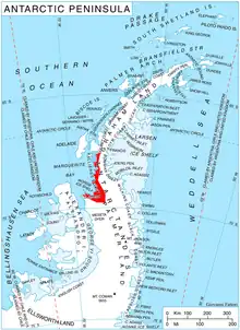
Location of Fallières Coast on the Antarctic Peninsula.
The peak is named after the settlement of Grozden in Southeastern Bulgaria.
Location
Grozden Peak is located at 67°52′20″S 66°36′30″W, which is 4.75 km south of Bunovo Peak, 8 km northeast of Zhefarovich Crag and 6.7 km east of Mercury Ridge. British mapping in 1978.
Maps
- Antarctic Digital Database (ADD). Scale 1:250000 topographic map of Antarctica. Scientific Committee on Antarctic Research (SCAR). Since 1993, regularly upgraded and updated.
- British Antarctic Territory. Scale 1:200000 topographic map. DOS 610 Series, Sheet W 67 66. Directorate of Overseas Surveys, Tolworth, UK, 1978.
Notes
- Reference Elevation Model of Antarctica. Polar Geospatial Center. University of Minnesota, 2019
References
- Bulgarian Antarctic Gazetteer. Antarctic Place-names Commission. (details in Bulgarian, basic data in English)
- Grozden Peak. SCAR Composite Antarctic Gazetteer.
External links
- Grozden Peak. Copernix satellite image
- village of Grozden in Bulgaria, Sungurlare municipalities' Grozden
This article includes information from the Antarctic Place-names Commission of Bulgaria which is used with permission.
This article is issued from Wikipedia. The text is licensed under Creative Commons - Attribution - Sharealike. Additional terms may apply for the media files.