Grivitsa Ridge
Grivitsa Ridge (Bulgarian: Гривишки хребет, ‘Grivishki Hrebet’ \'gri-vish-ki 'hre-bet\) is the mostly ice-free ridge extending 6.4 km in northwest-southeast direction, 3 km wide and rising to 1027 m at its northwest extremity[1] on Nordenskjöld Coast in Graham Land, Antarctica. It is bounded by Darvari Glacier to the north and Zaychar Glacier to the south, and linked to Detroit Plateau to the northwest.
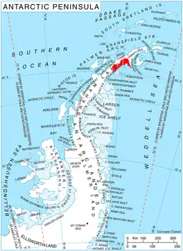
Location of Nordenskjöld Coast.
The ridge is named after the settlement of Grivitsa in Northern Bulgaria.
Location
Grivitsa Ridge is centred at 64°30′16″S 60°19′38″W. British mapping in 1978.
Map
- British Antarctic Territory. Scale 1:200000 topographic map. DOS 610 Series, Sheet W 64 60. Directorate of Overseas Surveys, UK, 1978.
- Antarctic Digital Database (ADD). Scale 1:250000 topographic map of Antarctica. Scientific Committee on Antarctic Research (SCAR). Since 1993, regularly upgraded and updated.
Notes
- Reference Elevation Model of Antarctica. Polar Geospatial Center. University of Minnesota, 2019
References
- Grivitsa Ridge. SCAR Composite Antarctic Gazetteer.
- Bulgarian Antarctic Gazetteer. Antarctic Place-names Commission. (details in Bulgarian, basic data in English)
External links
- Grivitsa Ridge. Copernix satellite image
This article includes information from the Antarctic Place-names Commission of Bulgaria which is used with permission.
This article is issued from Wikipedia. The text is licensed under Creative Commons - Attribution - Sharealike. Additional terms may apply for the media files.